Estimated Value: $169,529 - $323,000
--
Bed
1
Bath
1,260
Sq Ft
$180/Sq Ft
Est. Value
About This Home
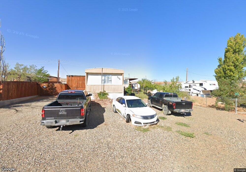
This home is located at 705 N William Dawes, Kanab, UT 84741 and is currently estimated at $226,843, approximately $180 per square foot. 705 N William Dawes is a home with nearby schools including Big Water School.
Ownership History
Date
Name
Owned For
Owner Type
Purchase Details
Closed on
May 21, 2021
Sold by
Lassen Catherine M
Bought by
Guevarra Robert W
Current Estimated Value
Purchase Details
Closed on
Jun 29, 2019
Sold by
Tamra Tibbetts
Bought by
Guevarra Robert W
Purchase Details
Closed on
May 25, 2007
Sold by
Lassen Erick S
Bought by
Short Adam and Short Tamra
Home Financials for this Owner
Home Financials are based on the most recent Mortgage that was taken out on this home.
Original Mortgage
$38,000
Interest Rate
6.18%
Create a Home Valuation Report for This Property
The Home Valuation Report is an in-depth analysis detailing your home's value as well as a comparison with similar homes in the area
Home Values in the Area
Average Home Value in this Area
Purchase History
| Date | Buyer | Sale Price | Title Company |
|---|---|---|---|
| Guevarra Robert W | -- | -- | |
| Guevarra Robert W | -- | -- | |
| Short Adam | -- | -- | |
| Short Adam | -- | -- |
Source: Public Records
Mortgage History
| Date | Status | Borrower | Loan Amount |
|---|---|---|---|
| Previous Owner | Short Adam | $38,000 |
Source: Public Records
Tax History Compared to Growth
Tax History
| Year | Tax Paid | Tax Assessment Tax Assessment Total Assessment is a certain percentage of the fair market value that is determined by local assessors to be the total taxable value of land and additions on the property. | Land | Improvement |
|---|---|---|---|---|
| 2025 | $307 | $34,643 | $16,724 | $17,919 |
| 2024 | $307 | $31,385 | $14,461 | $16,924 |
| 2023 | $267 | $28,500 | $13,390 | $15,110 |
| 2022 | $271 | $26,035 | $11,644 | $14,391 |
| 2021 | $171 | $24,045 | $21,045 | $3,000 |
| 2020 | $175 | $24,045 | $21,045 | $3,000 |
| 2019 | $180 | $24,045 | $21,045 | $3,000 |
| 2018 | $177 | $23,545 | $21,045 | $2,500 |
| 2017 | $162 | $20,800 | $18,300 | $2,500 |
| 2016 | $156 | $20,190 | $18,300 | $1,890 |
| 2015 | $155 | $19,800 | $18,300 | $1,500 |
| 2014 | $155 | $19,800 | $18,300 | $1,500 |
| 2013 | -- | $10,890 | $0 | $0 |
Source: Public Records
Map
Nearby Homes
- 530 Jonathan Edwards
- 65 Lexington
- 0 E Old North Church
- 95 Old North Church
- 25 Quill St
- 0 S Big Water Dr
- 245 S Big Water Dr
- 0 B-11-2 B-J-28 Unit 25-264712
- 1330 E Lone Rock View
- 800 S Shelter Cove
- 1107 E Old Glory Way
- 1185 Independence
- 933 Freedom
- 1100 Revolution Way
- 1000 Canyon Dr
- 725 Freedom Way
- 1095 Canyon Dr
- 1140 S Independence Dr
- 1140 Independence
- 1200 American Way
- 660 N William Dawes
- 700 N Jonathan Edwards
- 720 N William Dawes
- 640 N William Dawes
- 575 N William Dawes
- 570 N Jonathan Edwards
- 600 N William Dawes
- 725 N George Rogers Clark
- 40.72 Acre T43s R1w Section 4
- 705 N George Rogers Clark
- 525 N William Dawes
- 645 George Rogers Clark
- 745 N Jonathan Edwards
- 530 N Jonathan Edwards
- 515 N William Dawes
- 575 George Rogers Clark
- N Jonathon Edwards
- 500 N William Dawes
- 90 W Lexington
- 90 W Old North Church