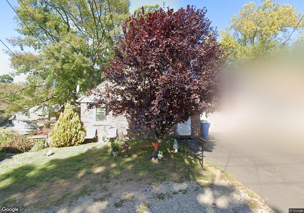
705 Neshaminy Rd Croydon, PA 19021
Estimated Value: $332,000 - $391,000
Studio
3
Baths
1,458
Sq Ft
$249/Sq Ft
Est. Value
About This Home
This home is located at 705 Neshaminy Rd, Croydon, PA 19021 and is currently estimated at $363,015, approximately $248 per square foot. 705 Neshaminy Rd is a home located in Bucks County with nearby schools including Truman Senior High School, School Lane Charter School, and St Charles Borromeo School.
Ownership History
Date
Name
Owned For
Owner Type
Purchase Details
Closed on
Dec 15, 2011
Sold by
Fuller Carole L and Roth Robert E
Bought by
Oconnell Sharon A and Oconnell Edward C
Current Estimated Value
Home Financials for this Owner
Home Financials are based on the most recent Mortgage that was taken out on this home.
Original Mortgage
$112,000
Outstanding Balance
$76,616
Interest Rate
4.01%
Mortgage Type
New Conventional
Estimated Equity
$286,399
Purchase Details
Closed on
Jul 15, 1964
Bought by
Roth Russell C and Roth Irene B
Create a Home Valuation Report for This Property
The Home Valuation Report is an in-depth analysis detailing your home's value as well as a comparison with similar homes in the area
Home Values in the Area
Average Home Value in this Area
Purchase History
| Date | Buyer | Sale Price | Title Company |
|---|---|---|---|
| Oconnell Sharon A | $140,000 | First American Title Ins Co | |
| Roth Russell C | -- | -- |
Source: Public Records
Mortgage History
| Date | Status | Borrower | Loan Amount |
|---|---|---|---|
| Open | Oconnell Sharon A | $112,000 |
Source: Public Records
Tax History
| Year | Tax Paid | Tax Assessment Tax Assessment Total Assessment is a certain percentage of the fair market value that is determined by local assessors to be the total taxable value of land and additions on the property. | Land | Improvement |
|---|---|---|---|---|
| 2025 | $7,061 | $26,000 | $3,400 | $22,600 |
| 2024 | $7,061 | $26,000 | $3,400 | $22,600 |
| 2023 | $7,009 | $26,000 | $3,400 | $22,600 |
| 2022 | $7,009 | $26,000 | $3,400 | $22,600 |
| 2021 | $7,009 | $26,000 | $3,400 | $22,600 |
| 2020 | $7,009 | $26,000 | $3,400 | $22,600 |
| 2019 | $6,983 | $26,000 | $3,400 | $22,600 |
| 2018 | $6,871 | $26,000 | $3,400 | $22,600 |
| 2017 | $6,766 | $26,000 | $3,400 | $22,600 |
| 2016 | $6,766 | $26,000 | $3,400 | $22,600 |
| 2015 | $5,247 | $26,000 | $3,400 | $22,600 |
| 2014 | $5,247 | $26,000 | $3,400 | $22,600 |
Source: Public Records
Map
Nearby Homes
- 208 Neshaminy Rd
- 4517 E Yates Rd
- 910 Magnolia Ave
- 535 Princess Ave
- 4387 Bensalem Blvd
- 0 Neshaminy St Unit PABU2089046
- 200 Janet Ave
- 1051 Maple Ave
- 530 Main Ave
- 601 Fourth Ave
- 618 Cedar Ave
- 619 First Ave
- 0 Allen Ave
- 730 Excelsior Ave
- 805 State Rd
- 1004 Weybridge Ct
- 419 Rutgers Ct
- 367 Dartmouth Ct Unit 367
- 3933 Wrexham Ct
- 811 Washington Ave
- 701 Neshaminy Rd
- 615 Neshaminy Rd
- 709 Neshaminy Rd
- 621 Neshaminy Rd
- 700 Neshaminy Rd
- 617 Neshaminy Rd
- 719 Neshaminy Rd
- 718 Neshaminy Rd
- 257 Newportville Rd
- 611 Neshaminy Rd
- 252 Belmont Ave
- 703 Newportville Rd
- 249 Belmont Ave
- 253 Newportville Rd
- 607 Neshaminy Rd
- 244 Belmont Ave
- 711 Newportville Rd
- 509 Louise Ave
- 245 Belmont Ave
- 507 Louise Ave
Your Personal Tour Guide
Ask me questions while you tour the home.