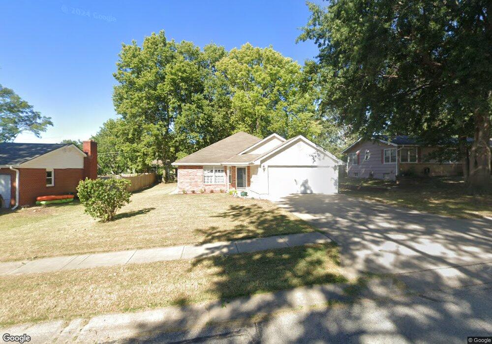
705 NW Range St Blue Springs, MO 64015
Estimated Value: $256,000 - $277,000
3
Beds
2
Baths
1,356
Sq Ft
$196/Sq Ft
Est. Value
About This Home
This home is located at 705 NW Range St, Blue Springs, MO 64015 and is currently estimated at $265,489, approximately $195 per square foot. 705 NW Range St is a home located in Jackson County with nearby schools including Thomas J. Ultican Elementary School, Paul Kinder Middle School, and Blue Springs High School.
Ownership History
Date
Name
Owned For
Owner Type
Purchase Details
Closed on
Apr 1, 2016
Sold by
Martin Louis Frederick and Martin Suzanne
Bought by
Martin Family Trust
Current Estimated Value
Purchase Details
Closed on
Aug 12, 2015
Sold by
Mcbride Teresa
Bought by
Martin Louis Frederick and Martin Suzanne
Purchase Details
Closed on
Oct 25, 2004
Sold by
Williamson John R and Williamson Therese A
Bought by
Lewellen Geraldine M
Purchase Details
Closed on
Jul 17, 2000
Sold by
Williamson Mary Patricia Jeanne
Bought by
Williamson John R and Williamson Therese A
Create a Home Valuation Report for This Property
The Home Valuation Report is an in-depth analysis detailing your home's value as well as a comparison with similar homes in the area
Home Values in the Area
Average Home Value in this Area
Purchase History
| Date | Buyer | Sale Price | Title Company |
|---|---|---|---|
| Martin Family Trust | -- | None Available | |
| Martin Louis Frederick | -- | None Available | |
| Lewellen Geraldine M | -- | Kansas City Title | |
| Williamson John R | -- | -- |
Source: Public Records
Tax History Compared to Growth
Tax History
| Year | Tax Paid | Tax Assessment Tax Assessment Total Assessment is a certain percentage of the fair market value that is determined by local assessors to be the total taxable value of land and additions on the property. | Land | Improvement |
|---|---|---|---|---|
| 2025 | $2,081 | $29,332 | $6,388 | $22,944 |
| 2024 | $2,041 | $25,508 | $4,172 | $21,336 |
| 2023 | $2,041 | $25,508 | $3,770 | $21,738 |
| 2022 | $3,114 | $34,390 | $4,267 | $30,123 |
| 2021 | $3,111 | $34,390 | $4,267 | $30,123 |
| 2020 | $2,780 | $31,260 | $4,267 | $26,993 |
| 2019 | $2,687 | $31,260 | $4,267 | $26,993 |
| 2018 | $2,430 | $27,205 | $3,713 | $23,492 |
| 2017 | $2,430 | $27,205 | $3,713 | $23,492 |
| 2016 | $2,363 | $26,524 | $2,527 | $23,997 |
| 2014 | $2,281 | $25,522 | $2,531 | $22,991 |
Source: Public Records
Map
Nearby Homes
- 1109 NW B St
- 804 NW Maynard St
- 503 NW 15th St
- 1109 NW Mock Ave
- 804 NW North Summit Cir
- 723 NW 6th Street Terrace
- 305 NW 17th St
- 205 NW 4th Street Ct
- 0 NW Jefferson St
- 678 NW Valleybrook Rd
- 403 NW Lakeview Rd
- 318 SW 10th St
- 409 NW Locust Dr
- 1705 SW Walnut St
- 510 SW 12 St
- 813 NW North Ridge Ct
- 2000 SW Smith St
- 401 SW 18th St
- 1504 NW Weatherstone Dr
- 514 SW 10th St
- 703 NW Range St
- 707 NW Range St
- 704 NW 10th St
- 700 NW 10th St
- 709 NW Range St
- 704 NW Range St
- 706 NW 10th St
- 706 NW Range St
- 708 NW 10th St
- 708 NW Range St
- 711 NW Range St
- 703 NW 10th St
- 705 NW 10th St
- 1000 NW R D Mize Rd
- 710 NW Range St
- 701 NW 10th St
- 910 NW R D Mize Rd
- 710 NW 10th St
- 1004 NW R D Mize Rd
- 715 NW Range St