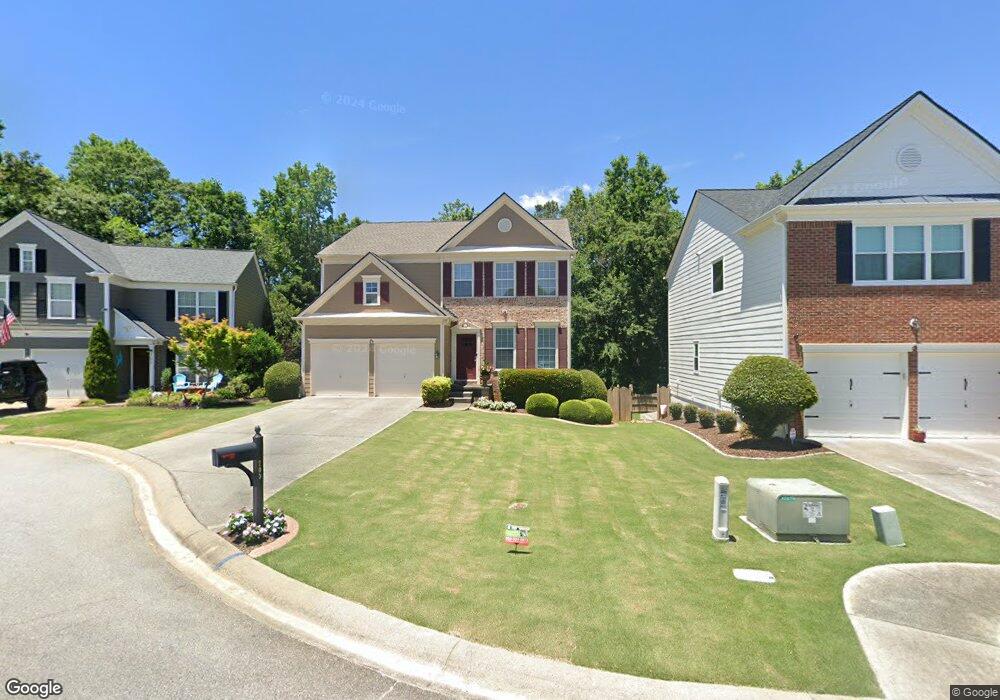
705 Purslane Way Woodstock, GA 30188
Estimated Value: $453,000 - $465,934
3
Beds
3
Baths
1,986
Sq Ft
$231/Sq Ft
Est. Value
About This Home
This home is located at 705 Purslane Way, Woodstock, GA 30188 and is currently estimated at $459,467, approximately $231 per square foot. 705 Purslane Way is a home located in Cherokee County with nearby schools including Little River Elementary, Mill Creek Middle School, and River Ridge High School.
Ownership History
Date
Name
Owned For
Owner Type
Purchase Details
Closed on
Jul 29, 2004
Sold by
Pulte Home Corp
Bought by
Murdock Donald and Murdock Linda
Current Estimated Value
Home Financials for this Owner
Home Financials are based on the most recent Mortgage that was taken out on this home.
Original Mortgage
$182,500
Outstanding Balance
$73,295
Interest Rate
3.38%
Mortgage Type
New Conventional
Estimated Equity
$386,172
Create a Home Valuation Report for This Property
The Home Valuation Report is an in-depth analysis detailing your home's value as well as a comparison with similar homes in the area
Home Values in the Area
Average Home Value in this Area
Purchase History
| Date | Buyer | Sale Price | Title Company |
|---|---|---|---|
| Murdock Donald | $228,200 | -- |
Source: Public Records
Mortgage History
| Date | Status | Borrower | Loan Amount |
|---|---|---|---|
| Open | Murdock Donald | $182,500 |
Source: Public Records
Tax History Compared to Growth
Tax History
| Year | Tax Paid | Tax Assessment Tax Assessment Total Assessment is a certain percentage of the fair market value that is determined by local assessors to be the total taxable value of land and additions on the property. | Land | Improvement |
|---|---|---|---|---|
| 2025 | $521 | $190,992 | $34,800 | $156,192 |
| 2024 | $512 | $189,904 | $34,800 | $155,104 |
| 2023 | $52 | $172,840 | $33,200 | $139,640 |
| 2022 | $557 | $146,000 | $27,200 | $118,800 |
| 2021 | $530 | $127,160 | $22,000 | $105,160 |
| 2020 | $579 | $117,680 | $20,000 | $97,680 |
| 2019 | $527 | $107,640 | $20,000 | $87,640 |
| 2018 | $540 | $102,080 | $17,600 | $84,480 |
| 2017 | $557 | $249,700 | $17,600 | $82,280 |
| 2016 | $554 | $231,700 | $16,800 | $75,880 |
| 2015 | $556 | $224,400 | $15,200 | $74,560 |
| 2014 | $507 | $203,800 | $14,000 | $67,520 |
Source: Public Records
Map
Nearby Homes
- 321 Burdock Trace
- 522 Watercress Dr
- 236 Persimmon Dr
- 809 Araya Ct
- 116 Neetle Close Dr
- 124 Riverside Ln
- 154 Towey Trail
- 144 Towey Trail
- 133 Finsbury Ln
- 202 Little River Way
- 414 Spring View Dr
- 202 Kigian Trail
- 237 Kigian Trail
- 205 Deerchase Dr
- 230 Apple Branch Dr
- 939 Bendleton Dr
- 140 Apple Valley Dr
- 212 Regent Square
- 707 Purslane Way
- 703 Purslane Way
- 709 Purslane Way
- 701 Purslane Way
- 711 Purslane Way
- 0 Purslane Way Unit 8410731
- 700 Purslane Way Unit 32
- 713 Purslane Way
- 603 Sorrell Way
- 305 Melilot Ct
- 702 Purslane Way
- 706 Purslane Way
- 303 Melilot Ct
- 715 Purslane Way
- 416 Yarrow Way
- 708 Purslane Way
- 306 Melilot Ct
- 0 Sorrell Way
- 511 Watercress Dr
- 509 Watercress Dr