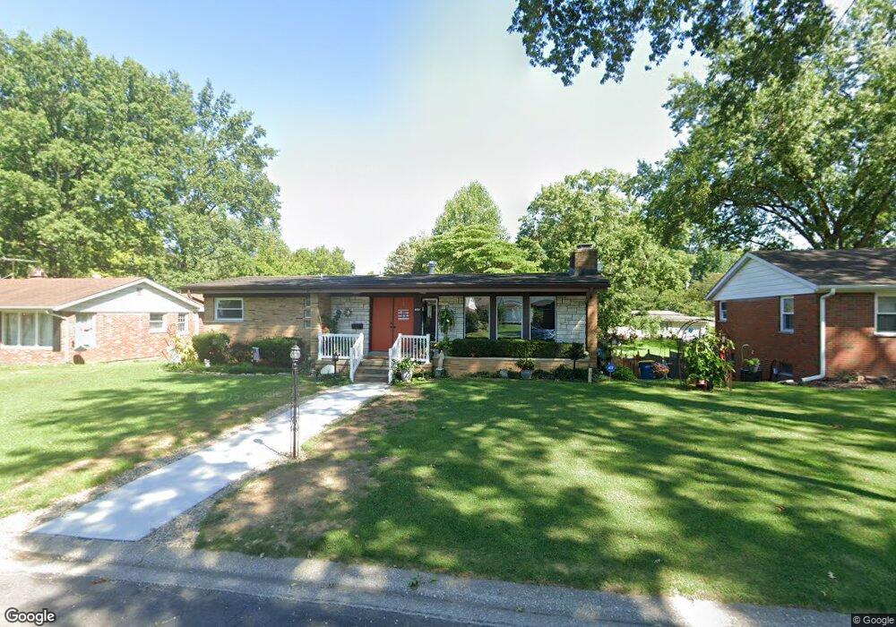
705 Roanoke Dr Edwardsville, IL 62025
Estimated Value: $237,000 - $313,000
3
Beds
4
Baths
1,562
Sq Ft
$177/Sq Ft
Est. Value
About This Home
This home is located at 705 Roanoke Dr, Edwardsville, IL 62025 and is currently estimated at $276,149, approximately $176 per square foot. 705 Roanoke Dr is a home located in Madison County with nearby schools including LeClaire Elementary School, Columbus Elementary School, and Liberty Middle School.
Ownership History
Date
Name
Owned For
Owner Type
Purchase Details
Closed on
Sep 10, 2004
Sold by
Jones Carl W and Jones Barbara J
Bought by
Seib Sandra J
Current Estimated Value
Home Financials for this Owner
Home Financials are based on the most recent Mortgage that was taken out on this home.
Original Mortgage
$100,000
Outstanding Balance
$49,774
Interest Rate
5.95%
Mortgage Type
Purchase Money Mortgage
Estimated Equity
$226,375
Create a Home Valuation Report for This Property
The Home Valuation Report is an in-depth analysis detailing your home's value as well as a comparison with similar homes in the area
Home Values in the Area
Average Home Value in this Area
Purchase History
| Date | Buyer | Sale Price | Title Company |
|---|---|---|---|
| Seib Sandra J | $150,000 | Abstracts & Titles Inc |
Source: Public Records
Mortgage History
| Date | Status | Borrower | Loan Amount |
|---|---|---|---|
| Open | Seib Sandra J | $100,000 |
Source: Public Records
Tax History Compared to Growth
Tax History
| Year | Tax Paid | Tax Assessment Tax Assessment Total Assessment is a certain percentage of the fair market value that is determined by local assessors to be the total taxable value of land and additions on the property. | Land | Improvement |
|---|---|---|---|---|
| 2024 | $5,726 | $93,200 | $9,080 | $84,120 |
| 2023 | $5,726 | $86,490 | $8,430 | $78,060 |
| 2022 | $5,323 | $79,950 | $7,790 | $72,160 |
| 2021 | $5,046 | $75,880 | $7,390 | $68,490 |
| 2020 | $4,875 | $73,530 | $7,160 | $66,370 |
| 2019 | $4,835 | $72,300 | $7,040 | $65,260 |
| 2018 | $4,745 | $69,050 | $6,720 | $62,330 |
| 2017 | $4,760 | $67,590 | $6,580 | $61,010 |
| 2016 | $4,300 | $67,590 | $6,580 | $61,010 |
| 2015 | $4,105 | $62,660 | $6,100 | $56,560 |
| 2014 | $4,105 | $62,660 | $6,100 | $56,560 |
| 2013 | $4,105 | $62,660 | $6,100 | $56,560 |
Source: Public Records
Map
Nearby Homes
- 629 Bollman Ave
- 424 Hadley Ave
- 503 Bollman Ave
- 426 Roanoke Dr
- 417 Montclaire Ave
- 4 Hadley Ct
- 638 Yale Ave
- 221 4th Ave
- 1120 Franklin Ave
- 502 Jaime Lynn Ct
- 613 Jaime Lynn Ct
- 424 Circle Dr
- 307 Monticello Place Unit A
- 500 Monticello Place
- 821 Sherman Ave
- 808 Meade Ave
- 714 Sherman Ave
- 1101 N Oxfordshire Ln
- 103 Thomas Terrace
- 311 Barnett Dr
- 629 Roanoke Dr
- 709 Roanoke Dr
- 715 Roanoke Dr
- 621 Roanoke Dr
- 708 Roanoke Dr
- 628 Roanoke Dr
- 1226 Oakland Ave
- 622 Roanoke Dr
- 709 Hadley Ave
- 712 Roanoke Dr
- 617 Roanoke Dr
- 721 Roanoke Dr
- 615 Hadley Ave
- 705 Bollman Ave
- 709 Bollman Ave
- 716 Roanoke Dr
- 1224 Oakland Ave
- 715 Hadley Ave
- 1227 Oakland Ave
- 613 Roanoke Dr