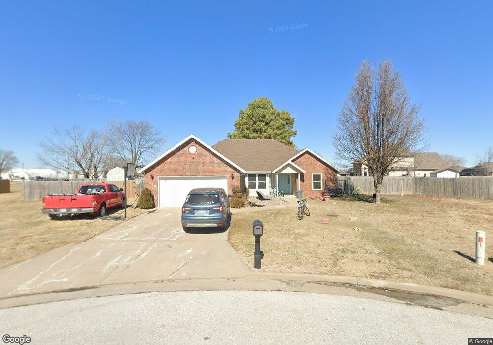
705 Rose Ln Carl Junction, MO 64834
Estimated Value: $244,000 - $275,000
3
Beds
2
Baths
1,670
Sq Ft
$152/Sq Ft
Est. Value
About This Home
This home is located at 705 Rose Ln, Carl Junction, MO 64834 and is currently estimated at $253,141, approximately $151 per square foot. 705 Rose Ln is a home located in Jasper County with nearby schools including Carl Junction Primary School (K-1), Carl Junction Intermediate School, and Carl Junction Primary School (2-3).
Ownership History
Date
Name
Owned For
Owner Type
Purchase Details
Closed on
Mar 8, 2016
Sold by
Beachner Jared Waldon and Beachner Natalie J
Bought by
Mwai Nola and Mwai Bernard M
Current Estimated Value
Purchase Details
Closed on
Mar 25, 2013
Sold by
Mitchell Chris and Mitchell Cristy D
Bought by
Beachner Jared Waldon and Beachner Natalie J
Home Financials for this Owner
Home Financials are based on the most recent Mortgage that was taken out on this home.
Original Mortgage
$147,669
Interest Rate
3.59%
Mortgage Type
VA
Purchase Details
Closed on
Jun 25, 2009
Sold by
Red Wood Development Inc
Bought by
Mitchell Cristy D
Home Financials for this Owner
Home Financials are based on the most recent Mortgage that was taken out on this home.
Original Mortgage
$137,267
Interest Rate
4.83%
Mortgage Type
FHA
Create a Home Valuation Report for This Property
The Home Valuation Report is an in-depth analysis detailing your home's value as well as a comparison with similar homes in the area
Home Values in the Area
Average Home Value in this Area
Purchase History
| Date | Buyer | Sale Price | Title Company |
|---|---|---|---|
| Mwai Nola | -- | None Available | |
| Beachner Jared Waldon | -- | None Available | |
| Mitchell Cristy D | -- | Fatco |
Source: Public Records
Mortgage History
| Date | Status | Borrower | Loan Amount |
|---|---|---|---|
| Previous Owner | Beachner Jared Waldon | $147,669 | |
| Previous Owner | Mitchell Cristy D | $137,267 |
Source: Public Records
Tax History Compared to Growth
Tax History
| Year | Tax Paid | Tax Assessment Tax Assessment Total Assessment is a certain percentage of the fair market value that is determined by local assessors to be the total taxable value of land and additions on the property. | Land | Improvement |
|---|---|---|---|---|
| 2025 | $1,348 | $25,970 | $2,700 | $23,270 |
| 2024 | $1,356 | $23,030 | $2,700 | $20,330 |
| 2023 | $1,356 | $23,030 | $2,700 | $20,330 |
| 2022 | $1,400 | $23,720 | $2,700 | $21,020 |
| 2021 | $1,201 | $23,720 | $2,700 | $21,020 |
| 2020 | $1,125 | $21,830 | $2,700 | $19,130 |
| 2019 | $1,068 | $21,830 | $2,700 | $19,130 |
| 2018 | $1,109 | $22,720 | $0 | $0 |
| 2017 | $1,112 | $22,720 | $0 | $0 |
| 2016 | $1,144 | $23,600 | $0 | $0 |
| 2015 | -- | $23,600 | $0 | $0 |
| 2014 | -- | $23,600 | $0 | $0 |
Source: Public Records
Map
Nearby Homes
- 907 Aberdeen Ave
- TBD Route Yy
- 29320 State Highway Yy
- Tract 3 Prairie Ln
- Tract 2 Prairie Ln
- Tract 1 Prairie Ln
- Tract 4 Prairie Ln
- 711 Prairie Ln
- 819 Delaney Dr
- 815 Delaney Dr
- Tract D1 County Road 284
- Tract D2 County Road 284
- Tract D3 County Road 284
- 29865 State Highway Yy
- 409 Gault St
- 409 W Gault St
- 311 S Roney St
- 505 W Walton Ave
- 1550KP-4 Plan at Rainer Farms
- 2360 Two Story Plan at Rainer Farms