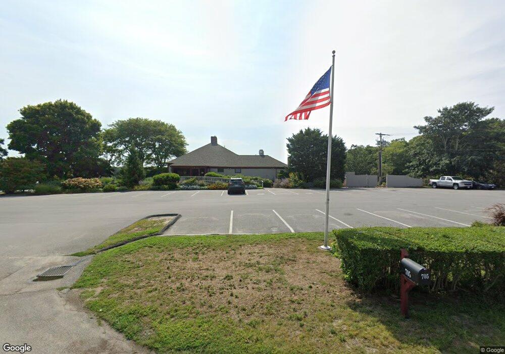
705 Route 28 Harwich Port, MA 2646
Harwich Port NeighborhoodEstimated Value: $4,360,600
--
Bed
--
Bath
5,113
Sq Ft
$853/Sq Ft
Est. Value
About This Home
This home is located at 705 Route 28, Harwich Port, MA 2646 and is currently estimated at $4,360,600, approximately $852 per square foot. 705 Route 28 is a home located in Barnstable County with nearby schools including Harwich Elementary School, Chatham Elementary School, and Monomoy Regional Middle School.
Ownership History
Date
Name
Owned For
Owner Type
Purchase Details
Closed on
Dec 14, 2012
Sold by
Brax Land Inc
Bought by
Loomis T Simmons Llc
Current Estimated Value
Home Financials for this Owner
Home Financials are based on the most recent Mortgage that was taken out on this home.
Original Mortgage
$1,110,000
Outstanding Balance
$766,101
Interest Rate
3.44%
Mortgage Type
Commercial
Estimated Equity
$3,594,499
Purchase Details
Closed on
Jan 26, 2004
Sold by
Brax Inc
Bought by
Bracket
Create a Home Valuation Report for This Property
The Home Valuation Report is an in-depth analysis detailing your home's value as well as a comparison with similar homes in the area
Home Values in the Area
Average Home Value in this Area
Purchase History
| Date | Buyer | Sale Price | Title Company |
|---|---|---|---|
| Loomis T Simmons Llc | $1,850,000 | -- | |
| Bracket | $125,000 | -- | |
| Bracket | $125,000 | -- |
Source: Public Records
Mortgage History
| Date | Status | Borrower | Loan Amount |
|---|---|---|---|
| Open | Loomis T Simmons Llc | $1,110,000 | |
| Closed | Bracket | $1,110,000 |
Source: Public Records
Tax History Compared to Growth
Tax History
| Year | Tax Paid | Tax Assessment Tax Assessment Total Assessment is a certain percentage of the fair market value that is determined by local assessors to be the total taxable value of land and additions on the property. | Land | Improvement |
|---|---|---|---|---|
| 2025 | $12,851 | $2,174,500 | $1,491,900 | $682,600 |
| 2024 | $12,727 | $2,110,600 | $1,434,300 | $676,300 |
| 2023 | $13,471 | $2,028,700 | $1,365,800 | $662,900 |
| 2022 | $15,644 | $1,929,000 | $1,288,500 | $640,500 |
| 2021 | $16,532 | $1,922,300 | $1,276,700 | $645,600 |
| 2020 | $16,362 | $1,874,200 | $1,223,300 | $650,900 |
| 2019 | $15,794 | $1,821,700 | $1,175,800 | $645,900 |
| 2018 | $16,475 | $1,817,600 | $1,175,800 | $641,800 |
| 2017 | $15,776 | $1,758,800 | $1,119,200 | $639,600 |
| 2016 | $15,726 | $1,733,800 | $1,097,300 | $636,500 |
| 2015 | $15,332 | $1,709,200 | $1,075,700 | $633,500 |
| 2014 | $14,682 | $1,674,100 | $1,044,400 | $629,700 |
Source: Public Records
Map
Nearby Homes
- 53 Freeman St
- 820 Massachusetts 28
- 9 Jason Ln
- 8 Old Wharf Rd
- 15 Pleasant St Unit W24
- 252 Chatham Rd
- 15 Shannon Rd
- 515 Massachusetts 28
- 515 Route 28
- 28 Dale Rd
- 106 Chatham Rd
- 303 Bank St
- 27 Quaker Ln
- 23 Zylpha Rd
- 21 Princes St
- 44 Beriah Brooks Rd
- 8 Wyndemere Bluffs Rd
- 405 Lower County Rd Unit 21
- 405 Lower County Rd Unit 23
- 116 Parallel St
- 702 Route 28
- 710 Route 28
- 00 00
- 0 Massachusetts 28
- 25 Colonial Way
- 85 Hoyt Rd
- 24 Wychmere Harbor Dr
- 19 Colonial Way
- 715 Route 28
- 80 Hoyt Rd
- 720 Route 28 Unit 1F
- 720 Route 28 Unit 1E
- 720 Route 28 Unit 1D
- 720 Route 28 Unit 1C
- 720 Route 28 Unit 1B
- 720 Route 28 Unit 1A
- 720 Route 28 Unit 2C
- 720 Route 28 Unit 1-1B
- 720 Route 28
- 690 Route 28