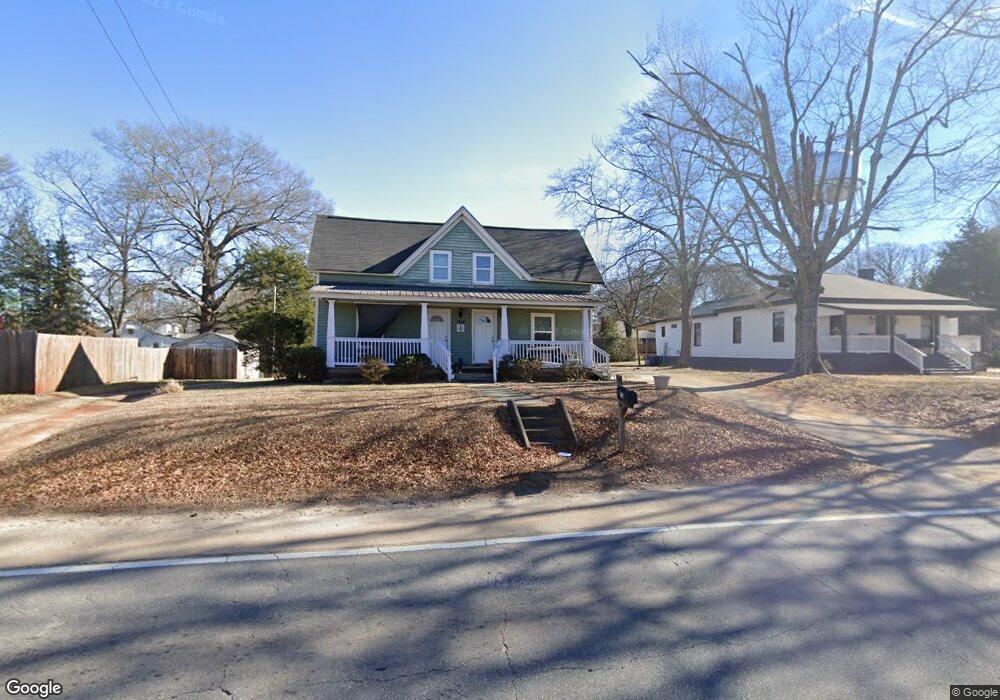
705 S Broad St Unit 156 Monroe, GA 30655
Estimated Value: $185,000 - $276,000
3
Beds
1
Bath
1,200
Sq Ft
$203/Sq Ft
Est. Value
About This Home
This home is located at 705 S Broad St Unit 156, Monroe, GA 30655 and is currently estimated at $243,900, approximately $203 per square foot. 705 S Broad St Unit 156 is a home located in Walton County with nearby schools including Atha Road Elementary School, Youth Middle School, and Walnut Grove High School.
Ownership History
Date
Name
Owned For
Owner Type
Purchase Details
Closed on
May 29, 2014
Sold by
Main Street Property Holdi
Bought by
Preston & Malcom Pc
Current Estimated Value
Purchase Details
Closed on
Jul 20, 2006
Sold by
Murray E Kenneth
Bought by
Sorrow G Reginald
Home Financials for this Owner
Home Financials are based on the most recent Mortgage that was taken out on this home.
Original Mortgage
$61,600
Interest Rate
6.54%
Mortgage Type
New Conventional
Purchase Details
Closed on
Mar 30, 2001
Sold by
Toney John V
Bought by
Murray E Kenneth
Home Financials for this Owner
Home Financials are based on the most recent Mortgage that was taken out on this home.
Original Mortgage
$50,000
Interest Rate
7.02%
Mortgage Type
New Conventional
Create a Home Valuation Report for This Property
The Home Valuation Report is an in-depth analysis detailing your home's value as well as a comparison with similar homes in the area
Home Values in the Area
Average Home Value in this Area
Purchase History
| Date | Buyer | Sale Price | Title Company |
|---|---|---|---|
| Preston & Malcom Pc | $45,000 | -- | |
| Sorrow G Reginald | $75,000 | -- | |
| Murray E Kenneth | $50,000 | -- |
Source: Public Records
Mortgage History
| Date | Status | Borrower | Loan Amount |
|---|---|---|---|
| Previous Owner | Sorrow G Reginald | $61,600 | |
| Previous Owner | Murray E Kenneth | $50,000 |
Source: Public Records
Tax History
| Year | Tax Paid | Tax Assessment Tax Assessment Total Assessment is a certain percentage of the fair market value that is determined by local assessors to be the total taxable value of land and additions on the property. | Land | Improvement |
|---|---|---|---|---|
| 2025 | $2,297 | $75,400 | $14,520 | $60,880 |
| 2024 | $2,132 | $71,200 | $12,000 | $59,200 |
| 2023 | $2,218 | $63,440 | $12,000 | $51,440 |
| 2022 | $877 | $23,480 | $12,000 | $11,480 |
| 2021 | $635 | $16,440 | $6,400 | $10,040 |
| 2020 | $522 | $13,160 | $4,800 | $8,360 |
| 2019 | $509 | $11,760 | $4,000 | $7,760 |
| 2018 | $463 | $11,760 | $4,000 | $7,760 |
| 2017 | $412 | $9,840 | $3,400 | $6,440 |
| 2016 | $379 | $9,200 | $3,400 | $5,800 |
| 2015 | $351 | $8,360 | $3,400 | $4,960 |
| 2014 | -- | $8,440 | $0 | $0 |
Source: Public Records
Map
Nearby Homes
- 808 S Broad St
- 1037 S Madison Ave
- 325 Stokes St
- 406 Bell St
- 352 Davis St
- 504 Davis St
- 307 Davis St
- 323 S Madison Ave
- 37 Alcovy Springs Dr
- 167 Alcovy Springs Dr
- 416 Shamrock Dr
- 206 Walker Dr
- 212 Walker Dr
- 603 Ash Ln
- 605 E Church St
- 529 Mill Farm Ln
- 209 Milledge Ave
- 733 W Creek Cir
- 525 Mill Farm Ln
- 739 Wheel House Ln Unit B
Your Personal Tour Guide
Ask me questions while you tour the home.