Estimated Value: $78,000 - $140,000
3
Beds
1
Bath
864
Sq Ft
$141/Sq Ft
Est. Value
About This Home
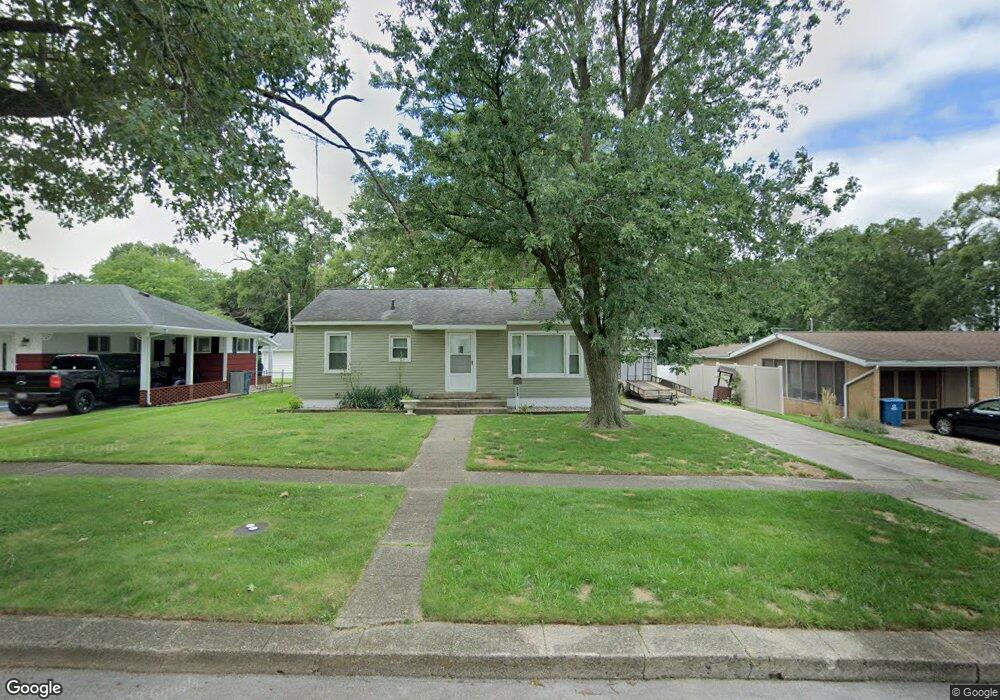
This home is located at 705 S Fisher St, Knox, IN 46534 and is currently estimated at $121,861, approximately $141 per square foot. 705 S Fisher St is a home located in Starke County with nearby schools including Knox Community Elementary School, Knox Community Middle School, and Knox Community High School.
Ownership History
Date
Name
Owned For
Owner Type
Purchase Details
Closed on
Jan 25, 2017
Sold by
Larry Mullins
Bought by
Prentis Davis
Current Estimated Value
Home Financials for this Owner
Home Financials are based on the most recent Mortgage that was taken out on this home.
Original Mortgage
$24,800
Outstanding Balance
$4,169
Interest Rate
4.16%
Mortgage Type
Commercial
Estimated Equity
$117,692
Purchase Details
Closed on
Nov 17, 2011
Sold by
Mullins Wanda
Bought by
Mullins Larry
Home Financials for this Owner
Home Financials are based on the most recent Mortgage that was taken out on this home.
Original Mortgage
$44,000
Interest Rate
4.12%
Mortgage Type
New Conventional
Create a Home Valuation Report for This Property
The Home Valuation Report is an in-depth analysis detailing your home's value as well as a comparison with similar homes in the area
Home Values in the Area
Average Home Value in this Area
Purchase History
| Date | Buyer | Sale Price | Title Company |
|---|---|---|---|
| Prentis Davis | $31,400 | -- | |
| Davis Prentis | $31,357 | Mckesson Title Corp | |
| Mullins Larry | -- | Mckesson Title Corp |
Source: Public Records
Mortgage History
| Date | Status | Borrower | Loan Amount |
|---|---|---|---|
| Open | Davis Prentis | $24,800 | |
| Previous Owner | Mullins Larry | $44,000 |
Source: Public Records
Tax History Compared to Growth
Tax History
| Year | Tax Paid | Tax Assessment Tax Assessment Total Assessment is a certain percentage of the fair market value that is determined by local assessors to be the total taxable value of land and additions on the property. | Land | Improvement |
|---|---|---|---|---|
| 2024 | $1,733 | $85,300 | $10,100 | $75,200 |
| 2023 | $1,577 | $77,500 | $9,200 | $68,300 |
| 2022 | $1,352 | $68,800 | $8,900 | $59,900 |
| 2021 | $1,204 | $61,300 | $8,800 | $52,500 |
| 2020 | $1,123 | $55,800 | $8,800 | $47,000 |
| 2019 | $1,070 | $53,600 | $8,500 | $45,100 |
| 2018 | $82 | $52,300 | $8,200 | $44,100 |
| 2017 | $20 | $40,100 | $8,200 | $31,900 |
| 2016 | $333 | $49,300 | $8,200 | $41,100 |
| 2014 | $347 | $53,200 | $8,200 | $45,000 |
| 2013 | $333 | $53,300 | $8,200 | $45,100 |
Source: Public Records
Map
Nearby Homes
- 600 S Roosevelt Rd
- 0000 S 350 E
- 14.89 Acres W Culver Rd
- 701 S Shield St
- 703 S Main St
- 605 S Main St
- 207 S Portland St
- 400 S Main St
- 601 S Heaton St
- 501 W John St
- 1675 U S 35
- 105 S Bower St
- 4152 S State Road 35
- 305 W Bender St
- 1301 W Culver Rd
- 625 S East St
- 207 W Lake St
- 203 W Lake St
- 400 S East St
- 313 Carlson Dr
- 707 S Fisher St
- 703 S Fisher St
- 706 Delamatyr St
- 702 Delamatyr St
- 701 S Fisher St
- 704 S Fisher St
- 702 S Fisher St
- 706 S Fisher St
- 402 Brown Cir
- 404 Brown Cir
- 400 Brown Cir
- 408 Brown Cir
- 403 W Jackson St
- 405 W Jackson St
- 705 S Portland St
- 703 S Portland St
- 707 S Portland St
- 705 Delamatyr St
- 703 Delamatyr St
- 401 W Ellis St