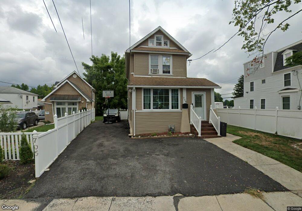
705 S Union Ave Lansdowne, PA 19050
Estimated Value: $209,000 - $257,000
3
Beds
2
Baths
1,520
Sq Ft
$158/Sq Ft
Est. Value
About This Home
This home is located at 705 S Union Ave, Lansdowne, PA 19050 and is currently estimated at $240,890, approximately $158 per square foot. 705 S Union Ave is a home located in Delaware County with nearby schools including Ardmore Avenue School, Penn Wood Middle School, and Penn Wood High School - Cypress Street Campus.
Ownership History
Date
Name
Owned For
Owner Type
Purchase Details
Closed on
Jun 30, 2006
Sold by
Strother Joseph A
Bought by
Williams Petrine
Current Estimated Value
Home Financials for this Owner
Home Financials are based on the most recent Mortgage that was taken out on this home.
Original Mortgage
$116,400
Outstanding Balance
$69,333
Interest Rate
6.71%
Mortgage Type
Purchase Money Mortgage
Estimated Equity
$171,557
Purchase Details
Closed on
Feb 11, 2005
Sold by
Strother Joseph A
Bought by
Strother Joseph A
Create a Home Valuation Report for This Property
The Home Valuation Report is an in-depth analysis detailing your home's value as well as a comparison with similar homes in the area
Home Values in the Area
Average Home Value in this Area
Purchase History
| Date | Buyer | Sale Price | Title Company |
|---|---|---|---|
| Williams Petrine | $120,000 | None Available | |
| Strother Joseph A | -- | -- |
Source: Public Records
Mortgage History
| Date | Status | Borrower | Loan Amount |
|---|---|---|---|
| Open | Williams Petrine | $116,400 |
Source: Public Records
Tax History Compared to Growth
Tax History
| Year | Tax Paid | Tax Assessment Tax Assessment Total Assessment is a certain percentage of the fair market value that is determined by local assessors to be the total taxable value of land and additions on the property. | Land | Improvement |
|---|---|---|---|---|
| 2025 | $5,462 | $127,910 | $27,880 | $100,030 |
| 2024 | $5,462 | $127,910 | $27,880 | $100,030 |
| 2023 | $4,960 | $127,910 | $27,880 | $100,030 |
| 2022 | $4,730 | $127,910 | $27,880 | $100,030 |
| 2021 | $7,153 | $127,910 | $27,880 | $100,030 |
| 2020 | $4,513 | $72,270 | $24,680 | $47,590 |
| 2019 | $4,434 | $72,270 | $24,680 | $47,590 |
| 2018 | $4,372 | $72,270 | $0 | $0 |
| 2017 | $4,281 | $72,270 | $0 | $0 |
| 2016 | $397 | $72,270 | $0 | $0 |
| 2015 | $397 | $72,270 | $0 | $0 |
| 2014 | $397 | $72,270 | $0 | $0 |
Source: Public Records
Map
Nearby Homes
- 201 Elder Ave
- 137 Elder Ave
- 103 Lincoln Ave
- 408 S Union Ave
- 192 Fairview Ave
- 144 Fairview Ave
- 32 Elder Ave
- 30 E Providence Rd
- 306 Golf Rd
- 530 Orchard Ave
- 603 Penn St
- 49 Elberon Ave
- 129 Branford Rd
- 1345 Park Ln
- 14 W Providence Rd
- 29 Concord Rd
- 27 Concord Rd
- 503 Bonsall Ave
- 1246 Wycombe Ave
- 435 Bonsall Ave