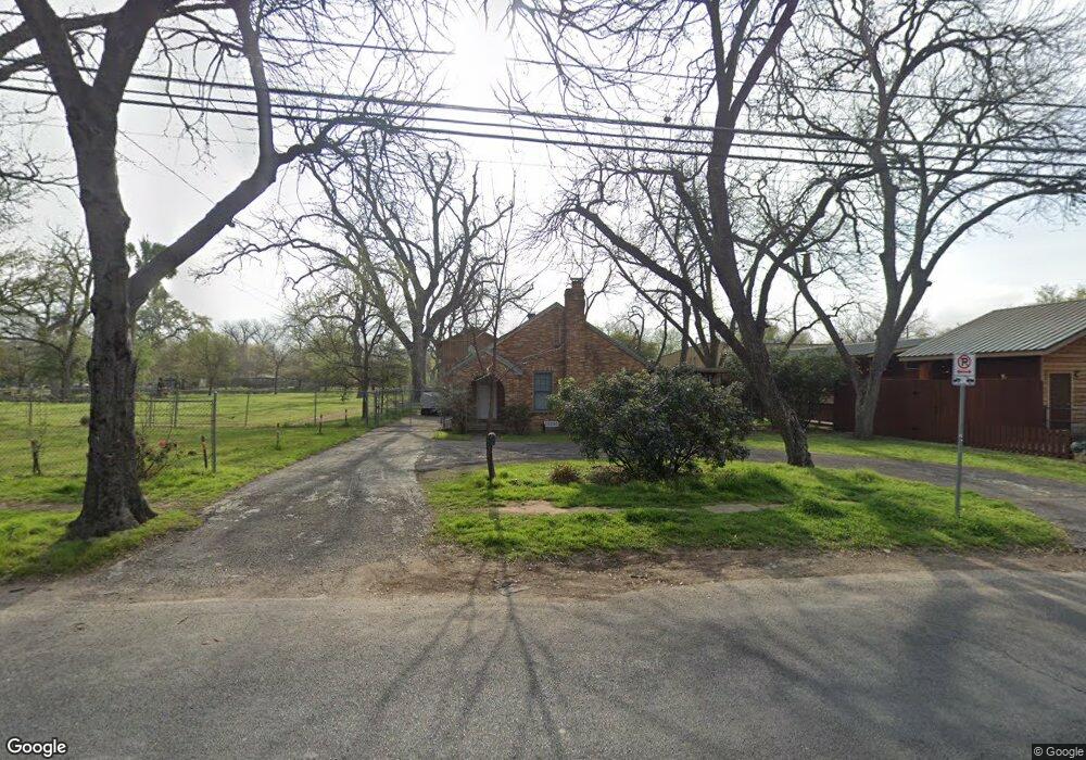
705 Shady Ln Austin, TX 78702
Govalle NeighborhoodEstimated Value: $549,000 - $784,000
Studio
1
Bath
1,288
Sq Ft
$529/Sq Ft
Est. Value
About This Home
This home is located at 705 Shady Ln, Austin, TX 78702 and is currently estimated at $681,180, approximately $528 per square foot. 705 Shady Ln is a home located in Travis County with nearby schools including Govalle Elementary School, Martin Middle School, and Eastside Early College High School.
Ownership History
Date
Name
Owned For
Owner Type
Purchase Details
Closed on
Aug 30, 2017
Sold by
Santis Rosa
Bought by
Shady Owls Properties Llc
Current Estimated Value
Purchase Details
Closed on
Aug 26, 2002
Sold by
Walton Sallie Jane Barnett
Bought by
Santis Rosa E
Purchase Details
Closed on
Dec 14, 1994
Sold by
Petri William C and Petri William C
Bought by
Walton Sallie Jane Barnett
Home Financials for this Owner
Home Financials are based on the most recent Mortgage that was taken out on this home.
Original Mortgage
$30,000
Interest Rate
9%
Mortgage Type
Purchase Money Mortgage
Create a Home Valuation Report for This Property
The Home Valuation Report is an in-depth analysis detailing your home's value as well as a comparison with similar homes in the area
Home Values in the Area
Average Home Value in this Area
Purchase History
| Date | Buyer | Sale Price | Title Company |
|---|---|---|---|
| Shady Owls Properties Llc | -- | None Available | |
| Santis Rosa E | -- | Fidelity National Title | |
| Walton Sallie Jane Barnett | -- | Austin Title Company |
Source: Public Records
Mortgage History
| Date | Status | Borrower | Loan Amount |
|---|---|---|---|
| Previous Owner | Walton Sallie Jane Barnett | $30,000 |
Source: Public Records
Tax History
| Year | Tax Paid | Tax Assessment Tax Assessment Total Assessment is a certain percentage of the fair market value that is determined by local assessors to be the total taxable value of land and additions on the property. | Land | Improvement |
|---|---|---|---|---|
| 2025 | $16,209 | $792,048 | $701,250 | $90,798 |
| 2023 | $9,129 | $792,048 | $701,250 | $90,798 |
| 2021 | $14,465 | $664,548 | $573,750 | $90,798 |
| 2020 | $8,996 | $419,400 | $250,000 | $169,400 |
| 2018 | $8,092 | $365,478 | $250,000 | $115,478 |
| 2017 | $7,334 | $328,848 | $192,500 | $136,348 |
| 2016 | $6,763 | $303,260 | $165,000 | $138,260 |
| 2015 | $5,411 | $288,590 | $82,500 | $206,090 |
| 2014 | $5,411 | $227,359 | $82,500 | $144,859 |
Source: Public Records
Map
Nearby Homes
- 4704 Gonzales St
- 604 Springdale Rd
- 3528 Gonzales St Unit 1B
- 3530 Gonzales St Unit B
- 746 Springdale Rd
- 3524 Gonzales St Unit 2A
- 601 Vermont Rd Unit 1
- 603 Vermont Rd Unit 2
- 3520 Gonzales St
- 909 Calle Limon Unit 2
- 911 Calle Limon Unit 1
- 1000 Gullett St Unit 2
- 3412 Gonzales St Unit 1
- 602 Allen St
- 5707 Tracy Lynn Ln Unit A
- 914 Bret Ln
- 640 Tillery St
- 506 Tillery St
- 1121 Walton Ln Unit B
- 3113 Prado St
- 5100 E 7th St
- 702 Shady Ln
- 730 Shady Ln
- 5012 E 7th St
- 719 Shady Ln
- 4910 E 7th St
- 4910 E 7th St Unit 111
- 5211 E 7th St
- 4905 E 7th St
- 4825 Gonzales St
- 4911 E 7th St
- 4813 Gonzales St
- 4805 Gonzales St
- 813 Shady Ln
- 643 Mansell Ave
- 647 Mansell Ave
- 4803 Gonzales St
- 740 Airport Blvd
- 5105 Glissman Rd
- 5101 Glissman Rd
Your Personal Tour Guide
Ask me questions while you tour the home.