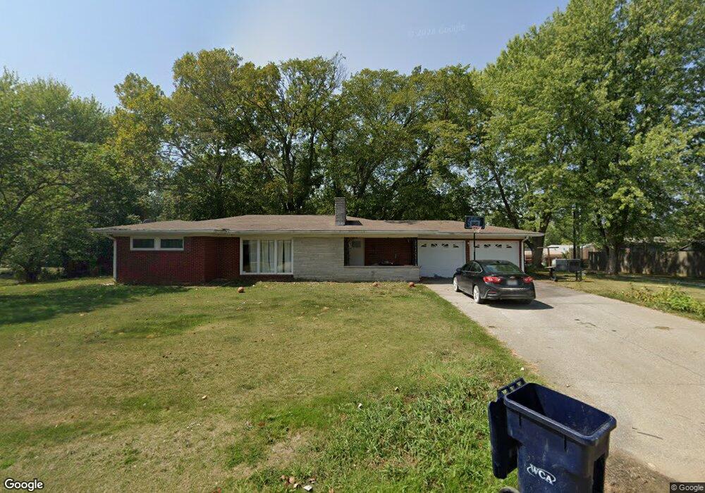
705 Summit Rd Knob Noster, MO 65336
Estimated Value: $196,000 - $257,000
3
Beds
2
Baths
1,400
Sq Ft
$159/Sq Ft
Est. Value
About This Home
This home is located at 705 Summit Rd, Knob Noster, MO 65336 and is currently estimated at $222,025, approximately $158 per square foot. 705 Summit Rd is a home located in Johnson County with nearby schools including Knob Noster High School.
Ownership History
Date
Name
Owned For
Owner Type
Purchase Details
Closed on
Sep 6, 2023
Sold by
Rhinehart Cody and Rhinehart Vickie
Bought by
Rhinehart Cody and Rhinehart Vickie
Current Estimated Value
Purchase Details
Closed on
Jul 24, 2013
Sold by
Kay Homer John
Bought by
Rhinehart Cody and Rhinehart Vickie
Home Financials for this Owner
Home Financials are based on the most recent Mortgage that was taken out on this home.
Original Mortgage
$51,200
Interest Rate
3.99%
Mortgage Type
Future Advance Clause Open End Mortgage
Create a Home Valuation Report for This Property
The Home Valuation Report is an in-depth analysis detailing your home's value as well as a comparison with similar homes in the area
Home Values in the Area
Average Home Value in this Area
Purchase History
| Date | Buyer | Sale Price | Title Company |
|---|---|---|---|
| Rhinehart Cody | -- | None Listed On Document | |
| Rhinehart Cody | $64,000 | None Available |
Source: Public Records
Mortgage History
| Date | Status | Borrower | Loan Amount |
|---|---|---|---|
| Previous Owner | Rhinehart Cody | $51,200 |
Source: Public Records
Tax History
| Year | Tax Paid | Tax Assessment Tax Assessment Total Assessment is a certain percentage of the fair market value that is determined by local assessors to be the total taxable value of land and additions on the property. | Land | Improvement |
|---|---|---|---|---|
| 2025 | $1,596 | $25,780 | $0 | $0 |
| 2024 | $1,417 | $23,742 | $0 | $0 |
| 2023 | $1,417 | $23,742 | $0 | $0 |
| 2022 | $1,360 | $22,803 | $0 | $0 |
| 2021 | $1,405 | $22,803 | $0 | $0 |
| 2020 | $1,355 | $21,861 | $0 | $0 |
| 2019 | $1,320 | $21,861 | $0 | $0 |
| 2017 | $1,257 | $21,861 | $0 | $0 |
| 2016 | $1,259 | $21,861 | $0 | $0 |
| 2015 | $1,272 | $21,861 | $0 | $0 |
| 2014 | $1,271 | $21,861 | $0 | $0 |
Source: Public Records
Map
Nearby Homes
- 611 Summit Rd
- 611 Short St
- 503 Dogwood Dr
- 102 Division St
- 217 Truman Rd
- 110 Newberry Ct
- 107 S Jefferson Ave
- 609,611,613 W Bridge St
- 626 Jill Ann Dr
- 581 Highway 50
- 411 E Mcpherson St
- 610 Elm St
- 1407 W 6th Street Terrace
- 210 W 7th St
- 1403 W 6th Street Terrace
- 1057 NE 75
- 1405 W 7th Street Terrace
- 606 Kendrick St
- 705 N Adams Ave
- 123 NE 981
Your Personal Tour Guide
Ask me questions while you tour the home.