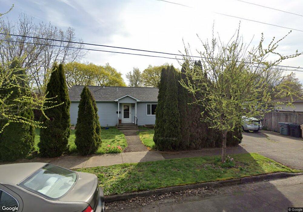
705 Takena St SW Albany, OR 97321
Broadway-Albany NeighborhoodEstimated Value: $361,000 - $388,000
4
Beds
2
Baths
1,230
Sq Ft
$304/Sq Ft
Est. Value
About This Home
This home is located at 705 Takena St SW, Albany, OR 97321 and is currently estimated at $374,500, approximately $304 per square foot. 705 Takena St SW is a home located in Linn County with nearby schools including Takena Elementary School, Central Elementary School, and Memorial Middle School.
Ownership History
Date
Name
Owned For
Owner Type
Purchase Details
Closed on
May 3, 2006
Sold by
Molloy James Richard and Molloy Ann Marie A
Bought by
Rogers Wesley D and Rogers Theresa M
Current Estimated Value
Home Financials for this Owner
Home Financials are based on the most recent Mortgage that was taken out on this home.
Original Mortgage
$21,475
Outstanding Balance
$16,924
Interest Rate
6.29%
Mortgage Type
Credit Line Revolving
Estimated Equity
$357,576
Create a Home Valuation Report for This Property
The Home Valuation Report is an in-depth analysis detailing your home's value as well as a comparison with similar homes in the area
Home Values in the Area
Average Home Value in this Area
Purchase History
| Date | Buyer | Sale Price | Title Company |
|---|---|---|---|
| Rogers Wesley D | $143,500 | Amerititle |
Source: Public Records
Mortgage History
| Date | Status | Borrower | Loan Amount |
|---|---|---|---|
| Open | Rogers Wesley D | $21,475 | |
| Open | Rogers Wesley D | $114,800 |
Source: Public Records
Tax History Compared to Growth
Tax History
| Year | Tax Paid | Tax Assessment Tax Assessment Total Assessment is a certain percentage of the fair market value that is determined by local assessors to be the total taxable value of land and additions on the property. | Land | Improvement |
|---|---|---|---|---|
| 2025 | $3,605 | $181,140 | -- | -- |
| 2024 | $3,500 | $175,870 | -- | -- |
| 2023 | $3,401 | $170,750 | $0 | $0 |
| 2022 | $3,347 | $165,780 | $0 | $0 |
| 2021 | $3,150 | $160,960 | $0 | $0 |
| 2020 | $3,108 | $156,280 | $0 | $0 |
| 2019 | $3,036 | $151,730 | $0 | $0 |
| 2018 | $2,957 | $147,320 | $0 | $0 |
| 2017 | $2,842 | $143,030 | $0 | $0 |
| 2016 | $2,579 | $138,870 | $0 | $0 |
| 2015 | $2,452 | $134,830 | $0 | $0 |
| 2014 | $2,249 | $130,910 | $0 | $0 |
Source: Public Records
Map
Nearby Homes
- 1138 9th Ave SW
- 1215 10th Ave SW
- 929 10th Ave SW
- 834 9th Ave SW
- 821 7th Ave SW
- 906 11th Ave SW
- 1248 Penn St SW
- 1220 Walnut St SW
- 1420 Park Terrace SW
- 870 14th Ave SW
- 718 Washington St SW
- 618 Washington St SW
- 1510 Walnut St SW
- 700 14th Ave SW
- 1230 SW Hop St
- 1510 Broadway St SW
- 1240 SW Hop St
- 516 12th Ave SW
- 420 4th (-430 1 2) Ave SW
- (next to) 2020 SW 15th Ave
- 745 Takena St SW
- 708 Takena St SW
- 1099 8th Ave SW
- 1100 SW 7th Ave Unit 68
- 738 Takena St SW
- 1097 8th Ave SW
- 1220 7th Ave SW
- 1093 8th Ave SW
- 1121 8th Ave SW
- 1091 8th Ave SW
- 1230 7th Ave SW
- 1225 8th Ave SW
- 1098 8th Ave SW
- 1096 8th Ave SW
- 820 Takena St SW
- 1094 8th Ave SW
- 1240 7th Ave SW
- 1235 8th Ave SW
- 1220 8th Ave SW
- 1090 8th Ave SW