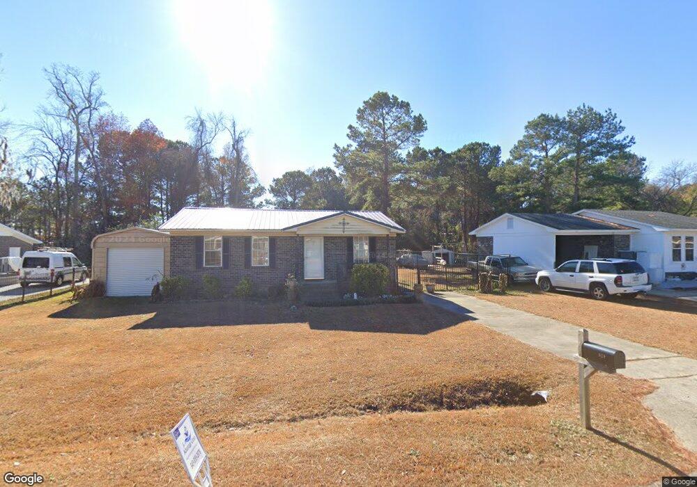
705 University Forest Cir Conway, SC 29526
Estimated Value: $168,000 - $187,650
2
Beds
1
Bath
875
Sq Ft
$205/Sq Ft
Est. Value
About This Home
This home is located at 705 University Forest Cir, Conway, SC 29526 and is currently estimated at $179,163, approximately $204 per square foot. 705 University Forest Cir is a home located in Horry County with nearby schools including Waccamaw Elementary School, Black Water Middle School, and Carolina Forest High School.
Ownership History
Date
Name
Owned For
Owner Type
Purchase Details
Closed on
Feb 11, 2025
Sold by
Gilstrap Casie S
Bought by
Simpson Thomas
Current Estimated Value
Purchase Details
Closed on
Dec 4, 2014
Sold by
Cac Properties Llc
Bought by
Gilstrap Casie S
Home Financials for this Owner
Home Financials are based on the most recent Mortgage that was taken out on this home.
Original Mortgage
$5,000
Interest Rate
4.09%
Mortgage Type
Future Advance Clause Open End Mortgage
Purchase Details
Closed on
May 27, 2008
Sold by
Estate Of Mary H Curtis
Bought by
Cac Properties Llc
Create a Home Valuation Report for This Property
The Home Valuation Report is an in-depth analysis detailing your home's value as well as a comparison with similar homes in the area
Home Values in the Area
Average Home Value in this Area
Purchase History
| Date | Buyer | Sale Price | Title Company |
|---|---|---|---|
| Simpson Thomas | $175,000 | -- | |
| Gilstrap Casie S | $65,000 | -- | |
| Cac Properties Llc | $66,000 | -- |
Source: Public Records
Mortgage History
| Date | Status | Borrower | Loan Amount |
|---|---|---|---|
| Previous Owner | Gilstrap Casie S | $5,000 | |
| Previous Owner | Gilstrap Casie S | $63,050 |
Source: Public Records
Tax History Compared to Growth
Tax History
| Year | Tax Paid | Tax Assessment Tax Assessment Total Assessment is a certain percentage of the fair market value that is determined by local assessors to be the total taxable value of land and additions on the property. | Land | Improvement |
|---|---|---|---|---|
| 2024 | $242 | $7,054 | $2,600 | $4,454 |
| 2023 | $242 | $3,185 | $842 | $2,343 |
| 2021 | $202 | $3,885 | $1,001 | $2,884 |
| 2020 | $148 | $3,885 | $1,001 | $2,884 |
| 2019 | $148 | $3,885 | $1,001 | $2,884 |
| 2018 | $0 | $2,770 | $718 | $2,052 |
| 2017 | $87 | $2,642 | $718 | $1,924 |
| 2016 | -- | $2,642 | $718 | $1,924 |
| 2015 | $78 | $2,542 | $718 | $1,824 |
| 2014 | $728 | $3,405 | $1,077 | $2,328 |
Source: Public Records
Map
Nearby Homes
- 706 Jamie Ln
- 187 Palm Terrace Loop
- 224 Fishburn Dr
- 223 Palm Terrace Loop
- 876 Old Magnolia Dr
- 1248 Wehler Ct
- 957 Jamestown Rd
- 990 Jamestown Rd
- 4009 Sweetspire Ct
- 4005 Sweetspire Ct
- 496 Royal Arch Dr
- 924 Akron St
- 480 Royal Arch Dr
- 132 Columbus St Unit Cali
- 1418 Hyman Ln
- 1209 Wehler Ct
- 125 Carolina Rd Unit DD-1
- 1056 Hunter Way
- 1065 Palm Dr
- 1049 Colonial Ln
- 631 University Forest Cir
- 703 University Forest Cir
- 700 Raintree Ln
- 701 University Forest Cir
- 709 University Forest Cir
- 625 University Forest Cir
- 628 University Forest Cir
- 702 Raintree Ln
- 623 University Forest Cir Unit University Forest Lo
- 623 University Forest Cir
- 630 University Forest Cir
- 635 University Forest Cir
- 635 University Forest Cir
- 703 Wendy Ln
- 622 University Forest Cir
- 713 Raintree Ln
- 704 Raintree Ln
- 634 University Forest Cir
- 621 University Forest Cir
- 713 University Forest Cir