Estimated Value: $325,145 - $356,000
3
Beds
1
Bath
2,071
Sq Ft
$166/Sq Ft
Est. Value
About This Home
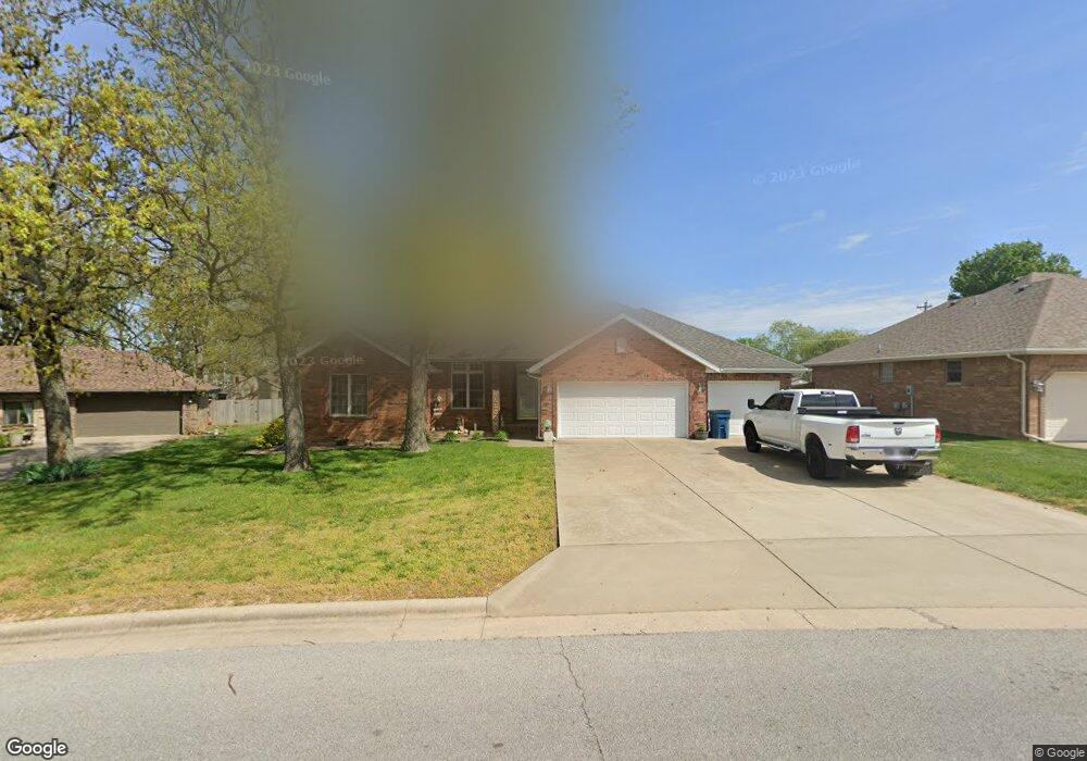
This home is located at 705 W Bryant St, Nixa, MO 65714 and is currently estimated at $343,286, approximately $165 per square foot. 705 W Bryant St is a home with nearby schools including Espy Elementary School, Nixa Junior High School, and Nicholas A. Inman Intermediate School.
Ownership History
Date
Name
Owned For
Owner Type
Purchase Details
Closed on
Dec 18, 2012
Sold by
Elmore Dan and Elmore Vickie
Bought by
Blumenthal Michael
Current Estimated Value
Home Financials for this Owner
Home Financials are based on the most recent Mortgage that was taken out on this home.
Original Mortgage
$161,500
Outstanding Balance
$110,129
Interest Rate
3.34%
Mortgage Type
Future Advance Clause Open End Mortgage
Estimated Equity
$233,157
Purchase Details
Closed on
Sep 7, 2010
Sold by
Elmore Dan and Elmore Vickie
Bought by
Elmore Dan and Elmore Vickie
Create a Home Valuation Report for This Property
The Home Valuation Report is an in-depth analysis detailing your home's value as well as a comparison with similar homes in the area
Home Values in the Area
Average Home Value in this Area
Purchase History
| Date | Buyer | Sale Price | Title Company |
|---|---|---|---|
| Blumenthal Michael | -- | None Available | |
| Elmore Dan | -- | None Available |
Source: Public Records
Mortgage History
| Date | Status | Borrower | Loan Amount |
|---|---|---|---|
| Open | Blumenthal Michael | $161,500 |
Source: Public Records
Tax History
| Year | Tax Paid | Tax Assessment Tax Assessment Total Assessment is a certain percentage of the fair market value that is determined by local assessors to be the total taxable value of land and additions on the property. | Land | Improvement |
|---|---|---|---|---|
| 2025 | $2,109 | $36,010 | -- | -- |
| 2024 | $2,109 | $33,840 | -- | -- |
| 2023 | $2,109 | $33,840 | $0 | $0 |
| 2022 | $1,957 | $31,370 | $0 | $0 |
| 2021 | $1,959 | $31,370 | $0 | $0 |
| 2020 | $1,751 | $26,770 | $0 | $0 |
| 2019 | $1,751 | $26,770 | $0 | $0 |
| 2018 | $1,631 | $26,770 | $0 | $0 |
| 2017 | $1,631 | $26,770 | $0 | $0 |
| 2016 | $1,606 | $26,770 | $0 | $0 |
| 2015 | $1,608 | $26,770 | $26,770 | $0 |
| 2014 | $1,576 | $26,890 | $0 | $0 |
| 2013 | $15 | $26,890 | $0 | $0 |
| 2011 | $15 | $51,880 | $0 | $0 |
Source: Public Records
Map
Nearby Homes
- 403 S Bryant St
- 000 West St
- Sw Corner Highway 160 & St S
- Tbd U S 160
- 704 W Savanna Ct
- 912 Wesley Ave
- 711 Robinwood Ln
- 424 S Southgate Dr
- 000 (Tbd) Highway 160 (14 8 Acres) St
- 1334 W Mount Vernon St
- 601 S Gregg Rd
- 788 S Hackberry Ave
- 805 W Briarwood Ln
- 891 W Pembrook Ave
- 985 W Pembrook Ave
- 207 Meadow St
- 104 Willow Ln
- 108 W Walnut St
- 1280 W Butterfield Dr
- 721 W Butterfield Dr
- 703 W Bryant St
- 707 W Bryant St
- 701 W Bryant St
- 402 S Bryant St
- 310 S Coventry Cir
- 401 S Bryant St
- 311 S Ellen St
- 401 S Kendall Ct
- 308 Coventry Cir
- 308 S Coventry Cir
- 309 S Coventry Cir
- 404 S Bryant St
- 309 S Ellen St
- 403 Kendall Ct
- 615 W Bryant St
- 405 S Bryant St
- 306 S Coventry Cir
- 406 S Bryant St
- 307 S Coventry Cir
- 312 S Ellen St
Your Personal Tour Guide
Ask me questions while you tour the home.