Estimated Value: $317,000 - $365,000
4
Beds
3
Baths
1,968
Sq Ft
$175/Sq Ft
Est. Value
About This Home
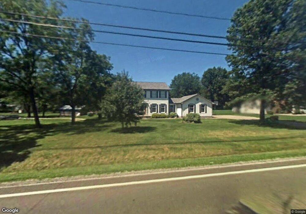
This home is located at 705 W Nimisila Rd, Akron, OH 44319 and is currently estimated at $344,847, approximately $175 per square foot. 705 W Nimisila Rd is a home located in Summit County with nearby schools including Manchester Middle School, Nolley Elementary School, and Manchester High School.
Ownership History
Date
Name
Owned For
Owner Type
Purchase Details
Closed on
May 10, 2001
Sold by
Carmichael Harry I and Carmichael Christine L
Bought by
Hall Roy D and Hall Cassaundra A
Current Estimated Value
Home Financials for this Owner
Home Financials are based on the most recent Mortgage that was taken out on this home.
Original Mortgage
$163,250
Outstanding Balance
$59,444
Interest Rate
7.02%
Estimated Equity
$285,403
Purchase Details
Closed on
Jul 22, 1997
Sold by
Hardgrove Marvin E
Bought by
Carmicheal Harry L and Carmicheal Christine L
Home Financials for this Owner
Home Financials are based on the most recent Mortgage that was taken out on this home.
Original Mortgage
$160,000
Interest Rate
6.5%
Mortgage Type
New Conventional
Create a Home Valuation Report for This Property
The Home Valuation Report is an in-depth analysis detailing your home's value as well as a comparison with similar homes in the area
Home Values in the Area
Average Home Value in this Area
Purchase History
| Date | Buyer | Sale Price | Title Company |
|---|---|---|---|
| Hall Roy D | $181,400 | Bond & Associates Title Agen | |
| Carmicheal Harry L | $12,000 | -- |
Source: Public Records
Mortgage History
| Date | Status | Borrower | Loan Amount |
|---|---|---|---|
| Open | Hall Roy D | $163,250 | |
| Closed | Carmicheal Harry L | $160,000 |
Source: Public Records
Tax History
| Year | Tax Paid | Tax Assessment Tax Assessment Total Assessment is a certain percentage of the fair market value that is determined by local assessors to be the total taxable value of land and additions on the property. | Land | Improvement |
|---|---|---|---|---|
| 2025 | $5,013 | $97,986 | $12,082 | $85,904 |
| 2024 | $4,890 | $97,986 | $12,082 | $85,904 |
| 2023 | $4,890 | $97,986 | $12,082 | $85,904 |
| 2022 | $4,989 | $77,914 | $9,587 | $68,327 |
| 2021 | $5,007 | $77,914 | $9,587 | $68,327 |
| 2020 | $4,921 | $77,920 | $9,590 | $68,330 |
| 2019 | $4,693 | $66,600 | $9,590 | $57,010 |
| 2018 | $4,049 | $66,600 | $9,590 | $57,010 |
| 2017 | $3,822 | $66,600 | $9,590 | $57,010 |
| 2016 | $3,777 | $56,950 | $9,590 | $47,360 |
| 2015 | $3,822 | $56,950 | $9,590 | $47,360 |
| 2014 | $3,793 | $56,950 | $9,590 | $47,360 |
| 2013 | $4,228 | $63,920 | $9,590 | $54,330 |
Source: Public Records
Map
Nearby Homes
- 781 Leeman Dr
- 715 Highland Park Dr
- 6235 Manchester Rd
- 6090 Manchester Rd Unit 6096
- 402 Yager Rd
- 6407 Southview Dr
- 5042 Laddie Dr
- 6775 Grove Rd
- 427 Catalina Dr
- 0 W Comet Rd Unit 5079117
- 1420 Trails End Dr
- 4786 Bickford Ave
- 6 Shrakes Hotel Dr
- 4 Shrakes Hotel Dr
- 7 Shrakes Hotel Dr
- 5 Shrakes Hotel Dr
- 3 Shrakes Hotel Dr
- lot 8 Whyem Dr
- 1365 Vanderhoof Rd
- 4628 Whyem Dr
- 695 W Nimisila Rd
- 714 Pearlman Rd
- 700 Pearlman Rd
- 719 W Nimisila Rd
- 724 Pearlman Rd
- 698 W Nimisila Rd
- 677 W Nimisila Rd
- 684 Pearlman Rd
- 706 W Nimisila Rd
- 682 W Nimisila Rd
- 733 W Nimisila Rd
- 714 W Nimisila Rd
- 672 W Nimisila Rd
- 738 Pearlman Rd
- 743 W Nimisila Rd
- 662 W Nimisila Rd
- 748 Pearlman Rd
- 705 Pearlman Rd
- 715 Pearlman Rd
- 695 Pearlman Rd
Your Personal Tour Guide
Ask me questions while you tour the home.