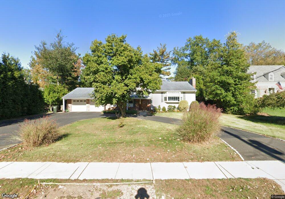
705 Westfield Rd Scotch Plains, NJ 07076
Estimated Value: $626,889 - $1,205,000
--
Bed
--
Bath
2,804
Sq Ft
$344/Sq Ft
Est. Value
About This Home
This home is located at 705 Westfield Rd, Scotch Plains, NJ 07076 and is currently estimated at $963,722, approximately $343 per square foot. 705 Westfield Rd is a home located in Union County with nearby schools including Howard B. Brunner Elementary School, Nettingham Middle School, and Scotch Plains-Fanwood High School.
Ownership History
Date
Name
Owned For
Owner Type
Purchase Details
Closed on
Oct 10, 2003
Sold by
Devico Joseph
Bought by
Leist Michael and Leist Norma
Current Estimated Value
Purchase Details
Closed on
Jun 21, 1999
Sold by
Skaar Miriam M
Bought by
Devico Joseph and Devico Susan
Home Financials for this Owner
Home Financials are based on the most recent Mortgage that was taken out on this home.
Original Mortgage
$240,000
Interest Rate
7.09%
Create a Home Valuation Report for This Property
The Home Valuation Report is an in-depth analysis detailing your home's value as well as a comparison with similar homes in the area
Home Values in the Area
Average Home Value in this Area
Purchase History
| Date | Buyer | Sale Price | Title Company |
|---|---|---|---|
| Leist Michael | $504,000 | -- | |
| Devico Joseph | $322,000 | -- |
Source: Public Records
Mortgage History
| Date | Status | Borrower | Loan Amount |
|---|---|---|---|
| Previous Owner | Devico Joseph | $240,000 |
Source: Public Records
Tax History Compared to Growth
Tax History
| Year | Tax Paid | Tax Assessment Tax Assessment Total Assessment is a certain percentage of the fair market value that is determined by local assessors to be the total taxable value of land and additions on the property. | Land | Improvement |
|---|---|---|---|---|
| 2025 | $16,369 | $139,100 | $30,200 | $108,900 |
| 2024 | $15,887 | $139,100 | $30,200 | $108,900 |
| 2023 | $15,887 | $139,100 | $30,200 | $108,900 |
| 2022 | $15,697 | $139,100 | $30,200 | $108,900 |
| 2021 | $15,671 | $139,100 | $30,200 | $108,900 |
| 2020 | $15,596 | $139,100 | $30,200 | $108,900 |
| 2019 | $15,480 | $139,100 | $30,200 | $108,900 |
| 2018 | $15,220 | $139,100 | $30,200 | $108,900 |
| 2017 | $14,882 | $139,100 | $30,200 | $108,900 |
| 2016 | $14,596 | $139,100 | $30,200 | $108,900 |
| 2015 | $14,357 | $139,100 | $30,200 | $108,900 |
| 2014 | $13,884 | $139,100 | $30,200 | $108,900 |
Source: Public Records
Map
Nearby Homes
- 24 Deborah Way
- 2269 Redwood Rd
- 4 Lois Place
- 177 Pleasant Ave
- 9 Timberline Dr
- 545 Westfield Rd
- 2286 Stocker Ln
- 2398 Hamlette Place
- 869 Ternay Ave
- 524 William St
- 2323 Belvedere Dr
- 2406 Park Place
- 2219 North Ave Unit 6
- 7 Riga Ct
- 21 Old South Ave
- 183 Watson Rd
- 26 Riga Ct Unit 3A
- 16 Riga Ct Unit 2B
- 360 Cook Ave
- 345 La Grande Ave
- 2200 Old Farm Rd
- 709 Westfield Rd
- 2212 Concord Rd
- 2216 Concord Rd
- 2208 Old Farm Rd
- 241 Westfield Rd
- 711 Westfield Rd
- 247 Westfield Rd
- 235 Westfield Rd
- 253 Westfield Rd
- 2220 Concord Rd
- 2201 Old Farm Rd
- 2205 Old Farm Rd
- 259 Westfield Rd
- 25 Birchwood Terrace
- 2209 Old Farm Rd
- 223 Westfield Rd
- 2224 Concord Rd
- 2227 Concord Rd
- 2218 Old Farm Rd