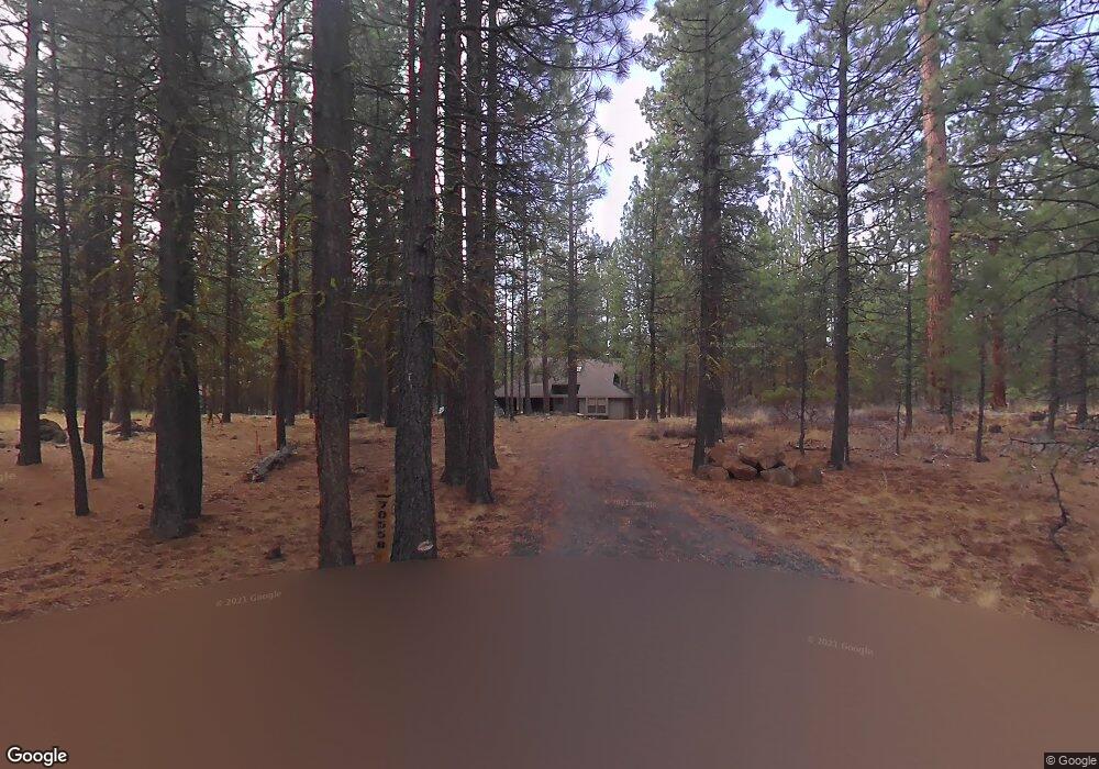
70558 Stonecrop Unit SM219 Sisters, OR 97759
Estimated Value: $1,262,000 - $1,589,000
4
Beds
2
Baths
2,225
Sq Ft
$611/Sq Ft
Est. Value
About This Home
This home is located at 70558 Stonecrop Unit SM219, Sisters, OR 97759 and is currently estimated at $1,359,041, approximately $610 per square foot. 70558 Stonecrop Unit SM219 is a home with nearby schools including Sisters Elementary School, Sisters Middle School, and Sisters High School.
Ownership History
Date
Name
Owned For
Owner Type
Purchase Details
Closed on
Apr 24, 2018
Sold by
Swanson Laurie F
Bought by
Swansn Llc
Current Estimated Value
Purchase Details
Closed on
Apr 23, 2018
Sold by
Swanson Laurie F
Bought by
Swanson Llc
Purchase Details
Closed on
Jun 29, 2006
Sold by
Leaf David N and Leaf Nancy L
Bought by
Swanson Laurie F
Home Financials for this Owner
Home Financials are based on the most recent Mortgage that was taken out on this home.
Original Mortgage
$100,000
Interest Rate
6.66%
Mortgage Type
Unknown
Create a Home Valuation Report for This Property
The Home Valuation Report is an in-depth analysis detailing your home's value as well as a comparison with similar homes in the area
Home Values in the Area
Average Home Value in this Area
Purchase History
| Date | Buyer | Sale Price | Title Company |
|---|---|---|---|
| Swansn Llc | -- | None Available | |
| Swanson Llc | -- | None Listed On Document | |
| Swanson Laurie F | $775,000 | Western Title & Escrow Co |
Source: Public Records
Mortgage History
| Date | Status | Borrower | Loan Amount |
|---|---|---|---|
| Previous Owner | Swanson Laurie F | $100,000 |
Source: Public Records
Tax History Compared to Growth
Tax History
| Year | Tax Paid | Tax Assessment Tax Assessment Total Assessment is a certain percentage of the fair market value that is determined by local assessors to be the total taxable value of land and additions on the property. | Land | Improvement |
|---|---|---|---|---|
| 2024 | $12,000 | $765,800 | -- | -- |
| 2023 | $11,511 | $743,500 | $0 | $0 |
| 2022 | $10,687 | $700,830 | $0 | $0 |
| 2021 | $10,799 | $680,420 | $0 | $0 |
| 2020 | $10,192 | $680,420 | $0 | $0 |
| 2019 | $9,931 | $660,610 | $0 | $0 |
| 2018 | $9,548 | $641,370 | $0 | $0 |
| 2017 | $9,193 | $622,690 | $0 | $0 |
| 2016 | $9,032 | $604,560 | $0 | $0 |
| 2015 | $8,564 | $586,960 | $0 | $0 |
| 2014 | $8,228 | $569,870 | $0 | $0 |
Source: Public Records
Map
Nearby Homes
- 70661 Steeple Bush Unit SM202
- 70684 Steeple Bush Unit SM 153
- 13637 Wolfberry Unit GM 142
- 70474 Alum Root
- 70665 Buck Brush Unit SM 89
- 70701 Pasque Flower Unit SM94
- 13584 Nine Bark
- 70686 Buck Brush Unit SM85
- 70755 Ponderosa Ln Unit SM 177
- 70340 Sword Fern Gm246
- 70332 Sword Fern Unit GM 245
- 70780 Bitter Root
- 13579 Sundew Unit SM34
- 13699 Speedwell Unit GM90
- 70311 Forsythia Unit GM277
- 13461 Hawks Beard Unit SH43
- 70786 Blazing Star Unit RR 64
- 13375 Spirea Unit GM 375
- 70440 Linnaea Borealis Unit GM395
- 70347 Cinquefoil Unit GM 188
- 70558 Stonecrop
- 70563 Stonecrop
- 70563 Stonecrop Sm 218
- 70563 Stonecrop Unit SM218
- 70563 Stonecrop-Sm218
- 70521 Colts Foot
- 70562 Stonecrop
- 70562 Stone Crop Unit SM 220
- 70515 Colts Foot
- 70529 Ponderosa Ln Unit GM124
- 70529 Ponderosa Ln
- 70617 Hawks Beard
- 70525 Colts Foot
- 70576 Stonecrop
- 70525 Colts Foot (3 4) Unit GM123
- 70525 Colts Foot (1 4) Unit GM123
- 70525 Colts Foot Gm123 Unit (1/2)
- 70525 Colts Foot Gm123
- 70511 Colts Foot Gm120