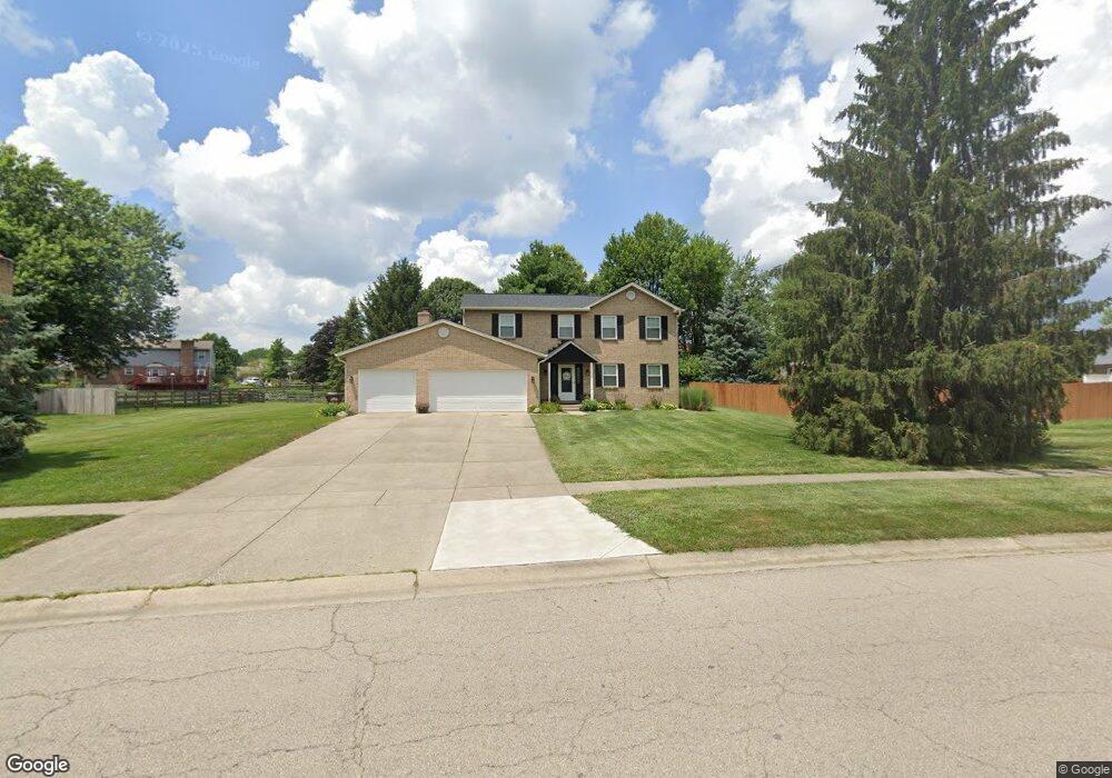
7056 Devon Dr Liberty Township, OH 45044
Estimated Value: $390,000 - $453,000
4
Beds
3
Baths
1,974
Sq Ft
$209/Sq Ft
Est. Value
About This Home
This home is located at 7056 Devon Dr, Liberty Township, OH 45044 and is currently estimated at $412,132, approximately $208 per square foot. 7056 Devon Dr is a home located in Butler County with nearby schools including Woodland Elementary School, Liberty Junior School, and Lakota East High School.
Ownership History
Date
Name
Owned For
Owner Type
Purchase Details
Closed on
Apr 21, 2003
Sold by
Menke Gary E and Menke Amy
Bought by
Pare Patrick D and Pare Stephanie L
Current Estimated Value
Home Financials for this Owner
Home Financials are based on the most recent Mortgage that was taken out on this home.
Original Mortgage
$150,000
Interest Rate
5.71%
Mortgage Type
Purchase Money Mortgage
Create a Home Valuation Report for This Property
The Home Valuation Report is an in-depth analysis detailing your home's value as well as a comparison with similar homes in the area
Home Values in the Area
Average Home Value in this Area
Purchase History
| Date | Buyer | Sale Price | Title Company |
|---|---|---|---|
| Pare Patrick D | $187,500 | -- |
Source: Public Records
Mortgage History
| Date | Status | Borrower | Loan Amount |
|---|---|---|---|
| Previous Owner | Pare Patrick D | $150,000 | |
| Closed | Pare Patrick D | $37,500 |
Source: Public Records
Tax History Compared to Growth
Tax History
| Year | Tax Paid | Tax Assessment Tax Assessment Total Assessment is a certain percentage of the fair market value that is determined by local assessors to be the total taxable value of land and additions on the property. | Land | Improvement |
|---|---|---|---|---|
| 2024 | $4,179 | $105,600 | $15,140 | $90,460 |
| 2023 | $4,125 | $108,140 | $15,140 | $93,000 |
| 2022 | $3,764 | $75,420 | $15,140 | $60,280 |
| 2021 | $3,744 | $75,420 | $15,140 | $60,280 |
| 2020 | $3,838 | $75,420 | $15,140 | $60,280 |
| 2019 | $6,181 | $64,170 | $14,060 | $50,110 |
| 2018 | $3,655 | $64,170 | $14,060 | $50,110 |
| 2017 | $3,654 | $64,170 | $14,060 | $50,110 |
| 2016 | $3,369 | $57,930 | $14,060 | $43,870 |
| 2015 | $3,329 | $57,930 | $14,060 | $43,870 |
| 2014 | $3,329 | $57,930 | $14,060 | $43,870 |
| 2013 | $3,329 | $55,020 | $14,060 | $40,960 |
Source: Public Records
Map
Nearby Homes
- 6919 Millikin Rd
- 7114 Becky Dr
- 6300 Lindsey Ct
- 5933 Old Pebble Path
- 6816 Devon Dr
- 7113 Shady Brook Bend
- 7083 Princeton Rd
- 7120 Shady Brook Bend
- 7108 Shady Brook Bend
- 7306 Millikin Rd
- 5913 Stones Throw Way
- 6380 Castle Hill Dr
- 6335 Gem Stone Dr
- 5725 Hawthrone Reserve Dr
- 7158 Airy View Dr
- 6828 Richards Dr
- 6951 Ash Creek Ct
- 7232 Eaglestone Ct
- 6512 Devon Dr
- 7081 Yankee Estates Dr