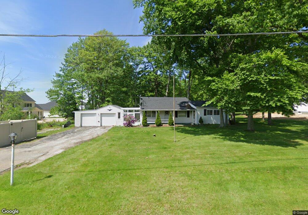
7058 Summit Dr Canfield, OH 44406
Estimated Value: $183,000 - $216,000
3
Beds
1
Bath
1,276
Sq Ft
$156/Sq Ft
Est. Value
About This Home
This home is located at 7058 Summit Dr, Canfield, OH 44406 and is currently estimated at $199,584, approximately $156 per square foot. 7058 Summit Dr is a home located in Mahoning County with nearby schools including Canfield Village Middle School, Canfield High School, and St Charles Elementary School.
Ownership History
Date
Name
Owned For
Owner Type
Purchase Details
Closed on
Dec 29, 2021
Bought by
Kpz Inc
Current Estimated Value
Home Financials for this Owner
Home Financials are based on the most recent Mortgage that was taken out on this home.
Interest Rate
3.05%
Purchase Details
Closed on
Dec 16, 2021
Bought by
Michael T Stanish
Home Financials for this Owner
Home Financials are based on the most recent Mortgage that was taken out on this home.
Interest Rate
3.05%
Purchase Details
Closed on
Aug 7, 2013
Sold by
Cook Nina May and Cook Nina M
Bought by
Stanish Michael T and Stanish Melissa J
Create a Home Valuation Report for This Property
The Home Valuation Report is an in-depth analysis detailing your home's value as well as a comparison with similar homes in the area
Home Values in the Area
Average Home Value in this Area
Purchase History
| Date | Buyer | Sale Price | Title Company |
|---|---|---|---|
| Kpz Inc | $10,000 | -- | |
| Michael T Stanish | -- | -- | |
| Stanish Michael T | $71,000 | Attorney |
Source: Public Records
Mortgage History
| Date | Status | Borrower | Loan Amount |
|---|---|---|---|
| Closed | Kpz Inc | -- | |
| Closed | Kpz Inc | -- |
Source: Public Records
Tax History
| Year | Tax Paid | Tax Assessment Tax Assessment Total Assessment is a certain percentage of the fair market value that is determined by local assessors to be the total taxable value of land and additions on the property. | Land | Improvement |
|---|---|---|---|---|
| 2025 | $1,945 | $46,080 | $12,800 | $33,280 |
| 2024 | $1,945 | $46,080 | $12,800 | $33,280 |
| 2023 | $1,914 | $46,080 | $12,800 | $33,280 |
| 2022 | $1,990 | $38,320 | $11,730 | $26,590 |
| 2021 | $1,938 | $38,500 | $11,910 | $26,590 |
| 2020 | $1,946 | $38,500 | $11,910 | $26,590 |
| 2019 | $1,998 | $35,230 | $11,910 | $23,320 |
| 2018 | $1,898 | $35,230 | $11,910 | $23,320 |
| 2017 | $1,895 | $35,230 | $11,910 | $23,320 |
| 2016 | $1,791 | $32,430 | $12,450 | $19,980 |
| 2015 | $1,752 | $32,430 | $12,450 | $19,980 |
| 2014 | $1,759 | $32,430 | $12,450 | $19,980 |
| 2013 | $1,238 | $32,430 | $12,450 | $19,980 |
Source: Public Records
Map
Nearby Homes
- 7767 Exeter Ct
- 6843 Abbey Rd
- 5034 Macy Ln
- 5025 Macy Ln
- 6850 Abbey Rd N
- 6916 S Raccoon Rd
- 6580 Abbey Rd N
- 4300 Westford Place Unit 6C
- 7245 Hanbury Close
- 7171 Paddington Rowe
- 4032 Saint Andrews Ct Unit 1
- 6465 Saint Andrews Dr Unit 6
- 6879 Kyle Ridge Pointe
- 523 Janet Dr
- 120 Talsman Dr Unit 4
- 3665 Mercedes Place
- 3641 Mercedes Place Unit 6c
- 8075 S Raccoon Rd
- 181 Talsman Dr Unit B
- 6060 S Raccoon Rd
- 6838 Langston Run
- 7020 Summit Dr
- 6842 Langston Run
- 7045 Summit Dr
- 6820 Langston Run
- 6846 Langston Run
- 6998 Summit Dr
- 6839 Langston Run
- 7025 Summit Dr
- 7065 Summit Dr
- 6850 Langston Run
- 6827 Langston Run
- 6845 Langston Run
- 6986 Summit Dr
- 6993 Summit Dr
- 6821 Langston Run
- 6851 Langston Run
- 6786 Langston Run
- 6815 Langston Run
- 6856 Langston Run
Your Personal Tour Guide
Ask me questions while you tour the home.