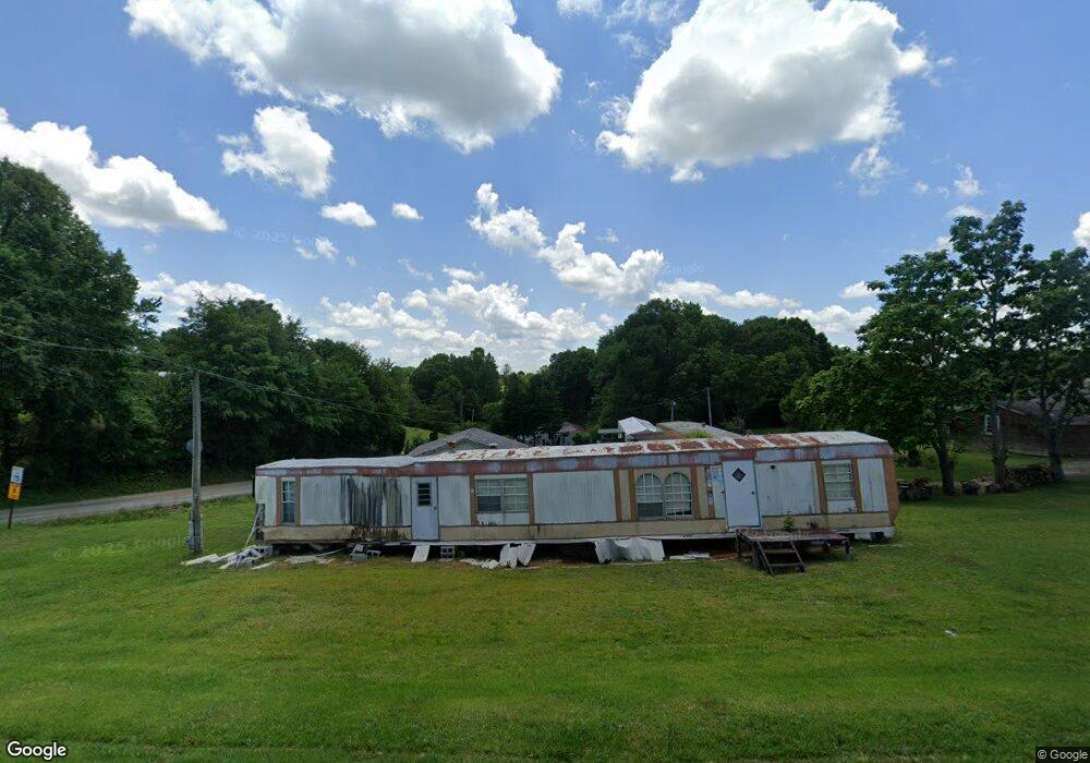
706 Airport Rd Unit &710 Baldwin, GA 30511
Estimated Value: $198,469 - $283,000
About This Home
This home is located at 706 Airport Rd Unit &710, Baldwin, GA 30511 and is currently estimated at $248,117, approximately $216 per square foot. 706 Airport Rd Unit &710 is a home located in Habersham County with nearby schools including Baldwin Elementary School, South Habersham Middle School, and Habersham Success Academy.
Ownership History
We collect this data history from publicly available records. To have your information removed, we recommend requesting removal directly through your county’s website.
Purchase Details
Home Financials for this Owner
Home Financials are based on the most recent Mortgage that was taken out on this home.Home Values in the Area
Average Home Value in this Area
Purchase History
We collect this data history from publicly available records. To have your information removed, we recommend requesting removal directly through your county’s website.
| Date | Buyer | Sale Price | Title Company |
|---|---|---|---|
| $99,900 | -- |
Mortgage History
We collect this data history from publicly available records. To have your information removed, we recommend requesting removal directly through your county’s website.
| Date | Status | Borrower | Loan Amount |
|---|---|---|---|
| Open | $79,920 |
Tax History
We collect this data history from publicly available records. To have your information removed, we recommend requesting removal directly through your county’s website.
| Year | Tax Paid | Tax Assessment Tax Assessment Total Assessment is a certain percentage of the fair market value that is determined by local assessors to be the total taxable value of land and additions on the property. | Land | Improvement |
|---|---|---|---|---|
| 2025 | $1,965 | $60,218 | $12,804 | $47,414 |
| 2024 | $1,598 | $61,560 | $12,060 | $49,500 |
| 2023 | $1,335 | $53,392 | $12,060 | $41,332 |
| 2022 | $1,175 | $45,064 | $9,648 | $35,416 |
| 2021 | $1,079 | $41,556 | $9,648 | $31,908 |
| 2020 | $1,002 | $37,264 | $9,648 | $27,616 |
| 2019 | $731 | $37,264 | $9,648 | $27,616 |
| 2018 | $899 | $33,640 | $9,648 | $23,992 |
| 2017 | $800 | $29,792 | $7,236 | $22,556 |
| 2016 | $777 | $74,480 | $7,236 | $22,556 |
| 2015 | $768 | $74,480 | $7,236 | $22,556 |
| 2014 | $782 | $74,420 | $7,236 | $22,532 |
| 2013 | -- | $29,768 | $7,236 | $22,532 |
Map
- 401 Wilbanks St
- 0 Highway 441 Bypass Unit 10428967
- 155 Dilmus Ct
- 216 Magnolia Villas Dr
- 304 Magnolia Villas Dr
- 266 Magnolia Villas Dr
- 245 Magnolia Villas Dr
- LOT 6 Parker Point
- 722 Pathway Cir
- 800 Park Ave
- 662 Forest Way
- 657 Forest Way
- 534 Creek Rd
- 554 Creek Rd
- 303 Alston Ridge Dr
- 420 Magnolia Grove Place
- 490 Magnolia Grove Place
- 456 Magnolia Grove Place
- 484 Magnolia Grove Place
- 0 Baldwin Heights Rd Unit 10771348
- 706 Airport Rd
- 706 Airport Rd
- 710 Airport Rd
- 436 Wilbanks St
- 125 City Park Dr
- 721 Airport Rd
- 120 City Park Dr
- 418 Wilbanks St
- 622 Airport Rd
- 721 Airport Rd
- 139 Pine Forest Cir
- 177 Meister Rd
- 1370 Industrial Blvd
- 125 Meister Rd
- 201 Meister Rd
- 1390 Industrial Blvd
- 400 Wilbanks St
- 0 Airport Rd Unit PAD 10 10135777
- 0 Airport Rd Unit PAD 10 10135694
- 109 Huntington Dr
Ask me questions while you tour the home.