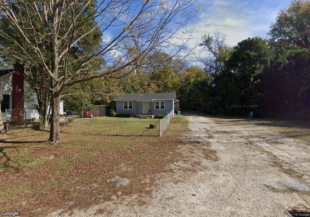
706 Avenue K West Point, GA 31833
Estimated Value: $46,489 - $99,000
2
Beds
1
Bath
720
Sq Ft
$97/Sq Ft
Est. Value
About This Home
This home is located at 706 Avenue K, West Point, GA 31833 and is currently estimated at $69,872, approximately $97 per square foot. 706 Avenue K is a home located in Troup County with nearby schools including West Point Elementary School, Long Cane Elementary School, and Whitesville Road Elementary School.
Ownership History
Date
Name
Owned For
Owner Type
Purchase Details
Closed on
Jan 22, 2019
Sold by
Cdr Ventures
Bought by
Refuge Point Church Inc
Current Estimated Value
Purchase Details
Closed on
Dec 18, 2018
Sold by
Winston Thomas Dale
Bought by
Cdr Ventures Llc
Purchase Details
Closed on
Sep 27, 1996
Sold by
Carolyn Thorpe J and Carolyn Parks
Bought by
Winston William
Purchase Details
Closed on
Dec 1, 1984
Sold by
Irene Knight
Bought by
Carolyn Thorpe J and Carolyn Parks
Purchase Details
Closed on
Nov 9, 1977
Sold by
Frank Knight
Bought by
Irene Knight
Purchase Details
Closed on
Oct 5, 1972
Sold by
Arlene Trayler
Bought by
Frank Knight
Purchase Details
Closed on
Jan 1, 1964
Sold by
Mary Jones
Bought by
Arlene Trayler
Create a Home Valuation Report for This Property
The Home Valuation Report is an in-depth analysis detailing your home's value as well as a comparison with similar homes in the area
Home Values in the Area
Average Home Value in this Area
Purchase History
| Date | Buyer | Sale Price | Title Company |
|---|---|---|---|
| Refuge Point Church Inc | $10,828 | -- | |
| Cdr Ventures Llc | $9,000 | -- | |
| Winston William | $7,500 | -- | |
| Carolyn Thorpe J | $12,000 | -- | |
| Irene Knight | -- | -- | |
| Frank Knight | -- | -- | |
| Arlene Trayler | -- | -- |
Source: Public Records
Tax History Compared to Growth
Tax History
| Year | Tax Paid | Tax Assessment Tax Assessment Total Assessment is a certain percentage of the fair market value that is determined by local assessors to be the total taxable value of land and additions on the property. | Land | Improvement |
|---|---|---|---|---|
| 2024 | $413 | $11,680 | $1,240 | $10,440 |
| 2023 | $0 | $12,400 | $1,240 | $11,160 |
| 2022 | $463 | $11,840 | $1,240 | $10,600 |
| 2021 | $454 | $11,600 | $1,240 | $10,360 |
| 2020 | $131 | $11,660 | $640 | $11,020 |
| 2019 | $109 | $9,780 | $672 | $9,108 |
| 2018 | $282 | $9,360 | $672 | $8,688 |
| 2017 | $282 | $9,360 | $672 | $8,688 |
| 2016 | $275 | $9,108 | $672 | $8,436 |
| 2015 | $275 | $9,108 | $672 | $8,436 |
| 2014 | $262 | $8,664 | $672 | $7,992 |
| 2013 | -- | $9,323 | $672 | $8,651 |
Source: Public Records
Map
Nearby Homes
- 0 Arrowhead Dr Unit 10451860
- 509 Cleveland St
- 713 Avenue H
- 804 E 6th St
- 1008 E 12th St
- 311 E 4th St
- 0 Sunset Dr Unit 10451831
- 112 Hillcrest Rd
- 1505 Wisteria Dr
- 128 Highland Dr
- 712 4th Ave
- 1007 4th Ave
- 1410 Roper Ave
- 1314 4th Ave
- 508 Pine St
- 1508 N 4th Ave
- 4517 Georgia 18
- 4509 Georgia 18
- 4523 Georgia 18
- 4527 Georgia 18