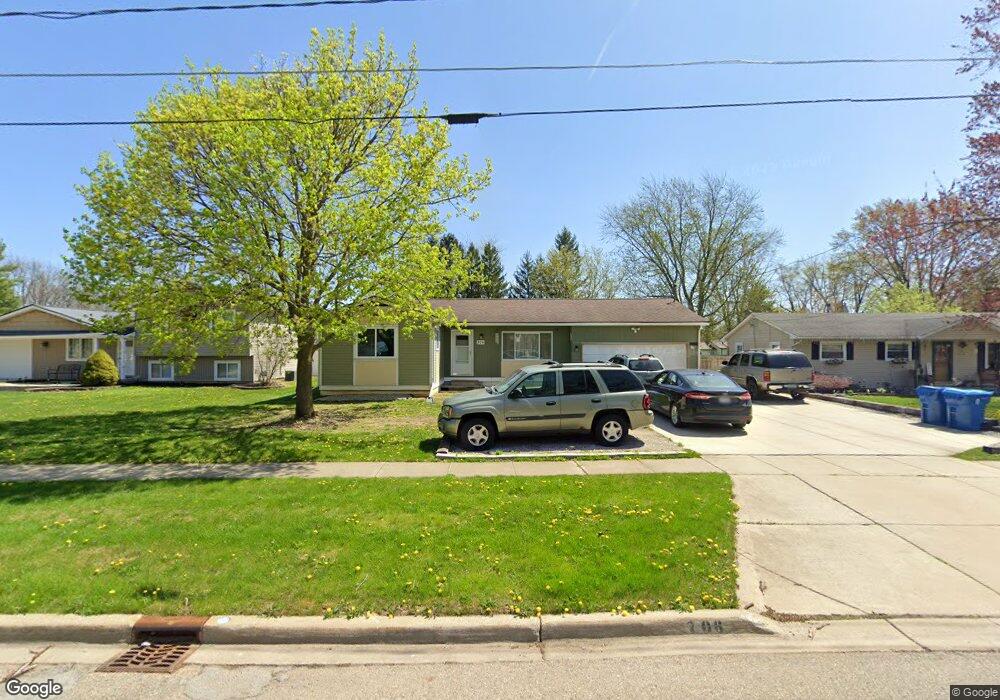
706 Bush St Linden, MI 48451
Estimated Value: $216,000 - $269,000
3
Beds
1
Bath
1,080
Sq Ft
$229/Sq Ft
Est. Value
About This Home
This home is located at 706 Bush St, Linden, MI 48451 and is currently estimated at $247,367, approximately $229 per square foot. 706 Bush St is a home located in Genesee County with nearby schools including Linden Elementary School, Linden Middle School, and Linden High School.
Ownership History
Date
Name
Owned For
Owner Type
Purchase Details
Closed on
Mar 8, 2006
Sold by
Poquette Barbara and Poquette Kenneth
Bought by
Washington Mutual Bank Fa
Current Estimated Value
Purchase Details
Closed on
Oct 3, 2003
Sold by
The Michael Lawrence Brown & Rose Marie
Bought by
Poquette Kenneth and Poquette Barbara
Purchase Details
Closed on
Apr 2, 1999
Sold by
Brown Michael L and Brown Rose Marie
Bought by
Join Michael and Join Rose
Create a Home Valuation Report for This Property
The Home Valuation Report is an in-depth analysis detailing your home's value as well as a comparison with similar homes in the area
Home Values in the Area
Average Home Value in this Area
Purchase History
| Date | Buyer | Sale Price | Title Company |
|---|---|---|---|
| Washington Mutual Bank Fa | $129,552 | None Available | |
| Va | -- | Attorneys Title Agency Llc | |
| Poquette Kenneth | $155,000 | Cislo Title Company | |
| Join Michael | -- | -- |
Source: Public Records
Tax History
| Year | Tax Paid | Tax Assessment Tax Assessment Total Assessment is a certain percentage of the fair market value that is determined by local assessors to be the total taxable value of land and additions on the property. | Land | Improvement |
|---|---|---|---|---|
| 2025 | $2,181 | $114,700 | $0 | $0 |
| 2024 | $1,293 | $102,300 | $0 | $0 |
| 2023 | $1,319 | $92,300 | $0 | $0 |
| 2022 | $1,992 | $75,600 | $0 | $0 |
| 2021 | $1,735 | $69,900 | $0 | $0 |
| 2020 | $1,202 | $65,500 | $0 | $0 |
| 2019 | $1,203 | $60,800 | $0 | $0 |
| 2018 | $1,610 | $60,800 | $0 | $0 |
| 2017 | $1,561 | $57,200 | $0 | $0 |
| 2016 | $1,569 | $52,800 | $0 | $0 |
| 2015 | $1,551 | $46,800 | $0 | $0 |
| 2012 | -- | $35,473 | $35,473 | $0 |
Source: Public Records
Map
Nearby Homes
- 712 Bush St
- 331 Andrea Ave Unit 63
- 231 Kathy Cir Unit 43
- 532 E Broad St
- 14238 Durant St
- 4468 Edison Blvd Unit 50
- 4453 Ford Ave
- 4448 Ford Ave
- 4447 Edison Blvd
- 4437 Edison Blvd
- 5202 Amelia Earhart Dr
- 5220 Amelia Earhart Dr
- 5194 Amelia Earhart Dr
- 15051 Poberezny Ct
- 14247 Webster Dr
- 394 Saddlebrook Dr
- 14270 Wright Dr
- 5465 Red Oak Ct Unit 20
- 513 W Broad St
- 1565 W Rolston Rd
Your Personal Tour Guide
Ask me questions while you tour the home.