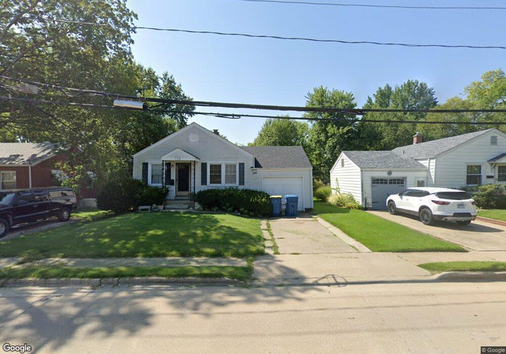
706 Franklin Ave Edwardsville, IL 62025
Estimated Value: $164,681 - $204,000
4
Beds
1
Bath
1,012
Sq Ft
$181/Sq Ft
Est. Value
About This Home
This home is located at 706 Franklin Ave, Edwardsville, IL 62025 and is currently estimated at $182,670, approximately $180 per square foot. 706 Franklin Ave is a home located in Madison County with nearby schools including LeClaire Elementary School, Columbus Elementary School, and Liberty Middle School.
Ownership History
Date
Name
Owned For
Owner Type
Purchase Details
Closed on
Mar 17, 2006
Sold by
Mikes John and Mikes Sheila
Bought by
Black Dog Properties Llc
Current Estimated Value
Purchase Details
Closed on
Mar 5, 2003
Sold by
Crossman Andrew and Crossman Andrew W
Bought by
Mikes John and Mikes Sheila
Home Financials for this Owner
Home Financials are based on the most recent Mortgage that was taken out on this home.
Original Mortgage
$72,000
Interest Rate
6.7%
Mortgage Type
Purchase Money Mortgage
Create a Home Valuation Report for This Property
The Home Valuation Report is an in-depth analysis detailing your home's value as well as a comparison with similar homes in the area
Home Values in the Area
Average Home Value in this Area
Purchase History
| Date | Buyer | Sale Price | Title Company |
|---|---|---|---|
| Black Dog Properties Llc | -- | Fatic | |
| Mikes John | $71,000 | Fatic |
Source: Public Records
Mortgage History
| Date | Status | Borrower | Loan Amount |
|---|---|---|---|
| Previous Owner | Mikes John | $72,000 |
Source: Public Records
Tax History Compared to Growth
Tax History
| Year | Tax Paid | Tax Assessment Tax Assessment Total Assessment is a certain percentage of the fair market value that is determined by local assessors to be the total taxable value of land and additions on the property. | Land | Improvement |
|---|---|---|---|---|
| 2024 | $3,567 | $49,960 | $6,140 | $43,820 |
| 2023 | $3,567 | $46,360 | $5,700 | $40,660 |
| 2022 | $3,358 | $42,860 | $5,270 | $37,590 |
| 2021 | $3,024 | $40,680 | $5,000 | $35,680 |
| 2020 | $2,933 | $39,430 | $4,850 | $34,580 |
| 2019 | $2,915 | $38,770 | $4,770 | $34,000 |
| 2018 | $2,868 | $37,030 | $4,560 | $32,470 |
| 2017 | $2,795 | $36,240 | $4,460 | $31,780 |
| 2016 | $2,530 | $36,240 | $4,460 | $31,780 |
| 2015 | $2,434 | $33,600 | $4,140 | $29,460 |
| 2014 | $2,434 | $33,600 | $4,140 | $29,460 |
| 2013 | $2,434 | $33,600 | $4,140 | $29,460 |
Source: Public Records
Map
Nearby Homes
- 629 Bollman Ave
- 424 Hadley Ave
- 426 Roanoke Dr
- 503 Bollman Ave
- 4 Hadley Ct
- 417 Montclaire Ave
- 1120 Franklin Ave
- 424 Circle Dr
- 221 4th Ave
- 638 Yale Ave
- 821 Sherman Ave
- 808 Meade Ave
- 714 Sherman Ave
- 103 Thomas Terrace
- 502 Jaime Lynn Ct
- 613 Jaime Lynn Ct
- 105 Barnett Dr
- 307 Monticello Place Unit A
- 311 Barnett Dr
- 1101 N Oxfordshire Ln
- 704 Franklin Ave
- 712 Franklin Ave
- 1200 Oakland Ave
- 1204 Oakland Ave
- 95Lot Granite Court (Lot 95)
- 97Lot Granite Court (Lot 97)
- 99LOT Granite Court (Lot 99)
- 101LOT Granite Court (Lot 101)
- 1203 Grant Dr
- 1206 Oakland Ave
- 1208 Oakland Ave
- 1213 Grant Dr
- 94LOT Granite Court (Lot 94)
- 96Lot Granite Court (Lot 96)
- 100LOT Granite Court (Lot 100)
- 102LOT Granite Court (Lot 102)
- 98Lot Granite Court (Lot 98)
- 1223 Oakland Ave
- 1210 Oakland Ave
- 1217 Grant Dr