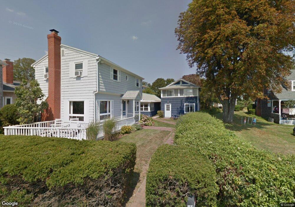
706 Mulberry Point Rd Guilford, CT 06437
Estimated Value: $596,000 - $2,040,000
--
Bed
2
Baths
--
Sq Ft
0.32
Acres
About This Home
This home is located at 706 Mulberry Point Rd, Guilford, CT 06437 and is currently estimated at $1,304,535. 706 Mulberry Point Rd is a home located in New Haven County with nearby schools including E.C. Adams Middle School, A. Baldwin Middle School, and Guilford High School.
Ownership History
Date
Name
Owned For
Owner Type
Purchase Details
Closed on
Sep 7, 2011
Sold by
Singer Scott L and Singer Coleen
Bought by
Grey Seal Llc
Current Estimated Value
Purchase Details
Closed on
Jul 31, 1992
Sold by
Boothroyd Marian H
Bought by
Lenzi Arthur F
Home Financials for this Owner
Home Financials are based on the most recent Mortgage that was taken out on this home.
Original Mortgage
$220,000
Interest Rate
6.5%
Mortgage Type
Purchase Money Mortgage
Create a Home Valuation Report for This Property
The Home Valuation Report is an in-depth analysis detailing your home's value as well as a comparison with similar homes in the area
Home Values in the Area
Average Home Value in this Area
Purchase History
| Date | Buyer | Sale Price | Title Company |
|---|---|---|---|
| Grey Seal Llc | -- | -- | |
| Lenzi Arthur F | $350,000 | -- |
Source: Public Records
Mortgage History
| Date | Status | Borrower | Loan Amount |
|---|---|---|---|
| Previous Owner | Lenzi Arthur F | $220,000 |
Source: Public Records
Tax History Compared to Growth
Tax History
| Year | Tax Paid | Tax Assessment Tax Assessment Total Assessment is a certain percentage of the fair market value that is determined by local assessors to be the total taxable value of land and additions on the property. | Land | Improvement |
|---|---|---|---|---|
| 2024 | $21,711 | $816,830 | $638,400 | $178,430 |
| 2023 | $20,978 | $810,600 | $638,400 | $172,200 |
| 2022 | $21,194 | $637,400 | $539,540 | $97,860 |
| 2021 | $20,751 | $636,140 | $539,540 | $96,600 |
| 2020 | $20,554 | $636,140 | $539,540 | $96,600 |
| 2019 | $20,376 | $636,140 | $539,540 | $96,600 |
| 2018 | $19,836 | $634,130 | $539,540 | $94,590 |
| 2017 | $21,479 | $731,580 | $618,950 | $112,630 |
| 2016 | $20,974 | $731,580 | $618,950 | $112,630 |
| 2015 | $20,660 | $731,580 | $618,950 | $112,630 |
| 2014 | $20,060 | $731,580 | $618,950 | $112,630 |
Source: Public Records
Map
Nearby Homes
- 76 Sachem Head Rd
- 35 Bayberry Ln
- 52 Seaside Ave
- 423 Whitfield St
- 379 Whitfield St Unit BS1438
- 379 Whitfield St Unit CN946
- 505 Old Whitfield St
- 65 Prospect Ave
- 66 High St Unit 38
- 66 High St Unit 36
- 66 High St Unit 17
- 66 High St Unit 40
- 140 Wildrose Ave
- 174 Whitfield St
- 12 Paddock Ln
- 65 Water St
- 215 Uncas Point Rd
- 427 3 Mile Course
- 29 Circle Beach Rd
- 575 Leetes Island Rd
- 698 Mulberry Point Rd
- 30 Decatur Ave
- 712 Mulberry Point Rd
- 11 Decatur Ave
- 690 Decatur Ave
- 688 Mulberry Point Rd
- 718 Mulberry Point Rd
- 702 Mulberry Point Rd
- 704 Mulberry Point Rd
- 25 Decatur Ave
- 690 Mulberry Point Rd
- 690 Mulberry Point Rd
- 684 Mulberry Point Rd
- 33 Decatur Ave
- 724 Mulberry Point Rd
- 138 Marshall Ave
- 37 Decatur Ave
- 734 Mulberry Point Rd
- 672 Mulberry Point Rd
- 137 Marshall Ave