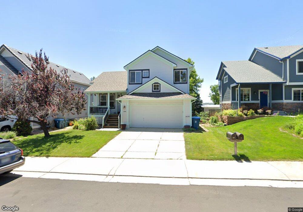
706 Nighthawk Cir Louisville, CO 80027
Estimated Value: $822,000 - $923,000
2
Beds
3
Baths
1,558
Sq Ft
$563/Sq Ft
Est. Value
About This Home
This home is located at 706 Nighthawk Cir, Louisville, CO 80027 and is currently estimated at $877,482, approximately $563 per square foot. 706 Nighthawk Cir is a home located in Boulder County with nearby schools including Fireside Elementary School, Monarch K-8 School, and Monarch High School.
Ownership History
Date
Name
Owned For
Owner Type
Purchase Details
Closed on
Apr 17, 2023
Sold by
Engel Dana C
Bought by
Dana C Engel Revocable Trust
Current Estimated Value
Purchase Details
Closed on
Oct 24, 1996
Sold by
Mcstain Enterprises Inc
Bought by
Engel Dana C
Home Financials for this Owner
Home Financials are based on the most recent Mortgage that was taken out on this home.
Original Mortgage
$130,000
Interest Rate
8.31%
Create a Home Valuation Report for This Property
The Home Valuation Report is an in-depth analysis detailing your home's value as well as a comparison with similar homes in the area
Home Values in the Area
Average Home Value in this Area
Purchase History
| Date | Buyer | Sale Price | Title Company |
|---|---|---|---|
| Dana C Engel Revocable Trust | -- | None Listed On Document | |
| Engel Dana C | $210,411 | -- |
Source: Public Records
Mortgage History
| Date | Status | Borrower | Loan Amount |
|---|---|---|---|
| Previous Owner | Engel Dana C | $130,000 |
Source: Public Records
Tax History Compared to Growth
Tax History
| Year | Tax Paid | Tax Assessment Tax Assessment Total Assessment is a certain percentage of the fair market value that is determined by local assessors to be the total taxable value of land and additions on the property. | Land | Improvement |
|---|---|---|---|---|
| 2025 | $4,104 | $61,219 | $21,688 | $39,531 |
| 2024 | $4,104 | $61,219 | $21,688 | $39,531 |
| 2023 | $4,034 | $52,361 | $23,510 | $32,535 |
| 2022 | $4,385 | $45,564 | $17,264 | $28,300 |
| 2021 | $4,719 | $50,951 | $19,305 | $31,646 |
| 2020 | $4,118 | $44,002 | $16,231 | $27,771 |
| 2019 | $4,059 | $44,002 | $16,231 | $27,771 |
| 2018 | $3,652 | $40,874 | $8,136 | $32,738 |
| 2017 | $3,579 | $45,189 | $8,995 | $36,194 |
| 2016 | $3,219 | $36,584 | $12,258 | $24,326 |
| 2015 | $3,051 | $31,777 | $17,353 | $14,424 |
| 2014 | $2,717 | $31,777 | $17,353 | $14,424 |
Source: Public Records
Map
Nearby Homes
- 494 Owl Dr Unit 4
- 810 Trail Ridge Dr
- 118 S Tanager Ct
- 812 W Mulberry St
- 823 Trail Ridge Dr
- 408 Fillmore Ct
- 848 Trail Ridge Dr
- 900 Eldorado Ln
- 593 Wildrose Way
- 592 Spruce Cir
- 159 S Polk Ave
- 641 W Dahlia St
- 955 Arapahoe Cir
- 958 Eldorado Ln
- 1006 Honeysuckle Ln
- 935 Eldorado Ln Unit A
- 935 Eldorado Ln
- 279 S Taft Ct Unit 53
- 426 W Spruce Ln
- 323 S Taft Ct Unit 26
- 710 Nighthawk Cir
- 702 Nighthawk Cir
- 714 Nighthawk Cir
- 797 W Pinyon Way
- 799 W Pinyon Way
- 701 Nighthawk Cir
- 795 W Pinyon Way
- 707 Nighthawk Cir
- 718 Nighthawk Cir
- 711 Nighthawk Cir
- 793 W Pinyon Way
- 799 Nighthawk Cir
- 722 Nighthawk Cir
- 717 Nighthawk Cir
- 797 Nighthawk Cir
- 792 W Pinyon Way
- 790 W Pinyon Way
- 794 W Pinyon Way
- 726 Nighthawk Cir
- 723 Nighthawk Cir