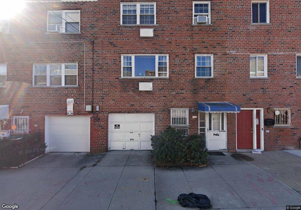
706 Sagamore St Bronx, NY 10462
Van Nest NeighborhoodEstimated Value: $604,998 - $671,000
--
Bed
--
Bath
1,714
Sq Ft
$380/Sq Ft
Est. Value
About This Home
This home is located at 706 Sagamore St, Bronx, NY 10462 and is currently estimated at $651,500, approximately $380 per square foot. 706 Sagamore St is a home located in Bronx County with nearby schools including P.S. 105 Senator Abraham Bernstein, Pelham Academy, and Bronx Green Middle School.
Ownership History
Date
Name
Owned For
Owner Type
Purchase Details
Closed on
Jul 23, 2004
Sold by
Pochodaj Gregory and Pochodaj Maria
Bought by
Gebreselassie Frewoini and Kahsai Yacob
Current Estimated Value
Home Financials for this Owner
Home Financials are based on the most recent Mortgage that was taken out on this home.
Original Mortgage
$224,000
Outstanding Balance
$110,512
Interest Rate
6.03%
Mortgage Type
Purchase Money Mortgage
Estimated Equity
$540,988
Create a Home Valuation Report for This Property
The Home Valuation Report is an in-depth analysis detailing your home's value as well as a comparison with similar homes in the area
Home Values in the Area
Average Home Value in this Area
Purchase History
| Date | Buyer | Sale Price | Title Company |
|---|---|---|---|
| Gebreselassie Frewoini | $280,000 | -- |
Source: Public Records
Mortgage History
| Date | Status | Borrower | Loan Amount |
|---|---|---|---|
| Open | Gebreselassie Frewoini | $224,000 |
Source: Public Records
Tax History Compared to Growth
Tax History
| Year | Tax Paid | Tax Assessment Tax Assessment Total Assessment is a certain percentage of the fair market value that is determined by local assessors to be the total taxable value of land and additions on the property. | Land | Improvement |
|---|---|---|---|---|
| 2025 | $4,491 | $23,702 | $3,545 | $20,157 |
| 2024 | $4,491 | $22,361 | $3,349 | $19,012 |
| 2023 | $4,284 | $21,096 | $3,686 | $17,410 |
| 2022 | $4,211 | $31,800 | $6,300 | $25,500 |
| 2021 | $4,406 | $32,460 | $6,300 | $26,160 |
| 2020 | $4,181 | $30,300 | $6,300 | $24,000 |
| 2019 | $3,898 | $24,420 | $6,300 | $18,120 |
| 2018 | $3,584 | $17,580 | $6,300 | $11,280 |
| 2017 | $4,195 | $20,580 | $6,300 | $14,280 |
| 2016 | $4,282 | $21,420 | $6,300 | $15,120 |
| 2015 | $2,556 | $20,733 | $6,268 | $14,465 |
| 2014 | $2,556 | $19,560 | $7,020 | $12,540 |
Source: Public Records
Map
Nearby Homes
- 1935 Holland Ave
- 1914 Holland Ave
- 1865 Hunt Ave
- 661 Sagamore St
- 1961 Wallace Ave
- 1907 Barnes Ave
- 1852 Amethyst St
- 1916 Barnes Ave
- 1827 Amethyst St
- 762 Brady Ave Unit 221
- 762 Brady Ave Unit 621
- 754 Brady Ave Unit 303
- 756 Brady Ave Unit 507
- 1869 Muliner Ave
- 760 Brady Ave Unit 117
- 758 Brady Ave Unit 411
- 758 Brady Ave Unit 214
- 760 Brady Ave Unit 417
- 1731 White Plains Rd
- 1904 Bronxdale Ave
- 708 Sagamore St
- 704 Sagamore St
- 702 Sagamore St
- 710 Sagamore St
- 1928 Cruger Ave
- 712 Sagamore St
- 700 Sagamore St
- 1926 Cruger Ave
- 1915 Hunt Ave Unit 1917
- 1915-1917 Hunt Ave
- 714 Sagamore St
- 1924 Cruger Ave
- 709 Sagamore St
- 711 Sagamore St
- 713 Sagamore St
- 1922 Cruger Ave
- 701 Sagamore St
- 1913 Hunt Ave
- 1913 Hunt Ave Unit 2
- 715 Sagamore St