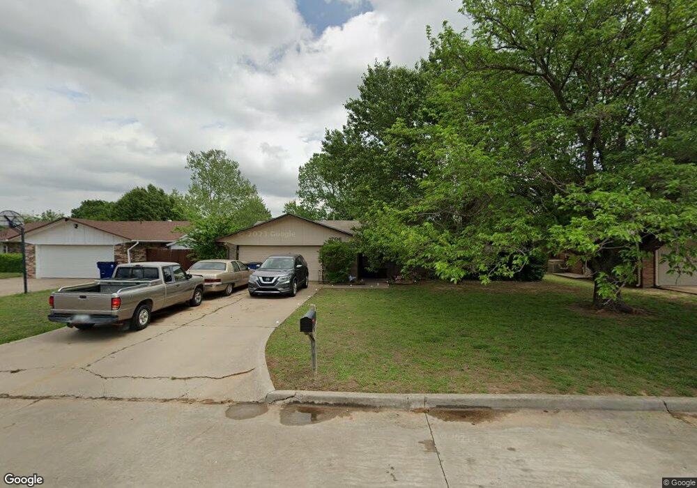
706 Westridge Dr Duncan, OK 73533
Estimated Value: $147,000 - $158,000
3
Beds
2
Baths
1,206
Sq Ft
$128/Sq Ft
Est. Value
About This Home
This home is located at 706 Westridge Dr, Duncan, OK 73533 and is currently estimated at $153,793, approximately $127 per square foot. 706 Westridge Dr is a home located in Stephens County with nearby schools including Mark Twain Elementary School, Duncan Middle School, and Duncan High School.
Ownership History
Date
Name
Owned For
Owner Type
Purchase Details
Closed on
Oct 29, 2025
Sold by
Seals Dianna Jean and Stiewert Family Trust
Bought by
Stiewert Rental Properties Llc
Current Estimated Value
Purchase Details
Closed on
Apr 20, 2011
Sold by
Han Ming G
Bought by
Stiewart Family Trust
Purchase Details
Closed on
Oct 22, 2004
Sold by
Howweth Doug Alan and Howweth F
Purchase Details
Closed on
Aug 24, 2001
Sold by
Kelly Kevin and Kelly Holly
Purchase Details
Closed on
Aug 20, 1998
Sold by
Tinsley Matthew Troy
Purchase Details
Closed on
Jun 19, 1996
Sold by
Smith Kim H
Purchase Details
Closed on
Mar 3, 1994
Sold by
Todd Bradley L
Create a Home Valuation Report for This Property
The Home Valuation Report is an in-depth analysis detailing your home's value as well as a comparison with similar homes in the area
Home Values in the Area
Average Home Value in this Area
Purchase History
| Date | Buyer | Sale Price | Title Company |
|---|---|---|---|
| Stiewert Rental Properties Llc | -- | None Listed On Document | |
| Stiewart Family Trust | $84,000 | None Available | |
| -- | $84,500 | -- | |
| -- | $73,000 | -- | |
| -- | $65,000 | -- | |
| -- | $53,000 | -- | |
| -- | $50,000 | -- |
Source: Public Records
Tax History Compared to Growth
Tax History
| Year | Tax Paid | Tax Assessment Tax Assessment Total Assessment is a certain percentage of the fair market value that is determined by local assessors to be the total taxable value of land and additions on the property. | Land | Improvement |
|---|---|---|---|---|
| 2025 | $1,015 | $12,031 | $859 | $11,172 |
| 2024 | $976 | $11,459 | $859 | $10,600 |
| 2023 | $976 | $11,458 | $859 | $10,599 |
| 2022 | $884 | $10,913 | $859 | $10,054 |
| 2021 | $843 | $9,898 | $859 | $9,039 |
| 2020 | $848 | $9,815 | $859 | $8,956 |
| 2019 | $824 | $9,530 | $859 | $8,671 |
| 2018 | $904 | $10,408 | $859 | $9,549 |
| 2017 | $831 | $10,150 | $859 | $9,291 |
| 2016 | $783 | $9,207 | $859 | $8,348 |
| 2015 | $767 | $8,974 | $827 | $8,147 |
| 2014 | $767 | $8,547 | $770 | $7,777 |
Source: Public Records
Map
Nearby Homes
- TBD S 27th St
- 106 Emery Rd
- 2110 W Main St
- 206 N 28th St
- 210 N 31st St
- 201 N 23rd St
- 2006 W Oak Ave
- 209 N 22nd St
- 2011 W Oak Ave
- 0 W Beech Ave
- 1223 S 42nd St
- 174831 N 2844 Rd
- 507 S 13th St
- 451 S 11th St
- 711 711 S 12th
- 1309 W Pecan Ave
- 1109 W Stephens Ave
- 123 N Highway 81
- 1009 W Duncan Ave
- 1244 Carriage Dr
- 702 Westridge Dr
- 710 Westridge Dr
- 705 Fieldcrest Dr
- 610 Westridge Dr
- 701 Fieldcrest Dr
- 709 Fieldcrest Dr
- 709 709 Fieldcrest Dr
- 705 Westridge Dr
- 609 Fieldcrest Dr
- 701 Westridge Dr
- 709 Westridge Dr
- 609 Westridge Dr
- 606 W Ridge Dr
- 605 605 Fieldcrest Dr
- 605 Fieldcrest Dr
- 605 Westridge Dr
- 602 Westridge Dr
- 602 W Ridge Dr
- 720 Catherine Ln
- 601 Fieldcrest Dr