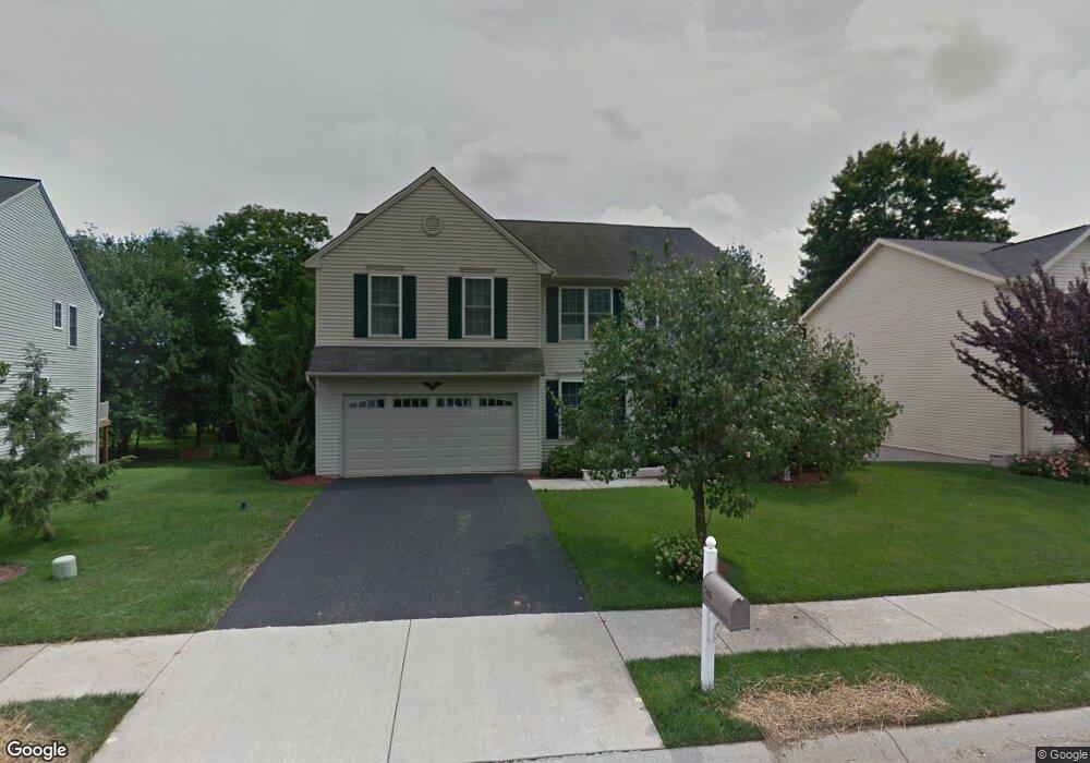
706 Westwood Dr Enola, PA 17025
East Pennsboro NeighborhoodEstimated Value: $411,000 - $472,209
4
Beds
3
Baths
2,576
Sq Ft
$172/Sq Ft
Est. Value
About This Home
This home is located at 706 Westwood Dr, Enola, PA 17025 and is currently estimated at $442,802, approximately $171 per square foot. 706 Westwood Dr is a home located in Cumberland County with nearby schools including East Pennsboro Area Middle School and East Pennsboro Area Senior High School.
Ownership History
Date
Name
Owned For
Owner Type
Purchase Details
Closed on
Aug 27, 2004
Sold by
B L C Properties
Bought by
Amin Hitendra
Current Estimated Value
Home Financials for this Owner
Home Financials are based on the most recent Mortgage that was taken out on this home.
Original Mortgage
$14,000,000
Outstanding Balance
$6,996,023
Interest Rate
6.01%
Mortgage Type
Construction
Estimated Equity
-$6,553,221
Create a Home Valuation Report for This Property
The Home Valuation Report is an in-depth analysis detailing your home's value as well as a comparison with similar homes in the area
Home Values in the Area
Average Home Value in this Area
Purchase History
| Date | Buyer | Sale Price | Title Company |
|---|---|---|---|
| Amin Hitendra | $295,015 | -- |
Source: Public Records
Mortgage History
| Date | Status | Borrower | Loan Amount |
|---|---|---|---|
| Open | Amin Hitendra | $14,000,000 |
Source: Public Records
Tax History Compared to Growth
Tax History
| Year | Tax Paid | Tax Assessment Tax Assessment Total Assessment is a certain percentage of the fair market value that is determined by local assessors to be the total taxable value of land and additions on the property. | Land | Improvement |
|---|---|---|---|---|
| 2025 | $6,155 | $298,200 | $67,700 | $230,500 |
| 2024 | $5,806 | $298,200 | $67,700 | $230,500 |
| 2023 | $5,478 | $298,200 | $67,700 | $230,500 |
| 2022 | $5,150 | $298,200 | $67,700 | $230,500 |
| 2021 | $5,062 | $298,200 | $67,700 | $230,500 |
| 2020 | $4,944 | $298,200 | $67,700 | $230,500 |
| 2019 | $4,885 | $298,200 | $67,700 | $230,500 |
| 2018 | $4,830 | $298,200 | $67,700 | $230,500 |
| 2017 | $4,623 | $298,200 | $67,700 | $230,500 |
| 2016 | -- | $298,200 | $67,700 | $230,500 |
| 2015 | -- | $298,200 | $67,700 | $230,500 |
| 2014 | -- | $298,200 | $67,700 | $230,500 |
Source: Public Records
Map
Nearby Homes
- 3 Memory Ln
- 810 Charlotte Way Unit 303
- 816 Charlotte Way
- 221 Lee Ct
- 819 Brian Dr
- 107 Melissa Ct
- 851 Louise Ct
- 104 Bungalow Rd
- 0 Belle Vista Dr
- 42 Beaver Ave
- 419 Mountain St
- 591 Belle Vista Dr
- 954 Valley Rd
- 305 W Shady Ln
- 105 Miller St
- 231 W Columbia Rd
- 233 W Columbia Rd
- 13 E Shady Ln
- 79 Railroad Ave
- 74 Railroad Ave
- 708 Westwood Dr
- 704 Westwood Dr
- 707 Westwood Dr
- 653 Brisbain Ln
- 710 Westwood Dr
- 705 Westwood Dr
- 709 Westwood Dr
- 655 Brisbain Ln
- 703 Westwood Dr
- 651 Brisbain Ln
- 799 Valley St
- 799 Valley St
- 711 Westwood Dr
- 2 Crooked Dr
- 712 Westwood Dr
- 8 Rexford Rd
- 657 Brisbain Ln
- 6 Rexford Rd
- 4 Crooked Dr
- 4 Rexford Rd