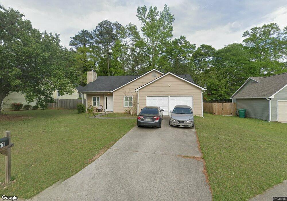
7061 Sir Galahad Way Unit 2 Jonesboro, GA 30236
Estimated Value: $199,000 - $233,000
3
Beds
2
Baths
1,441
Sq Ft
$150/Sq Ft
Est. Value
About This Home
This home is located at 7061 Sir Galahad Way Unit 2, Jonesboro, GA 30236 and is currently estimated at $215,592, approximately $149 per square foot. 7061 Sir Galahad Way Unit 2 is a home located in Clayton County with nearby schools including Kilpatrick Elementary School, Sequoyah Middle School, and Charles R. Drew High School.
Ownership History
Date
Name
Owned For
Owner Type
Purchase Details
Closed on
Dec 16, 1999
Sold by
Strong Foundation Inc
Bought by
Rehman Razaur
Current Estimated Value
Home Financials for this Owner
Home Financials are based on the most recent Mortgage that was taken out on this home.
Original Mortgage
$101,700
Outstanding Balance
$43,534
Interest Rate
10.25%
Mortgage Type
New Conventional
Estimated Equity
$172,058
Create a Home Valuation Report for This Property
The Home Valuation Report is an in-depth analysis detailing your home's value as well as a comparison with similar homes in the area
Home Values in the Area
Average Home Value in this Area
Purchase History
| Date | Buyer | Sale Price | Title Company |
|---|---|---|---|
| Rehman Razaur | $113,000 | -- |
Source: Public Records
Mortgage History
| Date | Status | Borrower | Loan Amount |
|---|---|---|---|
| Open | Rehman Razaur | $101,700 |
Source: Public Records
Tax History Compared to Growth
Tax History
| Year | Tax Paid | Tax Assessment Tax Assessment Total Assessment is a certain percentage of the fair market value that is determined by local assessors to be the total taxable value of land and additions on the property. | Land | Improvement |
|---|---|---|---|---|
| 2024 | $2,811 | $71,080 | $6,400 | $64,680 |
| 2023 | $2,002 | $55,440 | $6,400 | $49,040 |
| 2022 | $2,606 | $65,440 | $6,400 | $59,040 |
| 2021 | $2,245 | $55,880 | $6,400 | $49,480 |
| 2020 | $1,740 | $42,557 | $6,400 | $36,157 |
| 2019 | $1,492 | $35,825 | $3,840 | $31,985 |
| 2018 | $1,358 | $32,519 | $3,840 | $28,679 |
| 2017 | $1,177 | $27,994 | $3,840 | $24,154 |
| 2016 | $1,222 | $29,101 | $3,840 | $25,261 |
| 2015 | $719 | $0 | $0 | $0 |
| 2014 | $903 | $21,758 | $5,120 | $16,638 |
Source: Public Records
Map
Nearby Homes
- 7118 Lady Heidi Ct
- 7114 Lady Heidi Ct
- 285 Queen Helen Ln
- 213 Whipporwill Way
- 410 Queen Aliese Ln Unit 1
- 7371 Ovis Ct
- 7428 Mockingbird Trail
- 474 Autumn Dr
- 7390 Ovis Ln
- 3938 Alderwoods Dr
- 3942 Alderwoods Dr
- 542 Village Ln
- 7017 Sun Valley Way
- 90 Jonathan Rd
- 378 Durmire Dr
- 7103 Apache Ln
- 7461 Cardinal Way
- 7087 Apache Ln
- 200 Sunrise Cir
- 7057 Sir Galahad Way
- 7065 Sir Galahad Way Unit 2
- 7073 Sir Galahad Way Unit 2
- 7143 Lady Heidi Ct
- 7053 Sir Galahad Way
- 7147 Lady Heidi Ct Unit 2
- 7139 Lady Heidi Ct Unit 2
- 7077 Sir Galahad Way
- 7153 Lady Heidi Ct
- 7058 Sir Galahad Way
- 7054 Sir Galahad Way
- 7049 Sir Galahad Way
- 7062 Sir Galahad Way
- 7066 Sir Galahad Way
- 7050 Sir Galahad Way
- 7161 Lady Heidi Ct Unit 2
- 7081 Sir Galahad Way
- 7070 Sir Galahad Way
- 7045 Sir Galahad Way Unit 2
- 7135 Lady Heidi Ct