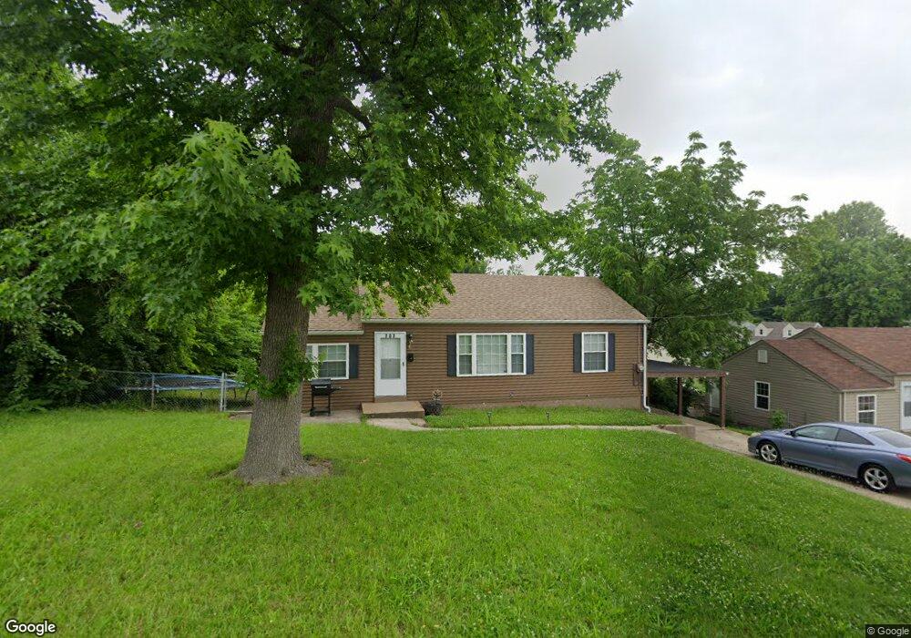
707 Abston Ave Saint Louis, MO 63135
Estimated Value: $86,271 - $109,000
3
Beds
1
Bath
1,056
Sq Ft
$92/Sq Ft
Est. Value
About This Home
This home is located at 707 Abston Ave, Saint Louis, MO 63135 and is currently estimated at $97,568, approximately $92 per square foot. 707 Abston Ave is a home located in St. Louis County with nearby schools including Ferguson Middle School, Johnson Wabash Elementary School, and McCluer High School.
Ownership History
Date
Name
Owned For
Owner Type
Purchase Details
Closed on
Sep 25, 2020
Sold by
Sfr3 Llc
Bought by
Sfr3 010 Llc
Current Estimated Value
Purchase Details
Closed on
Jul 30, 2019
Sold by
Binion Bobbie R
Bought by
Gc Construction & Design Llc
Purchase Details
Closed on
Jul 31, 1997
Sold by
Jim Gross Real Estate Co
Bought by
Binion Louis E and Binion Bobbie R
Home Financials for this Owner
Home Financials are based on the most recent Mortgage that was taken out on this home.
Original Mortgage
$48,000
Interest Rate
7.6%
Mortgage Type
FHA
Create a Home Valuation Report for This Property
The Home Valuation Report is an in-depth analysis detailing your home's value as well as a comparison with similar homes in the area
Home Values in the Area
Average Home Value in this Area
Purchase History
| Date | Buyer | Sale Price | Title Company |
|---|---|---|---|
| Sfr3 010 Llc | -- | Integrity Title Sln Llc | |
| Gc Construction & Design Llc | $10,000 | Copper Title Llc | |
| Growth Developments Llc | $20,000 | Copper Title Llc | |
| Binion Louis E | -- | Land Title Company |
Source: Public Records
Mortgage History
| Date | Status | Borrower | Loan Amount |
|---|---|---|---|
| Previous Owner | Binion Louis E | $48,000 |
Source: Public Records
Tax History
| Year | Tax Paid | Tax Assessment Tax Assessment Total Assessment is a certain percentage of the fair market value that is determined by local assessors to be the total taxable value of land and additions on the property. | Land | Improvement |
|---|---|---|---|---|
| 2025 | $870 | $15,490 | $1,220 | $14,270 |
| 2024 | $870 | $11,820 | $1,620 | $10,200 |
| 2023 | $866 | $11,820 | $1,620 | $10,200 |
| 2022 | $690 | $8,140 | $1,220 | $6,920 |
| 2021 | $668 | $8,140 | $1,220 | $6,920 |
| 2020 | $663 | $7,260 | $1,270 | $5,990 |
| 2019 | $651 | $7,260 | $1,270 | $5,990 |
| 2018 | $728 | $7,280 | $1,330 | $5,950 |
| 2017 | $714 | $7,280 | $1,330 | $5,950 |
| 2016 | $1,020 | $10,360 | $1,710 | $8,650 |
Source: Public Records
Map
Nearby Homes
- 138 N Marguerite Ave
- 310 N Marguerite Ave
- 825 Walters Dr
- 222 Henquin Dr
- 411 Warford Ave
- 308 Henquin Dr
- 324 Henquin Dr
- 439 Warford Ave
- 45 Beacon Ave
- 309 Newell Dr
- 810 January Ave
- 6135 Shillington Dr
- 6005 Shillington Dr
- 415 Wesley Ave
- 8115 Myrick St
- 215 Carson Rd
- 719 Tiffin Ave
- 35 Robert Ave
- 127 Thoroughman Ave
- 115 Lawrence Ave
- 701 Abston Ave
- 213 N Marguerite Ave
- 202 N Dade Ave
- 204 N Dade Ave
- 217 N Marguerite Ave
- 206 N Dade Ave
- 208 N Dade Ave
- 219 N Marguerite Ave
- 149 N Marguerite Ave
- 210 N Dade Ave
- 146 N Dade Ave
- 225 N Marguerite Ave
- 212 N Dade Ave
- 206 N Marguerite Ave
- 202 N Marguerite Ave
- 142 N Dade Ave
- 210 N Marguerite Ave
- 612 Abston Ave
- 214 N Marguerite Ave
- 214 N Dade Ave
Your Personal Tour Guide
Ask me questions while you tour the home.