I
Seller's Agent in 2017
Ida Leonard
Precious Realty Of Georgia, LLC
(229) 776-3124
10 Total Sales
Estimated Value: $147,000 - $176,000
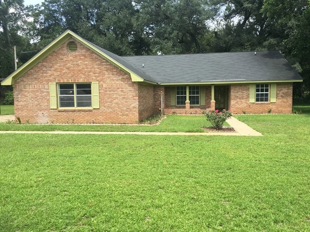
Spacious home with a large Great-room and beautiful hardwood floors throughout home. The split floor plan provides two additional bedrooms and a hall bath with linen closet. Home is situated on a one acre lot and has a beautiful manicured lawn. There is a two car garage and a covered carport. This home is a must see so don't miss this opportunity!! It's Priced for Quick Sale...
Last Agent to Sell the Property
Precious Realty Of Georgia, LLC Brokerage Phone: 2292917171 License #318331 Listed on: 09/07/2017
Last Buyer's Agent
Rashaunda Muldrow
Concierge Real Estate Group, LLC
| Date | Buyer | Sale Price | Title Company |
|---|---|---|---|
| Drake Gloria M | -- | -- | |
| Rcf2 Acquisition Trust | $111,893 | -- | |
| Johnson Portia S | -- | -- | |
| Mckinley Drake | $89,900 | -- | |
| Lamons Tommy Lee | $60,000 | -- | |
| Georgia Fed Fsb | $58,400 | -- |
| Date | Status | Borrower | Loan Amount |
|---|---|---|---|
| Previous Owner | Mckinley Drake | $88,271 |
| Date | Event | Price | List to Sale | Price per Sq Ft |
|---|---|---|---|---|
| 10/12/2017 10/12/17 | Sold | $89,900 | -- | $57 / Sq Ft |
| 09/07/2017 09/07/17 | Pending | -- | -- | -- |
| Year | Tax Paid | Tax Assessment Tax Assessment Total Assessment is a certain percentage of the fair market value that is determined by local assessors to be the total taxable value of land and additions on the property. | Land | Improvement |
|---|---|---|---|---|
| 2024 | $1,591 | $36,440 | $6,000 | $30,440 |
| 2023 | $760 | $36,440 | $6,000 | $30,440 |
| 2022 | $1,596 | $36,440 | $6,000 | $30,440 |
| 2021 | $1,477 | $36,440 | $6,000 | $30,440 |
| 2020 | $1,480 | $36,440 | $6,000 | $30,440 |
| 2019 | $1,483 | $36,440 | $6,000 | $30,440 |
| 2018 | $1,466 | $36,440 | $6,000 | $30,440 |
| 2017 | $1,464 | $36,440 | $6,000 | $30,440 |
| 2016 | $1,465 | $36,440 | $6,000 | $30,440 |
| 2015 | $1,387 | $36,440 | $6,000 | $30,440 |
| 2014 | $1,368 | $36,440 | $6,000 | $30,440 |
I
Seller's Agent in 2017
Ida Leonard
Precious Realty Of Georgia, LLC
(229) 776-3124
10 Total Sales
R
Buyer's Agent in 2017
Rashaunda Muldrow
Concierge Real Estate Group, LLC
Source: Albany Board of REALTORS®
MLS Number: 138897
APN: 00136-00004-017
