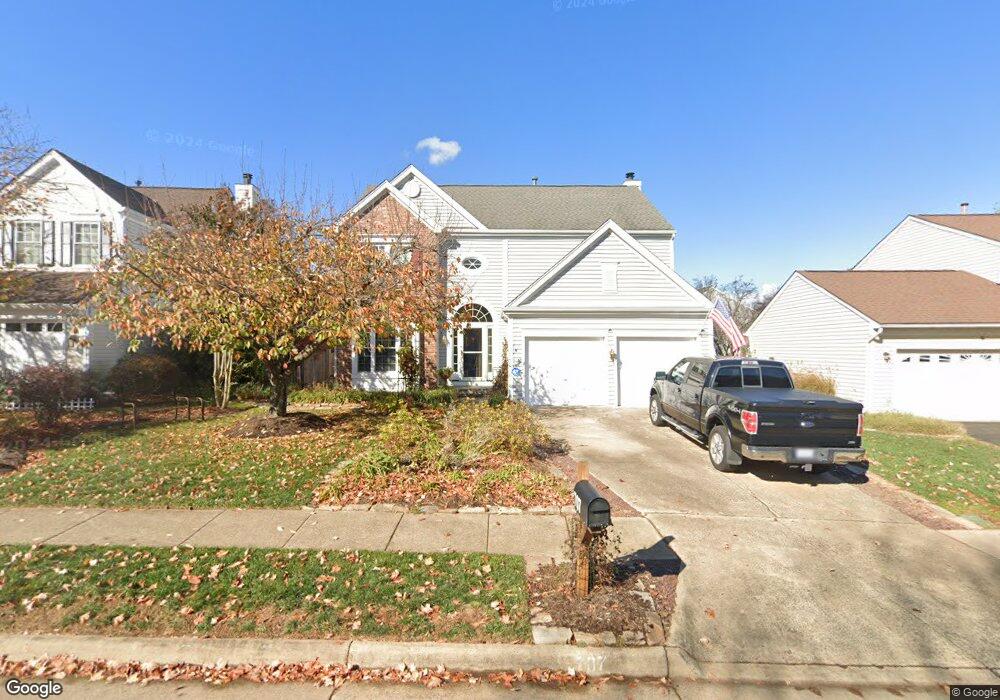
707 Catoctin Cir NE Leesburg, VA 20176
Estimated Value: $761,157 - $810,000
4
Beds
3
Baths
2,180
Sq Ft
$357/Sq Ft
Est. Value
About This Home
This home is located at 707 Catoctin Cir NE, Leesburg, VA 20176 and is currently estimated at $779,039, approximately $357 per square foot. 707 Catoctin Cir NE is a home located in Loudoun County with nearby schools including Frances Hazel Reid Elementary School, Smart's Mill Middle School, and Tuscarora High School.
Ownership History
Date
Name
Owned For
Owner Type
Purchase Details
Closed on
Aug 15, 1994
Sold by
Pulte Home
Bought by
Costic Michael J
Current Estimated Value
Home Financials for this Owner
Home Financials are based on the most recent Mortgage that was taken out on this home.
Original Mortgage
$193,800
Interest Rate
8.52%
Create a Home Valuation Report for This Property
The Home Valuation Report is an in-depth analysis detailing your home's value as well as a comparison with similar homes in the area
Home Values in the Area
Average Home Value in this Area
Purchase History
| Date | Buyer | Sale Price | Title Company |
|---|---|---|---|
| Costic Michael J | $204,000 | -- |
Source: Public Records
Mortgage History
| Date | Status | Borrower | Loan Amount |
|---|---|---|---|
| Closed | Costic Michael J | $193,800 |
Source: Public Records
Tax History Compared to Growth
Tax History
| Year | Tax Paid | Tax Assessment Tax Assessment Total Assessment is a certain percentage of the fair market value that is determined by local assessors to be the total taxable value of land and additions on the property. | Land | Improvement |
|---|---|---|---|---|
| 2025 | $5,660 | $703,150 | $256,000 | $447,150 |
| 2024 | $5,950 | $687,810 | $238,000 | $449,810 |
| 2023 | $5,915 | $676,050 | $223,000 | $453,050 |
| 2022 | $5,500 | $618,030 | $198,000 | $420,030 |
| 2021 | $5,206 | $531,210 | $179,200 | $352,010 |
| 2020 | $4,767 | $460,570 | $179,200 | $281,370 |
| 2019 | $4,614 | $441,570 | $179,200 | $262,370 |
| 2018 | $4,680 | $431,300 | $149,200 | $282,100 |
| 2017 | $4,406 | $391,650 | $149,200 | $242,450 |
| 2016 | $4,431 | $386,950 | $0 | $0 |
| 2015 | $733 | $251,460 | $0 | $251,460 |
| 2014 | $706 | $236,670 | $0 | $236,670 |
Source: Public Records
Map
Nearby Homes
- 706 Amber Ct NE
- 108 Stoneledge Place NE
- 523 Currant Terrace NE
- 514 Covington Terrace NE
- 41966 Dry Hollow Rd
- 105 Burt Ct NE
- 216 Wildman St NE
- 293 Ariel Dr NE
- 1204 James Rifle Ct NE
- 710 North St NE
- 276 Ariel Dr NE
- 732 Balls Bluff Rd NE
- 1129 Huntmaster Terrace NE Unit 301
- 1102 Huntmaster Terrace NE Unit 301
- 820 Ferndale Terrace NE
- 222 Wirt St NW
- 1148 Keokuk Terrace NE
- 1411 Barksdale Dr NE
- BIRKHALL Plan at Brickyard
- BALMORAL Plan at Brickyard
- 705 Catoctin Cir NE
- 709 Catoctin Cir NE
- 207 Grafton Way NE
- 703 Catoctin Cir NE
- 208 Stoneledge Place NE
- 205 Grafton Way NE
- 706 Catoctin Cir NE
- 704 Catoctin Cir NE
- 708 Catoctin Cir NE
- 206 Stoneledge Place NE
- 203 Grafton Way NE
- 214 Grafton Way NE
- 212 Grafton Way NE
- 702 Catoctin Cir NE
- 710 Catoctin Cir NE
- 210 Grafton Way NE
- 208 Grafton Way NE
- 212 Ashford Ct NE
- 210 Ashford Ct NE
- 204 Stoneledge Place NE