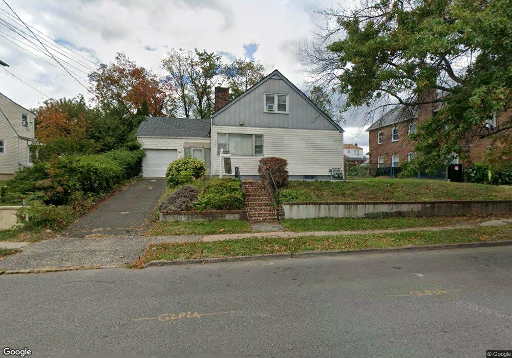
707 E 30th St Unit 2 Paterson, NJ 07513
Eastside NeighborhoodEstimated Value: $572,299 - $658,000
3
Beds
3
Baths
1,953
Sq Ft
$319/Sq Ft
Est. Value
About This Home
This home is located at 707 E 30th St Unit 2, Paterson, NJ 07513 and is currently estimated at $622,325, approximately $318 per square foot. 707 E 30th St Unit 2 is a home located in Passaic County with nearby schools including Dale Avenue Elementary School, Edward W. Kilpatrick School of Discovery, and Paterson Public School No. 3.
Ownership History
Date
Name
Owned For
Owner Type
Purchase Details
Closed on
Nov 10, 2025
Sold by
Hyndman Linda
Bought by
Cachuan Julian Cristobal
Current Estimated Value
Home Financials for this Owner
Home Financials are based on the most recent Mortgage that was taken out on this home.
Original Mortgage
$492,000
Outstanding Balance
$490,606
Interest Rate
6.3%
Mortgage Type
New Conventional
Estimated Equity
$131,719
Purchase Details
Closed on
Feb 1, 1996
Sold by
Tremble John
Bought by
Hyndman Linda
Home Financials for this Owner
Home Financials are based on the most recent Mortgage that was taken out on this home.
Original Mortgage
$150,000
Interest Rate
7.25%
Mortgage Type
VA
Create a Home Valuation Report for This Property
The Home Valuation Report is an in-depth analysis detailing your home's value as well as a comparison with similar homes in the area
Home Values in the Area
Average Home Value in this Area
Purchase History
| Date | Buyer | Sale Price | Title Company |
|---|---|---|---|
| Cachuan Julian Cristobal | $615,000 | Techno Title & Abstract | |
| Hyndman Linda | $147,000 | -- |
Source: Public Records
Mortgage History
| Date | Status | Borrower | Loan Amount |
|---|---|---|---|
| Open | Cachuan Julian Cristobal | $492,000 | |
| Previous Owner | Hyndman Linda | $150,000 |
Source: Public Records
Tax History
| Year | Tax Paid | Tax Assessment Tax Assessment Total Assessment is a certain percentage of the fair market value that is determined by local assessors to be the total taxable value of land and additions on the property. | Land | Improvement |
|---|---|---|---|---|
| 2025 | $12,666 | $248,600 | $84,200 | $164,400 |
| 2024 | $11,939 | $248,600 | $84,200 | $164,400 |
| 2022 | $11,540 | $248,600 | $84,200 | $164,400 |
| 2021 | $11,127 | $248,600 | $84,200 | $164,400 |
| 2020 | $10,379 | $248,600 | $84,200 | $164,400 |
| 2019 | $10,066 | $243,500 | $82,900 | $160,600 |
| 2018 | $10,395 | $240,300 | $82,300 | $158,000 |
| 2017 | $9,926 | $238,600 | $81,900 | $156,700 |
| 2016 | $10,302 | $243,200 | $77,500 | $165,700 |
| 2015 | $9,741 | $243,200 | $77,500 | $165,700 |
| 2014 | $9,500 | $336,200 | $176,600 | $159,600 |
Source: Public Records
Map
Nearby Homes
- 8 Kipp Place
- 6 Kipp Place
- 185 Trenton Ave Unit 187
- 156 Kentucky Ave Unit 158
- 137-139 23rd Ave
- 137 23rd Ave
- 102 22nd Ave Unit 104
- 941 E 25th St
- 501 E 32nd St
- 495-497 E 32nd St
- 966 E 24th St
- 960 E 24th St
- 1022 E 22nd St
- 310-312 Vreeland Ave
- 310 Vreeland Ave Unit 312
- 300-302 19th Ave
- 209 Michigan Ave Unit 211
- 302 19th Ave
- 297 Delaware Ave Unit 299
- 414 21st Ave
- 713 E 30th St Unit 715
- 715 E 30th St
- 701 E 30th St Unit 703
- 717-719 E 30th St
- 717 E 30th St Unit 719
- 684 E 31st St Unit 686
- 682 E 31st St Unit 684
- 678 E 31st St Unit 682
- 682-684 E 31st St
- 708 E 30th St Unit 714
- 688 E 31st St Unit 690
- 674-676 E 31st St
- 719 E 30th St Unit 723
- 704 E 30th St Unit 708
- 224 22nd Ave Unit 226
- 222 22nd Ave Unit 224
- 674 E 31st St Unit 676
- 702 E 30th St
- 222-224 22nd Ave
- 230 22nd Ave Unit 232
Your Personal Tour Guide
Ask me questions while you tour the home.