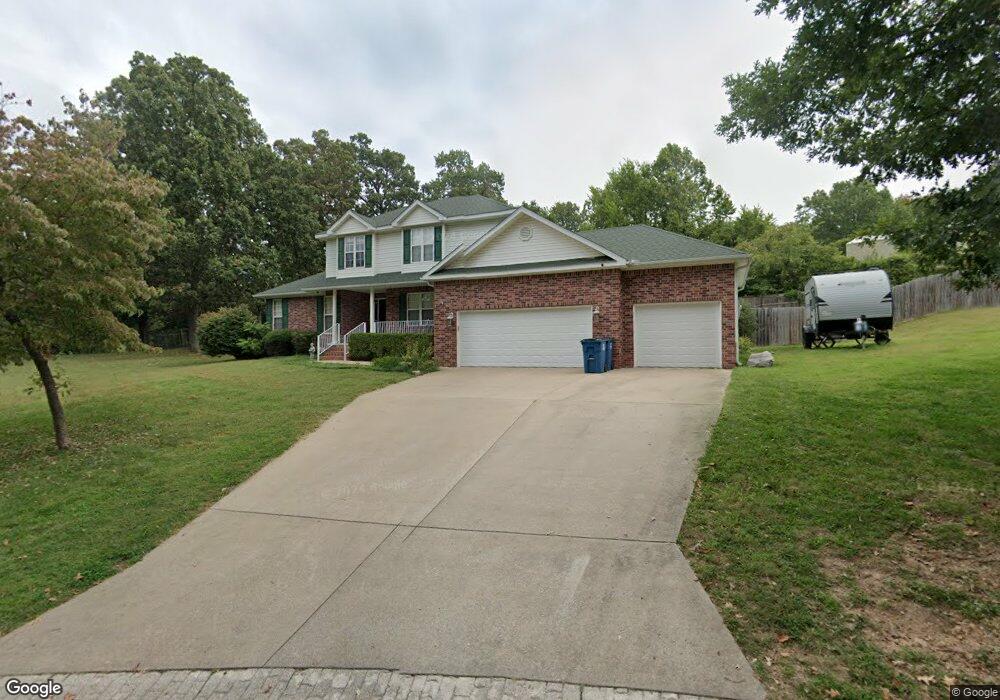
707 Laurel Cir Neosho, MO 64850
Estimated Value: $332,000 - $397,000
4
Beds
3
Baths
2,161
Sq Ft
$164/Sq Ft
Est. Value
About This Home
This home is located at 707 Laurel Cir, Neosho, MO 64850 and is currently estimated at $354,503, approximately $164 per square foot. 707 Laurel Cir is a home located in Newton County with nearby schools including Neosho High School, Ozark Christian Academy, and Neosho Christian Schools.
Ownership History
Date
Name
Owned For
Owner Type
Purchase Details
Closed on
Oct 19, 2020
Sold by
Tyler Pruitt John
Bought by
Hay Joshua L and Hay Cecelia
Current Estimated Value
Home Financials for this Owner
Home Financials are based on the most recent Mortgage that was taken out on this home.
Original Mortgage
$210,136
Interest Rate
2.8%
Mortgage Type
VA
Purchase Details
Closed on
Oct 14, 2020
Sold by
Norman Rouse
Bought by
Hays Joshua and Hay Cecelia
Home Financials for this Owner
Home Financials are based on the most recent Mortgage that was taken out on this home.
Original Mortgage
$210,136
Interest Rate
2.8%
Mortgage Type
VA
Create a Home Valuation Report for This Property
The Home Valuation Report is an in-depth analysis detailing your home's value as well as a comparison with similar homes in the area
Home Values in the Area
Average Home Value in this Area
Purchase History
| Date | Buyer | Sale Price | Title Company |
|---|---|---|---|
| Hay Joshua L | -- | None Listed On Document | |
| Hays Joshua | -- | None Listed On Document |
Source: Public Records
Mortgage History
| Date | Status | Borrower | Loan Amount |
|---|---|---|---|
| Closed | Hay Joshua L | $210,136 | |
| Closed | Hays Joshua | $210,136 |
Source: Public Records
Tax History
| Year | Tax Paid | Tax Assessment Tax Assessment Total Assessment is a certain percentage of the fair market value that is determined by local assessors to be the total taxable value of land and additions on the property. | Land | Improvement |
|---|---|---|---|---|
| 2024 | $2,116 | $38,540 | -- | -- |
| 2023 | $2,116 | $38,540 | $7,317 | $31,223 |
| 2022 | $2,116 | $38,670 | -- | -- |
| 2021 | $2,121 | $38,670 | $0 | $0 |
| 2020 | $1,864 | $34,110 | $0 | $0 |
| 2019 | $1,698 | $34,110 | $0 | $0 |
| 2018 | $1,708 | $34,110 | $0 | $0 |
| 2017 | $1,647 | $33,120 | $0 | $0 |
| 2016 | $1,647 | $32,830 | $0 | $0 |
| 2015 | -- | $32,530 | $0 | $0 |
| 2014 | -- | $32,530 | $0 | $0 |
Source: Public Records
Map
Nearby Homes
- Tbd W South St
- 620 W South St
- 512 Geyer Rd
- 1706 Watkins Dr
- 000 S High St
- Xxx S High
- 1704 Susan Place
- 903 S High St
- 720 Walnut Dr
- 802 S High St
- 1715 S High St
- 701 S High St
- 106 W South St
- 2.89 Ac W Daugherty Rd
- 620 Archer Ct
- 521 Oak Ridge Dr
- 1416 Hawthorne Dr
- 1701 Village Ln
- 1214 Linden Terrace
- 507 W Hill St
- 703 Laurel Cir
- 711 Laurel Cir
- 714 Laurel Cir
- 704 Laurel Cir
- 1206 Oakview Place
- 801 Laurel Cir
- 615 W South St
- 717 Laurel Cir
- 716 Laurel Cir
- 702 Wayne Ave
- 1400 Oak Ridge Dr
- 1408 Oak Ridge Dr
- 623 W South St
- 710 Wayne Ave Unit 1
- 710 Wayne Ave
- 611 W South St
- 631 W South St
- 805 Laurel Cir
- 1401 Oak Ridge Dr
- 1313 Oak Ridge Dr