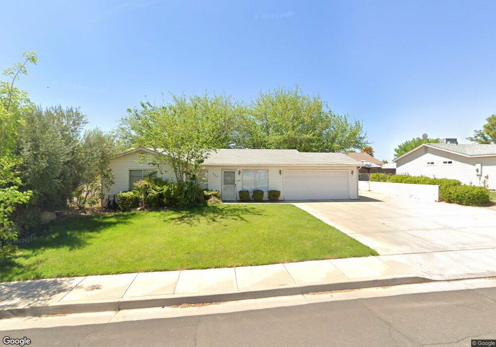
707 N 1590 W Saint George, UT 84770
Estimated Value: $330,000 - $375,000
3
Beds
2
Baths
1,036
Sq Ft
$344/Sq Ft
Est. Value
About This Home
This home is located at 707 N 1590 W, Saint George, UT 84770 and is currently estimated at $356,365, approximately $343 per square foot. 707 N 1590 W is a home located in Washington County with nearby schools including Sunset School, Snow Canyon Middle School, and Lava Ridge Intermediate School.
Ownership History
Date
Name
Owned For
Owner Type
Purchase Details
Closed on
May 17, 2012
Sold by
Tomlinson Stephen J
Bought by
Lam Enterprises Llc
Current Estimated Value
Home Financials for this Owner
Home Financials are based on the most recent Mortgage that was taken out on this home.
Original Mortgage
$80,250
Outstanding Balance
$55,809
Interest Rate
3.98%
Mortgage Type
New Conventional
Estimated Equity
$300,556
Purchase Details
Closed on
Oct 27, 2008
Sold by
Patterson Delmar D and Patterson Alta M
Bought by
Lambert Lance G and Lambert Mindy M
Home Financials for this Owner
Home Financials are based on the most recent Mortgage that was taken out on this home.
Original Mortgage
$39,660
Interest Rate
5.9%
Mortgage Type
Seller Take Back
Create a Home Valuation Report for This Property
The Home Valuation Report is an in-depth analysis detailing your home's value as well as a comparison with similar homes in the area
Home Values in the Area
Average Home Value in this Area
Purchase History
| Date | Buyer | Sale Price | Title Company |
|---|---|---|---|
| Lam Enterprises Llc | -- | Accommodation | |
| Tomlinson Stephen J | -- | Title Guarantee St George | |
| Lambert Lance G | -- | Accommodation |
Source: Public Records
Mortgage History
| Date | Status | Borrower | Loan Amount |
|---|---|---|---|
| Open | Tomlinson Stephen J | $80,250 | |
| Previous Owner | Lambert Lance G | $39,660 |
Source: Public Records
Tax History Compared to Growth
Tax History
| Year | Tax Paid | Tax Assessment Tax Assessment Total Assessment is a certain percentage of the fair market value that is determined by local assessors to be the total taxable value of land and additions on the property. | Land | Improvement |
|---|---|---|---|---|
| 2025 | $1,156 | $178,090 | $46,750 | $131,340 |
| 2023 | $1,207 | $180,400 | $35,750 | $144,650 |
| 2022 | $1,266 | $177,870 | $35,750 | $142,120 |
| 2021 | $1,119 | $234,400 | $45,000 | $189,400 |
| 2020 | $999 | $197,200 | $45,000 | $152,200 |
| 2019 | $983 | $189,600 | $40,000 | $149,600 |
| 2018 | $946 | $91,465 | $0 | $0 |
| 2017 | $882 | $85,250 | $0 | $0 |
| 2016 | $893 | $79,805 | $0 | $0 |
| 2015 | $863 | $73,975 | $0 | $0 |
| 2014 | $801 | $69,135 | $0 | $0 |
Source: Public Records
Map
Nearby Homes
- 1732 N 540 W Unit 120
- 1732 W 540 N Unit 120
- 1732 W 540 N Unit 13
- 1732 W 540 N Unit 68
- 1732 W 540 N Unit 17
- 1732 W 540 N Unit 92
- 1385 W 625 N
- 1385 W 625 North St
- 1735 W 540 N Unit 1006
- 1735 W 540 N Unit 2302
- 1735 W 540 N Unit 2302
- 1735 W 540 N Unit 1202
- 1735 W 540 N Unit 1001
- 954 N 1725 W Unit 32
- 1793 W 950 N Unit 3
- 727 N 1275 W
- 1708 W 1020 N Unit 146
- 695 N Daybreak Dr
- 1244 W 620 Cir N
- 1742 W 1020 N Unit 123
- 721 N 1590 W
- 699 N 1590 W
- 710 N 1620 Cir W
- 710 N 1620 West Cir
- 724 N 1620 Cir W
- 1600 W 700 N
- 724 N 1620 West Cir
- 696 N 1620 West Cir
- 696 N 1620 W
- 729 N 1590 W
- 682 N 1620 W
- 682 N 1620 West Cir
- 732 N 1620 West Cir
- 1581 W 700 N
- 1602 W 650 N
- 1560 W 700 N
- 709 N 1620 West Cir
- 1563 W 730 N
- 668 N 1620 Cir W
- 668 N 1620 West Cir