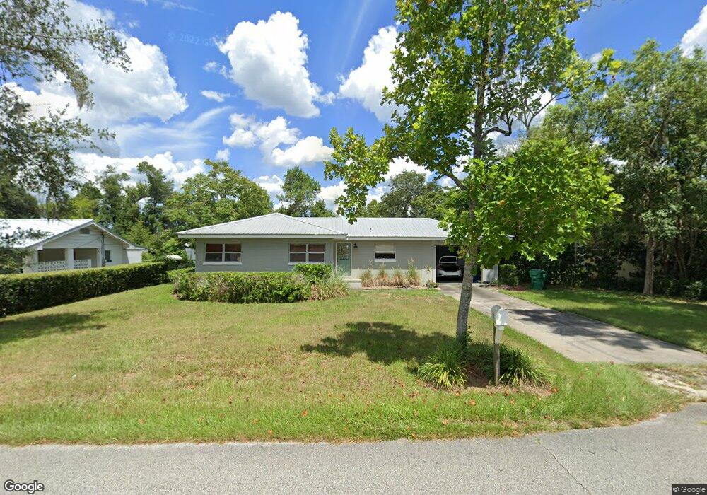
707 N Orange Ave Deland, FL 32720
Estimated Value: $216,782 - $285,000
2
Beds
1
Bath
1,288
Sq Ft
$190/Sq Ft
Est. Value
About This Home
This home is located at 707 N Orange Ave, Deland, FL 32720 and is currently estimated at $244,946, approximately $190 per square foot. 707 N Orange Ave is a home located in Volusia County with nearby schools including Citrus Grove Elementary, Deland High School, and Southwestern Middle School.
Ownership History
Date
Name
Owned For
Owner Type
Purchase Details
Closed on
Mar 7, 2025
Sold by
Robertson Barbara
Bought by
Barbara Robertson Living Trust and Robertson
Current Estimated Value
Purchase Details
Closed on
Oct 8, 1993
Sold by
Medlin Richard Gene and Medlin Donna Keef
Bought by
Robertson Barbara D
Home Financials for this Owner
Home Financials are based on the most recent Mortgage that was taken out on this home.
Original Mortgage
$44,000
Interest Rate
7.01%
Mortgage Type
Purchase Money Mortgage
Purchase Details
Closed on
Jul 15, 1981
Bought by
Robertson Barbara D
Purchase Details
Closed on
Jun 15, 1978
Bought by
Robertson Barbara D
Purchase Details
Closed on
Aug 15, 1977
Bought by
Robertson Barbara D
Create a Home Valuation Report for This Property
The Home Valuation Report is an in-depth analysis detailing your home's value as well as a comparison with similar homes in the area
Home Values in the Area
Average Home Value in this Area
Purchase History
| Date | Buyer | Sale Price | Title Company |
|---|---|---|---|
| Barbara Robertson Living Trust | $100 | None Listed On Document | |
| Barbara Robertson Living Trust | $100 | None Listed On Document | |
| Robertson Barbara D | $55,000 | -- | |
| Robertson Barbara D | $37,500 | -- | |
| Robertson Barbara D | $28,000 | -- | |
| Robertson Barbara D | $25,500 | -- |
Source: Public Records
Mortgage History
| Date | Status | Borrower | Loan Amount |
|---|---|---|---|
| Previous Owner | Robertson Barbara D | $44,000 |
Source: Public Records
Tax History Compared to Growth
Tax History
| Year | Tax Paid | Tax Assessment Tax Assessment Total Assessment is a certain percentage of the fair market value that is determined by local assessors to be the total taxable value of land and additions on the property. | Land | Improvement |
|---|---|---|---|---|
| 2025 | $539 | $66,817 | -- | -- |
| 2024 | $539 | $64,934 | -- | -- |
| 2023 | $539 | $63,043 | $0 | $0 |
| 2022 | $539 | $61,207 | $0 | $0 |
| 2021 | $568 | $59,424 | $0 | $0 |
| 2020 | $566 | $58,604 | $0 | $0 |
| 2019 | $584 | $57,286 | $0 | $0 |
| 2018 | $602 | $56,218 | $0 | $0 |
| 2017 | $616 | $55,062 | $0 | $0 |
| 2016 | $601 | $53,929 | $0 | $0 |
| 2015 | $619 | $53,554 | $0 | $0 |
| 2014 | $630 | $53,129 | $0 | $0 |
Source: Public Records
Map
Nearby Homes
- 600 W Hogle Ave
- 727 N Stone St
- 718 W Hogle Ave
- 0 W Plymouth Ave
- 748 W Florence Ave
- 2055 Buckhanon Trail
- 735 N Clara Ave
- 740 N Sans Souci Ave
- 738 N Sans Souci Ave
- 0 N Stone St
- 1675 N Stone St
- 1669 N Stone St
- 600 N Boundary Ave Unit 119B
- 600 N Boundary Ave Unit 110A
- 600 N Boundary Ave Unit 114-C
- 600 N Boundary Ave Unit 114B
- 600 N Boundary Ave Unit 106-D
- 210 W University Ave
- 138 W Stetson Ave
- 3015 Buckhanon Trail
- 709 N Orange Ave
- 705 N Orange Ave
- 513 Gordon Ct
- 511 W Hogle Ave
- 600 Marion Ct
- 711 N Orange Ave
- 601 W Hogle Ave
- 509 Gordon Ct
- 601 Marion Ct
- 602 Marion Ct
- 512 W Hogle Ave
- 506 Gordon Ct
- 507 W Hogle Ave
- 510 W Hogle Ave
- 702 N Orange Ave
- 603 Marion Ct
- 507 Gordon Ct
- 604 Marion Ct
- 605 W Hogle Ave
- 504 Gordon Ct