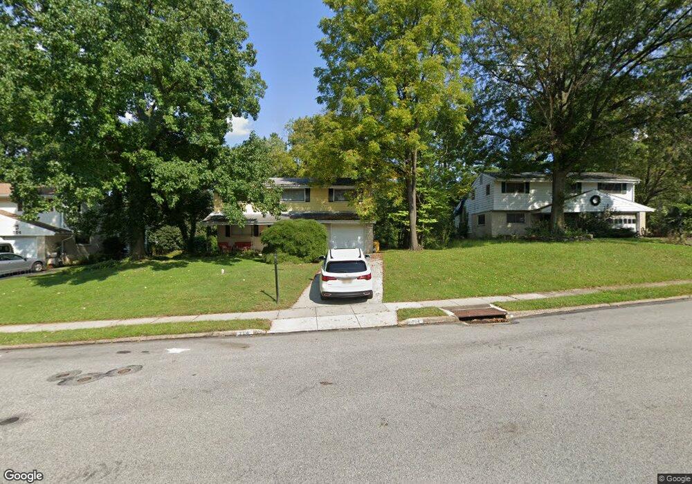
707 Preston Rd Glenside, PA 19038
Estimated Value: $599,000 - $840,000
4
Beds
3
Baths
3,274
Sq Ft
$221/Sq Ft
Est. Value
About This Home
This home is located at 707 Preston Rd, Glenside, PA 19038 and is currently estimated at $724,445, approximately $221 per square foot. 707 Preston Rd is a home located in Montgomery County with nearby schools including Erdenheim Elementary School, Enfield Elementary School, and Springfield Township Middle School.
Ownership History
Date
Name
Owned For
Owner Type
Purchase Details
Closed on
Oct 28, 2005
Sold by
Miller Daniel C and Miller Mary Elizabeth Gibbons
Bought by
Flood Marc and Collier Joyce L
Current Estimated Value
Home Financials for this Owner
Home Financials are based on the most recent Mortgage that was taken out on this home.
Original Mortgage
$240,000
Outstanding Balance
$130,615
Interest Rate
5.93%
Estimated Equity
$593,830
Purchase Details
Closed on
Jul 9, 2001
Sold by
Talaga James A and Talaga Elaine C
Bought by
Miller Daniel C and Gibbons Mary Elizabeth
Create a Home Valuation Report for This Property
The Home Valuation Report is an in-depth analysis detailing your home's value as well as a comparison with similar homes in the area
Home Values in the Area
Average Home Value in this Area
Purchase History
| Date | Buyer | Sale Price | Title Company |
|---|---|---|---|
| Flood Marc | $380,000 | -- | |
| Miller Daniel C | $230,500 | -- |
Source: Public Records
Mortgage History
| Date | Status | Borrower | Loan Amount |
|---|---|---|---|
| Open | Flood Marc | $240,000 |
Source: Public Records
Tax History Compared to Growth
Tax History
| Year | Tax Paid | Tax Assessment Tax Assessment Total Assessment is a certain percentage of the fair market value that is determined by local assessors to be the total taxable value of land and additions on the property. | Land | Improvement |
|---|---|---|---|---|
| 2025 | $8,143 | $172,870 | -- | -- |
| 2024 | $8,143 | $172,870 | -- | -- |
| 2023 | $7,859 | $172,870 | $0 | $0 |
| 2022 | $7,634 | $172,870 | $0 | $0 |
| 2021 | $7,435 | $172,870 | $0 | $0 |
| 2020 | $7,261 | $172,870 | $0 | $0 |
| 2019 | $7,149 | $172,870 | $0 | $0 |
| 2018 | $7,149 | $172,870 | $0 | $0 |
| 2017 | $6,825 | $172,870 | $0 | $0 |
| 2016 | $6,757 | $172,870 | $0 | $0 |
| 2015 | $6,423 | $172,870 | $0 | $0 |
| 2014 | $6,423 | $172,870 | $0 | $0 |
Source: Public Records
Map
Nearby Homes
- 402 Longfield Rd
- 223 Larrimore Ln
- 303 Glenway Rd
- 1104 Cromwell Rd
- 1005 Harston Ln
- 418 Glenway Rd
- 32 Jones Ave
- 21 Franklin Ave
- 8612 Trumbauer Dr
- 21 Jones Ave
- 11 Franklin Ave
- 404 Pennybrook Ct Unit 15 REDFORD INTERIOR
- 401 Pennybrook Ct Unit 1 REDFORD END
- 406 Pennybrook Ct Unit 14 REDFORD INTERIOR
- 403 Pennybrook Ct Unit 2 REDFORD INTERIOR
- 001 Pennybrook Ct Unit REDFORD INTERIOR
- 408 Pennybrook Ct Unit 13 REDFORD END
- 405 Pennybrook Ct Unit 3 REDFORD INTERIOR
- 407 Pennybrook Ct Unit 4 REDFORD END
- 8705 Patton Rd