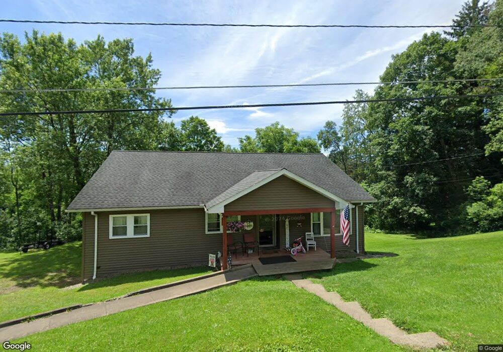
707 W North St Smethport, PA 16749
Estimated Value: $139,589 - $169,000
--
Bed
--
Bath
1,056
Sq Ft
$143/Sq Ft
Est. Value
About This Home
This home is located at 707 W North St, Smethport, PA 16749 and is currently estimated at $150,897, approximately $142 per square foot. 707 W North St is a home located in McKean County with nearby schools including Smethport Area Elementary School and Smethport Area Junior/Senior High School.
Ownership History
Date
Name
Owned For
Owner Type
Purchase Details
Closed on
Sep 18, 2020
Sold by
Rounsville Joshua B and Rounsville Tarah M
Bought by
Rounsville Joshua B and Rounsville Tarah M
Current Estimated Value
Home Financials for this Owner
Home Financials are based on the most recent Mortgage that was taken out on this home.
Original Mortgage
$89,000
Interest Rate
2.9%
Mortgage Type
Commercial
Purchase Details
Closed on
Dec 23, 2015
Sold by
Rounsville Joshua B and Rounsville Kathryn L
Bought by
Rounsville Joshua B
Home Financials for this Owner
Home Financials are based on the most recent Mortgage that was taken out on this home.
Original Mortgage
$102,000
Interest Rate
3.98%
Mortgage Type
New Conventional
Purchase Details
Closed on
Sep 11, 2006
Sold by
Rounsville Joshua B and Kolivoski Kathryn L
Bought by
Rounsville Joshua B and Rounsville Kathryn L
Create a Home Valuation Report for This Property
The Home Valuation Report is an in-depth analysis detailing your home's value as well as a comparison with similar homes in the area
Home Values in the Area
Average Home Value in this Area
Purchase History
| Date | Buyer | Sale Price | Title Company |
|---|---|---|---|
| Rounsville Joshua B | -- | None Available | |
| Rounsville Joshua B | -- | None Available | |
| Rounsville Joshua B | -- | None Available |
Source: Public Records
Mortgage History
| Date | Status | Borrower | Loan Amount |
|---|---|---|---|
| Closed | Rounsville Joshua B | $89,000 | |
| Closed | Rounsville Joshua B | $102,000 |
Source: Public Records
Tax History Compared to Growth
Tax History
| Year | Tax Paid | Tax Assessment Tax Assessment Total Assessment is a certain percentage of the fair market value that is determined by local assessors to be the total taxable value of land and additions on the property. | Land | Improvement |
|---|---|---|---|---|
| 2025 | $2,049 | $59,780 | $11,800 | $47,980 |
| 2024 | $1,975 | $59,780 | $11,800 | $47,980 |
| 2023 | $1,975 | $59,780 | $11,800 | $47,980 |
| 2022 | $1,975 | $59,780 | $11,800 | $47,980 |
| 2021 | $1,949 | $59,780 | $11,800 | $47,980 |
| 2020 | $1,949 | $59,780 | $11,800 | $47,980 |
| 2019 | $1,852 | $59,780 | $11,800 | $47,980 |
| 2018 | $18 | $59,780 | $11,800 | $47,980 |
| 2017 | -- | $59,780 | $11,800 | $47,980 |
| 2016 | $1,667 | $59,780 | $11,800 | $47,980 |
| 2015 | $588 | $59,780 | $11,800 | $47,980 |
| 2014 | $588 | $59,780 | $11,800 | $47,980 |
Source: Public Records
Map
Nearby Homes
- 712 W Main St
- 00 W Main St
- 911 W Main St
- 305 State St
- 19 W Willow St
- 108 Library Dr
- 402 E Water St
- 314 Emerald Isle
- 501 Allegheny St
- 308 Emerald Isle
- 225 Emerald Isle
- 41 Bank St
- 18398 Route 6
- 18398 U S 6
- 6113 Route 46
- 0 Rte 59 Smethport Ormsby Rd Unit 24-264
- 198 Spring Run Rd
- 3488 Pennsylvania 46
- 3488 Route 46
- 179 White Hollow Rd
- 706 W North St
- 706 W Green St
- 802 W Green St
- 704 W Green St
- 702 W Green St
- 709 W Green St
- 705 W Green St
- 612 W Green St
- 410 Washington St
- 606 W Green St
- 708 W King St
- 407 Washington St
- 704 W King St
- 802 W King St
- 706 W King St
- 808 W King St
- 602 W Green St
- 711 W King St
- 601 W Green St
- 217 N Marvin St