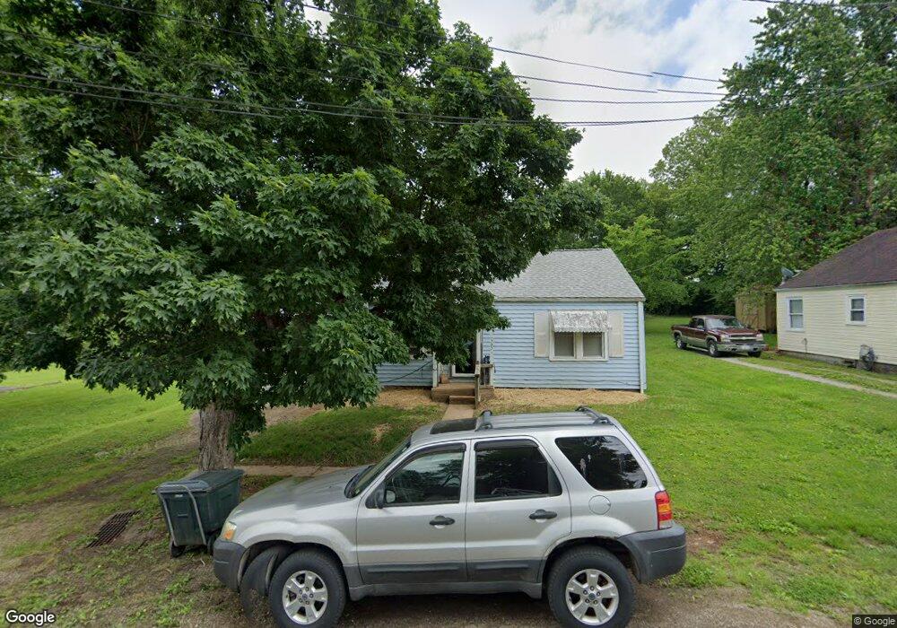
707 Walnut St Fredericktown, MO 63645
Estimated Value: $104,561 - $168,000
3
Beds
--
Bath
960
Sq Ft
$128/Sq Ft
Est. Value
About This Home
This home is located at 707 Walnut St, Fredericktown, MO 63645 and is currently estimated at $123,140, approximately $128 per square foot. 707 Walnut St is a home with nearby schools including Fredericktown Elementary School, Fredericktown Intermediate School, and Kelly A. Burlison Middle School.
Ownership History
Date
Name
Owned For
Owner Type
Purchase Details
Closed on
Nov 2, 2007
Sold by
Kennedy Rose Mignon and Klobe Carol Sue
Bought by
White Jason R and White Stephanie Z
Current Estimated Value
Home Financials for this Owner
Home Financials are based on the most recent Mortgage that was taken out on this home.
Original Mortgage
$28,000
Outstanding Balance
$17,473
Interest Rate
6.38%
Mortgage Type
Future Advance Clause Open End Mortgage
Estimated Equity
$105,667
Create a Home Valuation Report for This Property
The Home Valuation Report is an in-depth analysis detailing your home's value as well as a comparison with similar homes in the area
Home Values in the Area
Average Home Value in this Area
Purchase History
| Date | Buyer | Sale Price | Title Company |
|---|---|---|---|
| White Jason R | -- | None Available |
Source: Public Records
Mortgage History
| Date | Status | Borrower | Loan Amount |
|---|---|---|---|
| Open | White Jason R | $28,000 |
Source: Public Records
Tax History
| Year | Tax Paid | Tax Assessment Tax Assessment Total Assessment is a certain percentage of the fair market value that is determined by local assessors to be the total taxable value of land and additions on the property. | Land | Improvement |
|---|---|---|---|---|
| 2025 | $562 | $8,950 | $0 | $0 |
| 2024 | $566 | $8,950 | $0 | $0 |
| 2023 | $563 | $8,950 | $0 | $0 |
| 2022 | $525 | $8,270 | $0 | $0 |
| 2021 | $523 | $8,270 | $0 | $0 |
| 2020 | $542 | $8,100 | $0 | $0 |
| 2019 | $537 | $8,100 | $0 | $0 |
| 2018 | $540 | $8,100 | $0 | $0 |
| 2017 | $527 | $8,100 | $0 | $0 |
| 2016 | $517 | $8,100 | $0 | $0 |
| 2015 | -- | $8,100 | $0 | $0 |
| 2014 | -- | $8,100 | $0 | $0 |
| 2013 | -- | $8,100 | $0 | $0 |
| 2012 | -- | $8,100 | $0 | $0 |
Source: Public Records
Map
Nearby Homes
- 307 Benson St
- 700 S Main St
- 206 Virginia St
- 408 Park Dr
- 6 Head Dr
- 404 Marshall St
- 306 Williams St
- 0 S Mine La Motte Ave
- 211 S Main St
- 300 S Mine La Motte Ave
- 318 E Marvin Ave
- 811 Andrews St
- 410 Lindell St
- 1261 W Main St
- 504 Albert St
- 000 Cr537_tract 8
- 406 Franklin St
- 419 Franklin St
- 316 Sherlock Dr
- 115 Holmes St
- 709 Walnut St
- 703 Walnut St
- 706 Walnut St
- 711 Walnut St
- 704 Walnut St
- 307 W Marvin St
- 308 Thost St
- 706 Marshall St
- 712 Walnut St
- 309 W Marvin Ave
- 710 Marshall St
- 710A Marshall St
- 306 Thost St
- 704 Marshall St
- 714 Walnut St
- 305 W Marvin Ave
- 712 Marshall St
- 303 W Marvin Ave
- 0 45+ - Acres Unit 17094393
- 461 Route 2 B
Your Personal Tour Guide
Ask me questions while you tour the home.