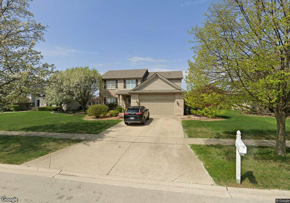
707 Westwind Dr New Lenox, IL 60451
Estimated Value: $499,278 - $618,000
4
Beds
4
Baths
--
Sq Ft
10,454
Sq Ft Lot
About This Home
This home is located at 707 Westwind Dr, New Lenox, IL 60451 and is currently estimated at $536,820. 707 Westwind Dr is a home located in Will County with nearby schools including Spencer Trail, Spencer Pointe, and Spencer Crossing Intermediate School.
Ownership History
Date
Name
Owned For
Owner Type
Purchase Details
Closed on
Aug 31, 2009
Sold by
Mundada Santoshkumar and Mundada Ekta
Bought by
Cahill Daniel J and Cahill Renee M
Current Estimated Value
Home Financials for this Owner
Home Financials are based on the most recent Mortgage that was taken out on this home.
Original Mortgage
$260,000
Outstanding Balance
$170,815
Interest Rate
5.28%
Mortgage Type
New Conventional
Estimated Equity
$366,005
Purchase Details
Closed on
Nov 13, 2003
Sold by
Chicago Title Land Trust Co
Bought by
Mundada Santoshkumar and Mundada Ekta
Home Financials for this Owner
Home Financials are based on the most recent Mortgage that was taken out on this home.
Original Mortgage
$236,400
Interest Rate
5.12%
Mortgage Type
Purchase Money Mortgage
Create a Home Valuation Report for This Property
The Home Valuation Report is an in-depth analysis detailing your home's value as well as a comparison with similar homes in the area
Home Values in the Area
Average Home Value in this Area
Purchase History
| Date | Buyer | Sale Price | Title Company |
|---|---|---|---|
| Cahill Daniel J | $325,000 | Chicago Title Insurance Co | |
| Mundada Santoshkumar | $296,000 | Chicago Title Insurance Co |
Source: Public Records
Mortgage History
| Date | Status | Borrower | Loan Amount |
|---|---|---|---|
| Open | Cahill Daniel J | $260,000 | |
| Previous Owner | Mundada Santoshkumar | $236,400 |
Source: Public Records
Tax History Compared to Growth
Tax History
| Year | Tax Paid | Tax Assessment Tax Assessment Total Assessment is a certain percentage of the fair market value that is determined by local assessors to be the total taxable value of land and additions on the property. | Land | Improvement |
|---|---|---|---|---|
| 2024 | $11,337 | $147,706 | $36,393 | $111,313 |
| 2023 | $11,337 | $134,645 | $33,175 | $101,470 |
| 2022 | $10,214 | $124,040 | $30,562 | $93,478 |
| 2021 | $9,698 | $116,656 | $28,743 | $87,913 |
| 2020 | $9,423 | $112,493 | $27,717 | $84,776 |
| 2019 | $9,020 | $109,005 | $26,858 | $82,147 |
| 2018 | $8,813 | $105,247 | $25,932 | $79,315 |
| 2017 | $8,375 | $102,221 | $25,186 | $77,035 |
| 2016 | $8,130 | $99,485 | $24,512 | $74,973 |
| 2015 | $7,873 | $96,353 | $23,740 | $72,613 |
| 2014 | $7,873 | $95,164 | $23,447 | $71,717 |
| 2013 | $7,873 | $96,447 | $23,763 | $72,684 |
Source: Public Records
Map
Nearby Homes
- 651 Schooner Dr
- 2758 Bluestone Bay Dr
- 2667 E Lincoln Hwy
- 641 Lisson Grove
- 701 Bishops Gate
- 190 Pottawatomie Ln
- 2848 Southwind Dr
- 1535 Glenbrooke Ln
- 1351 E Lincoln Hwy
- 214 Somerset Ct
- 21359 Saddle Ln
- 21170 Sage Brush Ln
- 21606 Skyway Dr
- 21244 Sage Brush Ln
- 709 Garadice Dr
- 1595 Glenbrooke Ln
- 1591 Glenbrooke Ln
- 1587 Glenbrooke Ln
- 1583 Glenbrooke Ln
- 1579 Glenbrooke Bldg 60 Ln
- 715 Westwind Dr
- 701 Westwind Dr
- 714 Teal Dr
- 721 Westwind Dr
- 702 Teal Dr
- 708 Teal Dr Unit 1
- 2625 Schooner Dr
- 2605 Schooner Dr
- 2635 Schooner Dr
- 720 Teal Dr
- 727 Westwind Dr
- 2616 Schooner Dr
- 2624 Schooner Dr
- 2641 Schooner Dr
- 2630 Schooner Dr
- 726 Teal Dr
- 735 Westwind Dr
- 715 Teal Dr
- 709 Teal Dr
- 2645 Schooner Dr