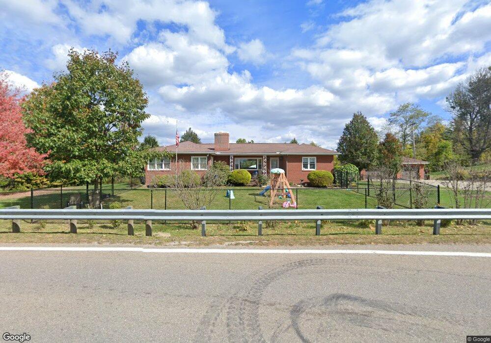
70737 Colerain Rd Bridge Port, OH 43912
Estimated Value: $209,000 - $232,196
3
Beds
2
Baths
2,271
Sq Ft
$97/Sq Ft
Est. Value
About This Home
This home is located at 70737 Colerain Rd, Bridge Port, OH 43912 and is currently estimated at $219,549, approximately $96 per square foot. 70737 Colerain Rd is a home located in Belmont County with nearby schools including Anna Marie Ayers Elementary School, Martins Ferry Middle School, and Martins Ferry High School.
Ownership History
Date
Name
Owned For
Owner Type
Purchase Details
Closed on
Oct 22, 2008
Sold by
Roberts Margaret E
Bought by
White Paul B and White Christine L
Current Estimated Value
Home Financials for this Owner
Home Financials are based on the most recent Mortgage that was taken out on this home.
Original Mortgage
$120,000
Interest Rate
5.94%
Mortgage Type
Purchase Money Mortgage
Purchase Details
Closed on
Feb 24, 2003
Sold by
Harries Ii William George
Bought by
Harries Ii William George
Purchase Details
Closed on
May 11, 1998
Sold by
Harris Dr William and Harris Wi
Bought by
Harris Dr William and Harris Wi
Purchase Details
Closed on
May 1, 1998
Sold by
Harris Dr William George
Bought by
Harris Dr William George
Purchase Details
Closed on
Apr 6, 1998
Sold by
Harris Dr William George
Bought by
Harris Dr William George
Purchase Details
Closed on
Jan 1, 1986
Sold by
Harris Emily L
Bought by
Harris Emily L
Create a Home Valuation Report for This Property
The Home Valuation Report is an in-depth analysis detailing your home's value as well as a comparison with similar homes in the area
Home Values in the Area
Average Home Value in this Area
Purchase History
| Date | Buyer | Sale Price | Title Company |
|---|---|---|---|
| White Paul B | $150,000 | Attorney | |
| Harries Ii William George | -- | -- | |
| Harris Dr William | -- | -- | |
| Harris Dr William George | -- | -- | |
| Harris Dr William George | -- | -- | |
| Harris Emily L | -- | -- |
Source: Public Records
Mortgage History
| Date | Status | Borrower | Loan Amount |
|---|---|---|---|
| Closed | White Paul B | $120,000 |
Source: Public Records
Tax History Compared to Growth
Tax History
| Year | Tax Paid | Tax Assessment Tax Assessment Total Assessment is a certain percentage of the fair market value that is determined by local assessors to be the total taxable value of land and additions on the property. | Land | Improvement |
|---|---|---|---|---|
| 2024 | $2,526 | $70,750 | $8,660 | $62,090 |
| 2023 | $2,381 | $62,490 | $8,870 | $53,620 |
| 2022 | $2,381 | $62,490 | $8,866 | $53,624 |
| 2021 | $2,370 | $62,517 | $8,869 | $53,648 |
| 2020 | $2,191 | $54,360 | $7,710 | $46,650 |
| 2019 | $2,193 | $54,360 | $7,710 | $46,650 |
| 2018 | $2,289 | $54,360 | $7,710 | $46,650 |
| 2017 | $2,347 | $55,390 | $9,080 | $46,310 |
| 2016 | $2,351 | $55,390 | $9,080 | $46,310 |
| 2015 | $2,367 | $55,390 | $9,080 | $46,310 |
| 2014 | $1,885 | $46,220 | $8,260 | $37,960 |
| 2013 | $1,820 | $46,220 | $8,260 | $37,960 |
Source: Public Records
Map
Nearby Homes
- 70540 Colerain Rd
- 70610 Chermont Rd
- 70571 Pine Hollow Rd
- 53760 Farmington Rd
- 69895 Woods Rd
- 69657 Chermont Rd
- 53979 Colerain Pike
- 71850 Colerain Rd
- 71900 Cope St
- 68960 Pine Terrace Rd
- 55379 Barnes Rd
- 54980 Maple Ave
- 55273 Poplar Ave
- 56745 Ferryview Rd
- 68511 Liston Ave
- 69282 Zelda Ave
- 69341 Old Cadiz Rd
- 55490 National Rd
- 55500 National Rd
- 55480 National Rd
- 70699 Colerain Rd
- 70691 Colerain Rd
- 70687 Colerain Rd
- 70830 Colerain Rd
- 70837 Colerain Rd
- 70851 Colerain Rd
- 70859 Colerain Rd
- 70867 Colerain Rd
- 70641 Colerain Pike
- 70641 Colerain Rd
- 70877 Colerain Rd
- 54919 Lawvers Dr
- 70887 Colerain Rd
- 54897 Lawvers Dr
- 70893 Colerain Rd
- 55041 Lawvers Dr
- 54997 Lawvers Dr
- 54999 Lawvers Dr
- 54961 Lawvers Dr
- 70895 Colerain Rd