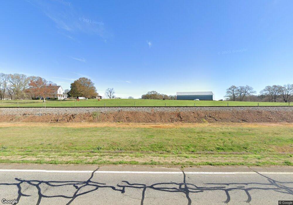
7075 Highway 52 Gillsville, GA 30543
Estimated Value: $362,000 - $1,058,433
4
Beds
2
Baths
1,824
Sq Ft
$473/Sq Ft
Est. Value
About This Home
This home is located at 7075 Highway 52, Gillsville, GA 30543 and is currently estimated at $863,108, approximately $473 per square foot. 7075 Highway 52 is a home located in Banks County with nearby schools including Banks County Primary School, Banks County Elementary School, and Banks County Middle School.
Ownership History
Date
Name
Owned For
Owner Type
Purchase Details
Closed on
Feb 21, 2023
Sold by
Country Charm Eggs Llc
Bought by
Midwest Poultry Services Lp
Current Estimated Value
Purchase Details
Closed on
Feb 10, 2022
Sold by
Cape Kevin Seth
Bought by
Ryals Joshua
Purchase Details
Closed on
Mar 23, 2012
Sold by
Henderson I William Samuel
Bought by
Country Charm Eggs Llc
Purchase Details
Closed on
Dec 31, 2008
Sold by
Henderson William Samuel
Bought by
Henderson William Samuel and Haulbrook Suzanne H
Create a Home Valuation Report for This Property
The Home Valuation Report is an in-depth analysis detailing your home's value as well as a comparison with similar homes in the area
Home Values in the Area
Average Home Value in this Area
Purchase History
| Date | Buyer | Sale Price | Title Company |
|---|---|---|---|
| Midwest Poultry Services Lp | $27,078,304 | -- | |
| Midwest Poultry Services Lp | -- | -- | |
| Ryals Joshua | $875,000 | -- | |
| Country Charm Eggs Llc | $550,000 | -- | |
| Henderson William Samuel | -- | -- |
Source: Public Records
Tax History Compared to Growth
Tax History
| Year | Tax Paid | Tax Assessment Tax Assessment Total Assessment is a certain percentage of the fair market value that is determined by local assessors to be the total taxable value of land and additions on the property. | Land | Improvement |
|---|---|---|---|---|
| 2025 | $9,197 | $466,774 | $342,097 | $124,677 |
| 2024 | $8,838 | $434,233 | $315,067 | $119,166 |
| 2023 | $8,390 | $399,290 | $307,356 | $91,934 |
| 2022 | $2,215 | $281,661 | $220,814 | $60,847 |
| 2021 | $2,221 | $240,143 | $184,039 | $56,104 |
| 2020 | $2,071 | $154,201 | $105,986 | $48,215 |
| 2019 | $2,055 | $154,201 | $105,986 | $48,215 |
| 2018 | $1,975 | $150,992 | $106,470 | $44,522 |
| 2017 | $1,998 | $135,689 | $92,583 | $43,106 |
| 2016 | $2,028 | $135,689 | $92,583 | $43,106 |
| 2015 | $1,854 | $135,689 | $92,583 | $43,106 |
| 2014 | $1,854 | $249,933 | $206,827 | $43,106 |
| 2013 | -- | $249,933 | $206,827 | $43,106 |
Source: Public Records
Map
Nearby Homes
- 5336 Channel Dr
- 3200 Unity Church Rd
- 0 Unity Church Rd Unit 7657175
- 0 Unity Church Rd Unit CL340705
- 0 Unity Church Rd Unit 10614442
- 2215 Georgia 323
- 6210 Highway 52
- 2588 Highway 323
- 11 Owens Rd
- 0 H D R Dr Unit 10637398
- 0 H D R Dr Unit 7676406
- 0 H D R Dr Unit 10637403
- 491 Queen Rd
- 1478 Bob Mann Rd
- 1546 Bob Mann Rd
- 195 Sims Farm Way
- 4996 Gillsville Hwy
- Plan 2604 at Eagle Heights
- Plan 2505 at Eagle Heights
- Plan 2906 at Eagle Heights
- 113 Mcclure Rd
- 137 Mcclure Rd
- 126 Mcclure Rd
- 155 Mcclure Rd
- 203 Mcclure Rd
- 207 Mcclure Rd
- 211 Mcclure Rd
- 319 Mcclure Rd
- 199* Mcclure Rd
- 199 Mcclure Rd
- 0 Mcclure Rd Unit 8692153
- 0 Mcclure Rd
- 343 Mcclure Rd
- 369 Mcclure Rd
- 377 Mcclure Rd
- 372 Mcclure Rd
- 391 Mcclure Rd
- 342 Mcclure Rd
- 477 Herbert Segars Rd
- 278 Mcclure Rd