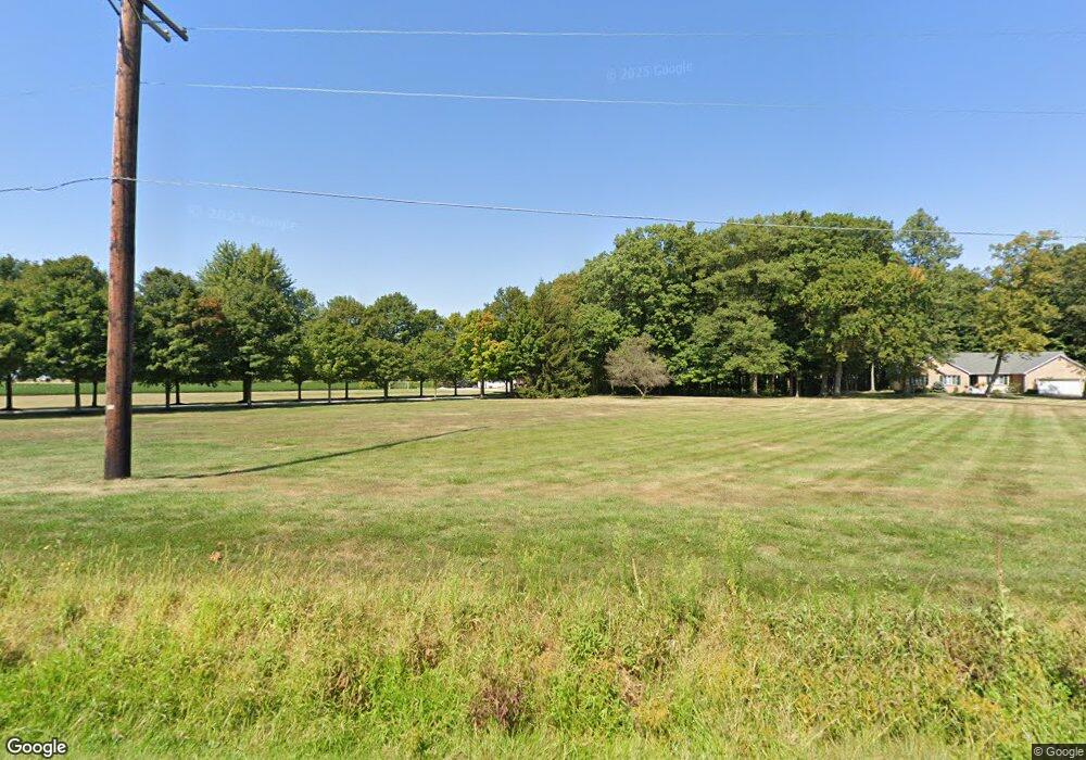
7076 State Route 105 Pemberville, OH 43450
Estimated Value: $378,000 - $412,000
4
Beds
3
Baths
2,424
Sq Ft
$164/Sq Ft
Est. Value
About This Home
This home is located at 7076 State Route 105, Pemberville, OH 43450 and is currently estimated at $396,444, approximately $163 per square foot. 7076 State Route 105 is a home located in Wood County with nearby schools including Pemberville Elementary School, Eastwood Middle School, and Eastwood High School.
Ownership History
Date
Name
Owned For
Owner Type
Purchase Details
Closed on
Sep 1, 2011
Sold by
Paradowski Sandra A
Bought by
Greulich Chase and Greulich Melissa
Current Estimated Value
Home Financials for this Owner
Home Financials are based on the most recent Mortgage that was taken out on this home.
Original Mortgage
$220,172
Outstanding Balance
$151,562
Interest Rate
4.37%
Mortgage Type
FHA
Estimated Equity
$244,882
Purchase Details
Closed on
Jun 22, 1989
Bought by
Paradowski Bernard F
Create a Home Valuation Report for This Property
The Home Valuation Report is an in-depth analysis detailing your home's value as well as a comparison with similar homes in the area
Home Values in the Area
Average Home Value in this Area
Purchase History
| Date | Buyer | Sale Price | Title Company |
|---|---|---|---|
| Greulich Chase | $225,900 | Attorney | |
| Paradowski Bernard F | $18,000 | -- |
Source: Public Records
Mortgage History
| Date | Status | Borrower | Loan Amount |
|---|---|---|---|
| Open | Greulich Chase | $220,172 |
Source: Public Records
Tax History Compared to Growth
Tax History
| Year | Tax Paid | Tax Assessment Tax Assessment Total Assessment is a certain percentage of the fair market value that is determined by local assessors to be the total taxable value of land and additions on the property. | Land | Improvement |
|---|---|---|---|---|
| 2024 | $3,875 | $108,395 | $21,595 | $86,800 |
| 2023 | $3,875 | $108,400 | $21,600 | $86,800 |
| 2021 | $3,632 | $92,400 | $18,060 | $74,340 |
| 2020 | $3,697 | $92,400 | $18,060 | $74,340 |
| 2019 | $3,150 | $76,690 | $16,240 | $60,450 |
| 2018 | $3,145 | $76,690 | $16,240 | $60,450 |
| 2017 | $2,963 | $76,690 | $16,240 | $60,450 |
| 2016 | $2,875 | $77,420 | $17,080 | $60,340 |
| 2015 | $2,875 | $77,420 | $17,080 | $60,340 |
| 2014 | $3,273 | $77,420 | $17,080 | $60,340 |
| 2013 | $3,189 | $70,390 | $15,540 | $54,850 |
Source: Public Records
Map
Nearby Homes
- 6587 Scotch Ridge Rd
- 15560 McCutchenville Rd
- 420 Linden Dr
- 424 Linden Dr
- 423 Linden Dr
- 449 Linden Dr
- 425 Linden Dr
- 457 Linden Dr
- 426 Linden Dr
- 421 Linden Dr
- 451 Linden Dr
- 447 Linden Dr
- 459 Linden Dr
- 427 Linden Dr
- 458 Linden (Lot 39) Dr
- 455 Linden (Lot 42) Dr
- 123 Catalpa (Lot 21) Ct
- 428 Linden Drive (Lot 9)
- 214 Main St
- 219 Bond St
- 7076 Scotch Ridge Rd
- 7014 State Route 105
- 6991 State Route 105
- 7011 State Route 105
- 6973 State Route 105
- 6973 Scotch Ridge Rd
- 7065 State Route 105
- 6997 State Route 105
- 6841 State Route 105
- 6881 Alexander Rd
- 6812 State Route 105
- 6812 Scotch Ridge Rd
- 0 Scotch Ridge Rd
- 6844 State Route 105
- 7368 State Route 105
- 7040 Alexander Rd
- 6838 State Route 105
- 6614 Alexander Rd
- 6780 State Route 105
- 6780 Scotch Ridge Rd
