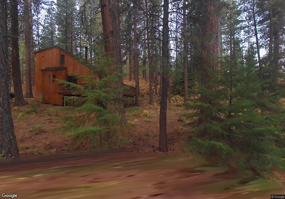
70785 Bitter Root Unit SM2 Black Butte Ranch, OR 97759
Estimated Value: $681,000 - $881,000
3
Beds
2
Baths
948
Sq Ft
$782/Sq Ft
Est. Value
About This Home
This home is located at 70785 Bitter Root Unit SM2, Black Butte Ranch, OR 97759 and is currently estimated at $741,599, approximately $782 per square foot. 70785 Bitter Root Unit SM2 is a home located in Deschutes County with nearby schools including Sisters Elementary School, Sisters Middle School, and Sisters High School.
Ownership History
Date
Name
Owned For
Owner Type
Purchase Details
Closed on
Aug 1, 2018
Sold by
Doolittle George L and Doolittle Elizabeth H
Bought by
Bernard Anita Jeanne Bonno and Bonno Bernard Trust
Current Estimated Value
Home Financials for this Owner
Home Financials are based on the most recent Mortgage that was taken out on this home.
Original Mortgage
$195,000
Outstanding Balance
$168,642
Interest Rate
4.5%
Mortgage Type
New Conventional
Estimated Equity
$572,957
Create a Home Valuation Report for This Property
The Home Valuation Report is an in-depth analysis detailing your home's value as well as a comparison with similar homes in the area
Home Values in the Area
Average Home Value in this Area
Purchase History
| Date | Buyer | Sale Price | Title Company |
|---|---|---|---|
| Bernard Anita Jeanne Bonno | $335,000 | Western Title & Escrow |
Source: Public Records
Mortgage History
| Date | Status | Borrower | Loan Amount |
|---|---|---|---|
| Open | Bernard Anita Jeanne Bonno | $195,000 |
Source: Public Records
Tax History Compared to Growth
Tax History
| Year | Tax Paid | Tax Assessment Tax Assessment Total Assessment is a certain percentage of the fair market value that is determined by local assessors to be the total taxable value of land and additions on the property. | Land | Improvement |
|---|---|---|---|---|
| 2025 | $6,657 | $412,020 | -- | -- |
| 2024 | $6,300 | $400,020 | -- | -- |
| 2023 | $6,044 | $388,370 | $0 | $0 |
| 2022 | $5,613 | $366,080 | $0 | $0 |
| 2021 | $5,673 | $355,420 | $0 | $0 |
| 2020 | $5,366 | $355,420 | $0 | $0 |
| 2019 | $5,219 | $345,070 | $0 | $0 |
| 2018 | $5,030 | $335,020 | $0 | $0 |
| 2017 | $4,844 | $325,270 | $0 | $0 |
| 2016 | $4,760 | $315,800 | $0 | $0 |
| 2015 | $4,516 | $306,610 | $0 | $0 |
| 2014 | $4,340 | $297,680 | $0 | $0 |
Source: Public Records
Map
Nearby Homes
- 70780 Bitter Root
- 13579 Sundew Unit SM34
- 13584 Nine Bark
- 13582 Hollyhock Unit BBH13
- 70661 Steeple Bush Unit SM202
- 70701 Pasque Flower Unit SM94
- 13251 Snowbrush Unit GH 266
- 70948 Mules Ear
- 70786 Blazing Star Unit RR 64
- 13400 Foxtail Unit GCC 101
- 13400 Foxtail Unit GCC83
- 13400 Foxtail Unit 99
- 13168 Hawks Beard Unit GH 133
- 70410 Mcallister Rd Unit 2060
- 71059 Bracken Ln Unit GH 91A
- 70474 Alum Root
- 70440 Linnaea Borealis Unit GM395
- 70332 Sword Fern Unit GM 245
- 70305 Arvensis Unit GM 348
- 13699 Speedwell Unit GM90
- 70785 Bitter Root
- 70781 Bitter Root
- 70781 Bitter Root Unit SM-1
- 70781 Bitter Root
- 70795 Bitter Root
- 70790 Bitter Root Unit SM6
- 70782 Bitter Root Sm#7
- 70782 Bitter Root
- 70782 Bitter Root Sm 7
- 70796 Bitter Root
- 70780 Bitter Root Unit SM8
- 70789 Goldenrod
- 70794 Bitter Root
- 70770 Bitter Root
- 70766 Bitter Root
- 70787 Goldenrod
- 70787 Goldenrod Unit SM15
- 70787 Golden Rod Sm 15
- 70791 Goldenrod