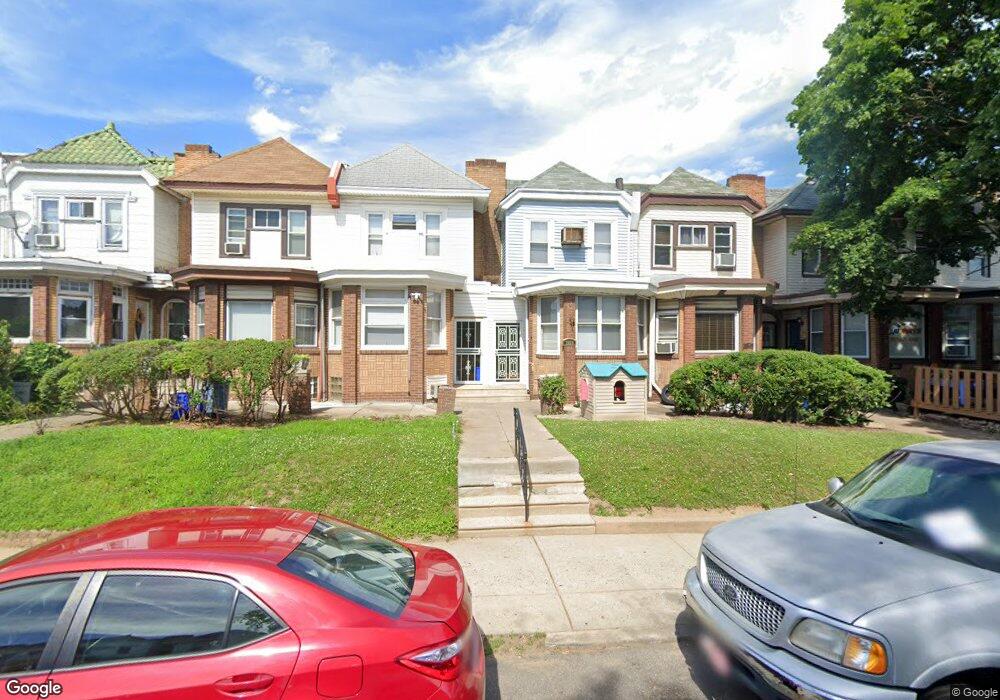
7079 Forrest Ave Philadelphia, PA 19138
West Oak Lane NeighborhoodEstimated Value: $201,000 - $303,000
3
Beds
1
Bath
1,394
Sq Ft
$172/Sq Ft
Est. Value
About This Home
This home is located at 7079 Forrest Ave, Philadelphia, PA 19138 and is currently estimated at $239,695, approximately $171 per square foot. 7079 Forrest Ave is a home located in Philadelphia County with nearby schools including William Rowen School, Gen. Louis Wagner Middle School, and Martin Luther King High School.
Ownership History
Date
Name
Owned For
Owner Type
Purchase Details
Closed on
Jun 3, 2025
Sold by
Walker Deborah Rennie
Bought by
Crews Marcia A and Crews Barry N
Current Estimated Value
Purchase Details
Closed on
May 17, 2010
Sold by
Walker Deborah Rennie and Estate Of Vincent E Walker
Bought by
Walker Deborah Rennie
Purchase Details
Closed on
Sep 16, 2003
Sold by
Walker Mamie and Estate Of Isaac Mcintyre
Bought by
Walker Vincent E
Home Financials for this Owner
Home Financials are based on the most recent Mortgage that was taken out on this home.
Original Mortgage
$44,000
Interest Rate
6.35%
Mortgage Type
Purchase Money Mortgage
Purchase Details
Closed on
Jun 9, 1995
Sold by
Mcintyre Minnie
Bought by
Mcintyre Isaac
Create a Home Valuation Report for This Property
The Home Valuation Report is an in-depth analysis detailing your home's value as well as a comparison with similar homes in the area
Home Values in the Area
Average Home Value in this Area
Purchase History
| Date | Buyer | Sale Price | Title Company |
|---|---|---|---|
| Crews Marcia A | -- | None Listed On Document | |
| Walker Deborah Rennie | -- | None Available | |
| Walker Vincent E | $55,000 | -- | |
| Mcintyre Isaac | -- | -- |
Source: Public Records
Mortgage History
| Date | Status | Borrower | Loan Amount |
|---|---|---|---|
| Previous Owner | Walker Vincent E | $44,000 |
Source: Public Records
Tax History Compared to Growth
Tax History
| Year | Tax Paid | Tax Assessment Tax Assessment Total Assessment is a certain percentage of the fair market value that is determined by local assessors to be the total taxable value of land and additions on the property. | Land | Improvement |
|---|---|---|---|---|
| 2026 | $2,416 | $209,100 | $41,820 | $167,280 |
| 2025 | $2,416 | $209,100 | $41,820 | $167,280 |
| 2024 | $2,416 | $209,100 | $41,820 | $167,280 |
| 2023 | $2,416 | $172,600 | $34,520 | $138,080 |
| 2022 | $1,828 | $172,600 | $34,520 | $138,080 |
| 2021 | $1,828 | $0 | $0 | $0 |
| 2020 | $1,828 | $0 | $0 | $0 |
| 2019 | $1,908 | $0 | $0 | $0 |
| 2018 | $1,660 | $0 | $0 | $0 |
| 2017 | $1,660 | $0 | $0 | $0 |
| 2016 | $1,660 | $0 | $0 | $0 |
| 2015 | -- | $0 | $0 | $0 |
| 2014 | -- | $118,600 | $10,390 | $108,210 |
| 2012 | -- | $14,592 | $2,762 | $11,830 |
Source: Public Records
Map
Nearby Homes
- 7092 Forrest Ave
- 7206 Forrest Ave
- 7159 N 20th St
- 7188 N Uber St
- 7016 Andrews Ave
- 7001 Limekiln Pike
- 7245 Ogontz Ave
- 7349 E Walnut Ln
- 1839 E Pastorius St
- 6944 Cedar Park Ave
- 7313 Limekiln Pike
- 6908 Ogontz Ave
- 6905 Forrest Ave
- 1996 73rd Ave
- 1821 E Tulpehocken St
- 1822 Nolan St
- 7321 Sommers Rd
- 1979 73rd Ave
- 1975 73rd Ave
- 1911 72nd Ave
- 7077 Forrest Ave
- 7081 Forrest Ave
- 7075 Forrest Ave
- 7083 Forrest Ave
- 7073 Forrest Ave
- 7085 Forrest Ave
- 7071 Forrest Ave
- 7069 Forrest Ave
- 7089 Forrest Ave
- 7067 Forrest Ave
- 7091 Forrest Ave
- 7065 Forrest Ave
- 7093 Forrest Ave
- 7063 Forrest Ave
- 7130 Ogontz Ave
- 7132 Ogontz Ave
- 7134 Ogontz Ave
- 7126 Ogontz Ave
- 7136 Ogontz Ave
- 7124 Ogontz Ave