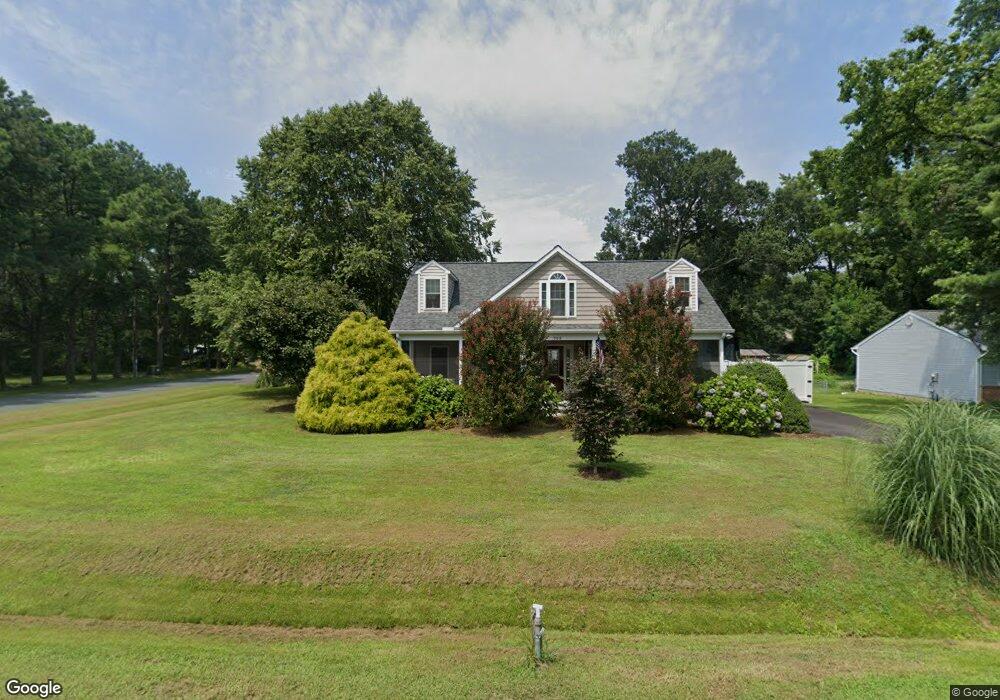
708 Chesapeake Dr Stevensville, MD 21666
Estimated Value: $469,774 - $581,000
--
Bed
2
Baths
1,770
Sq Ft
$310/Sq Ft
Est. Value
About This Home
This home is located at 708 Chesapeake Dr, Stevensville, MD 21666 and is currently estimated at $548,694, approximately $309 per square foot. 708 Chesapeake Dr is a home located in Queen Anne's County with nearby schools including Matapeake Elementary School, Matapeake Middle School, and Kent Island High School.
Ownership History
Date
Name
Owned For
Owner Type
Purchase Details
Closed on
Sep 10, 2020
Sold by
Mccreary Robert A
Bought by
England John and England Eileen
Current Estimated Value
Home Financials for this Owner
Home Financials are based on the most recent Mortgage that was taken out on this home.
Original Mortgage
$332,000
Outstanding Balance
$294,628
Interest Rate
2.9%
Mortgage Type
New Conventional
Estimated Equity
$254,066
Purchase Details
Closed on
Jun 27, 1996
Sold by
Kotras Edward C and Kotras Mary T
Bought by
Mccreary Robert A
Create a Home Valuation Report for This Property
The Home Valuation Report is an in-depth analysis detailing your home's value as well as a comparison with similar homes in the area
Home Values in the Area
Average Home Value in this Area
Purchase History
| Date | Buyer | Sale Price | Title Company |
|---|---|---|---|
| England John | $415,000 | The Atlantic Title Group | |
| Mccreary Robert A | $75,000 | -- |
Source: Public Records
Mortgage History
| Date | Status | Borrower | Loan Amount |
|---|---|---|---|
| Open | England John | $332,000 | |
| Closed | Mccreary Robert A | -- |
Source: Public Records
Tax History Compared to Growth
Tax History
| Year | Tax Paid | Tax Assessment Tax Assessment Total Assessment is a certain percentage of the fair market value that is determined by local assessors to be the total taxable value of land and additions on the property. | Land | Improvement |
|---|---|---|---|---|
| 2025 | $3,688 | $427,533 | $0 | $0 |
| 2024 | $3,491 | $389,267 | $0 | $0 |
| 2023 | $3,306 | $351,000 | $161,600 | $189,400 |
| 2022 | $3,273 | $347,400 | $0 | $0 |
| 2021 | $3,297 | $343,800 | $0 | $0 |
| 2020 | $2,693 | $340,200 | $161,600 | $178,600 |
| 2019 | $3,204 | $334,100 | $0 | $0 |
| 2018 | $3,146 | $328,000 | $0 | $0 |
| 2017 | $2,258 | $321,900 | $0 | $0 |
| 2016 | -- | $317,867 | $0 | $0 |
| 2015 | $883 | $313,833 | $0 | $0 |
| 2014 | $883 | $309,800 | $0 | $0 |
Source: Public Records
Map
Nearby Homes
- 410 Stafford Rd
- 412 Bay City Rd
- 914 Chesapeake Dr
- 312 William Way
- 418 Bay City Rd
- 1000 Chesapeake Dr
- 526 Victoria Dr
- 802 Broadcreek Dr
- 103 Irene Way
- 306 Irene Way
- 440 Moorings Cir Unit 85
- 312 Topside Dr Unit 223
- 298 Moorings Cir
- 349 Topside Dr
- 736 Moorings Cir Unit 35
- 858 Moorings Cir Unit 11
- 109 Woodmoor Rd
- 119 Keenan Way
- 111 Keenan Way
- 0 Sunset Wharf Lot D-3 Unit MDQA2010280
- 706 Chesapeake Dr
- 0 Chesapeake Dr
- 302 Stafford Rd
- 800 Chesapeake Dr
- 704 Chesapeake Dr
- 702 Chesapeake Dr
- 709 Chesapeake Dr
- 801 Salisbury Way
- 306 Stafford Rd
- 802 Chesapeake Dr
- 707 Chesapeake Dr
- 303 Bay City Rd
- 801 Chesapeake Dr
- 705 Chesapeake Dr
- 305 Bay City Rd
- 700 Chesapeake Dr
- 803 Salisbury Way
- 804 Chesapeake Dr
- 803 Chesapeake Dr
- 308 Stafford Rd