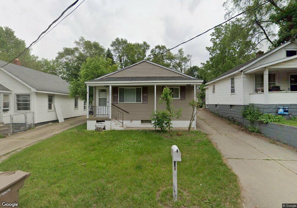
708 Cortwright St Pontiac, MI 48340
Estimated Value: $102,000 - $116,000
2
Beds
1
Bath
781
Sq Ft
$140/Sq Ft
Est. Value
About This Home
This home is located at 708 Cortwright St, Pontiac, MI 48340 and is currently estimated at $109,074, approximately $139 per square foot. 708 Cortwright St is a home located in Oakland County with nearby schools including Walt Whitman Elementary School, Pontiac Middle School, and Pontiac High School.
Ownership History
Date
Name
Owned For
Owner Type
Purchase Details
Closed on
Aug 2, 2018
Sold by
Thompson Kenneth E
Bought by
Thompson Kenneth E
Current Estimated Value
Purchase Details
Closed on
Aug 30, 2010
Sold by
Rathbun Wendy S
Bought by
Thompson Kenneth E
Purchase Details
Closed on
Oct 26, 1994
Sold by
Kinner Raymond
Bought by
Rathbun Wendy S
Home Financials for this Owner
Home Financials are based on the most recent Mortgage that was taken out on this home.
Original Mortgage
$35,050
Interest Rate
8.86%
Create a Home Valuation Report for This Property
The Home Valuation Report is an in-depth analysis detailing your home's value as well as a comparison with similar homes in the area
Home Values in the Area
Average Home Value in this Area
Purchase History
| Date | Buyer | Sale Price | Title Company |
|---|---|---|---|
| Thompson Kenneth E | -- | None Available | |
| Thompson Kenneth E | $9,000 | Devon Title Agency | |
| Rathbun Wendy S | $34,000 | -- |
Source: Public Records
Mortgage History
| Date | Status | Borrower | Loan Amount |
|---|---|---|---|
| Previous Owner | Rathbun Wendy S | $35,050 |
Source: Public Records
Tax History
| Year | Tax Paid | Tax Assessment Tax Assessment Total Assessment is a certain percentage of the fair market value that is determined by local assessors to be the total taxable value of land and additions on the property. | Land | Improvement |
|---|---|---|---|---|
| 2025 | $565 | $35,780 | $0 | $0 |
| 2024 | $471 | $32,990 | $0 | $0 |
| 2023 | $449 | $29,050 | $0 | $0 |
| 2022 | $499 | $25,670 | $0 | $0 |
| 2021 | $485 | $21,980 | $0 | $0 |
| 2020 | $408 | $19,460 | $0 | $0 |
| 2019 | $461 | $16,730 | $0 | $0 |
| 2018 | $627 | $14,110 | $0 | $0 |
| 2017 | $605 | $13,280 | $0 | $0 |
| 2016 | $632 | $11,520 | $0 | $0 |
| 2015 | -- | $11,090 | $0 | $0 |
| 2014 | -- | $10,660 | $0 | $0 |
| 2011 | -- | $13,570 | $0 | $0 |
Source: Public Records
Map
Nearby Homes
- 782 Stanley Ave
- 753 Stanley Ave
- 686 Lounsbury Ave
- 145 Parkdale Ave
- 173 High St
- 152 W Mansfield Ave
- 45 N Merrimac St
- 146 W Beverly Ave
- 141 W Cornell Ave
- 95 W Beverly Ave
- 0000 Meadowlawn Dr
- 54 Hudson Ave
- 202 W Rundell St
- 103 W Cornell Ave
- 180 W Rutgers Ave
- 252 W Strathmore Ave
- 195 W Strathmore Ave
- 744 Saint Clair St
- 77 W Rutgers Ave
- 25 W Cornell Ave
- 704 Cortwright St
- 712 Cortwright St
- 716 Cortwright St
- 719 Hollister St
- 822 Blaine Ave
- 720 Cortwright St
- 841 Miles St
- 713 Hollister St
- 725 Hollister St
- 818 Blaine Ave
- 724 Cortwright St
- 840 Blaine Ave
- 814 Blaine Ave
- 845 Miles St
- 721 Cortwright St
- 844 Blaine Ave
- 731 Hollister St
- 725 Cortwright St
- 849 Miles St
- 732 Cortwright St
Your Personal Tour Guide
Ask me questions while you tour the home.