Estimated Value: $281,000 - $467,000
Studio
1
Bath
--
Sq Ft
3,920
Sq Ft Lot
About This Home
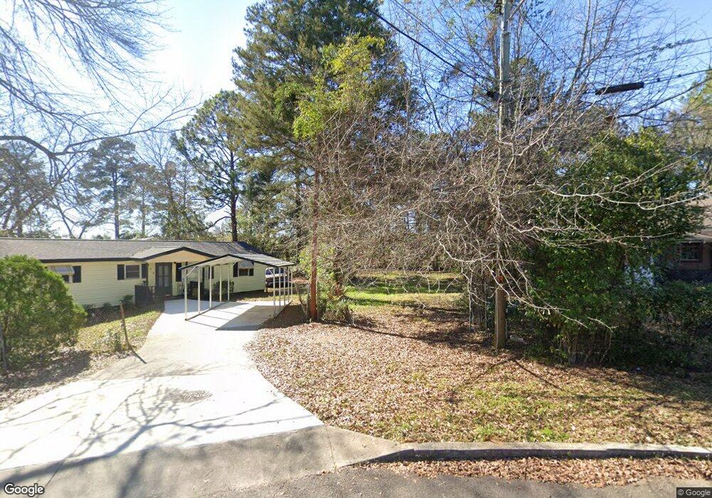
This home is located at 708 Patterson Dr, Perry, GA 31069 and is currently estimated at $374,000. 708 Patterson Dr is a home located in Houston County with nearby schools including Morningside Elementary School, Perry Middle School, and Perry High School.
Ownership History
Date
Name
Owned For
Owner Type
Purchase Details
Closed on
Jun 22, 2018
Sold by
Rhodes Yuonne
Bought by
Glouer Larry
Current Estimated Value
Purchase Details
Closed on
Nov 5, 2004
Sold by
Houser Bernice
Bought by
Glover Larry and Thompson Yvonne
Purchase Details
Closed on
Feb 1, 1995
Sold by
Taylor Susie Mae Estate
Bought by
Houser Bernice
Purchase Details
Closed on
Nov 1, 1985
Sold by
Porter Willie
Bought by
Taylor Susie Mae
Purchase Details
Closed on
Dec 23, 1970
Sold by
Taylor Susie Mae
Bought by
Taylor Susie Mae and Porter Willie
Purchase Details
Closed on
Dec 6, 1955
Bought by
Taylor Susie Mae
Create a Home Valuation Report for This Property
The Home Valuation Report is an in-depth analysis detailing your home's value as well as a comparison with similar homes in the area
Home Values in the Area
Average Home Value in this Area
Purchase History
| Date | Buyer | Sale Price | Title Company |
|---|---|---|---|
| Glouer Larry | -- | None Available | |
| Glouer Larry | -- | None Available | |
| Glover Larry | -- | -- | |
| Houser Bernice | -- | -- | |
| Taylor Susie Mae | -- | -- | |
| Taylor Susie Mae | -- | -- | |
| Taylor Susie Mae | -- | -- |
Source: Public Records
Tax History
| Year | Tax Paid | Tax Assessment Tax Assessment Total Assessment is a certain percentage of the fair market value that is determined by local assessors to be the total taxable value of land and additions on the property. | Land | Improvement |
|---|---|---|---|---|
| 2025 | $99 | $3,000 | $3,000 | $0 |
| 2024 | $38 | $1,040 | $1,040 | $0 |
| 2023 | $38 | $1,040 | $1,040 | $0 |
| 2022 | $24 | $1,040 | $1,040 | $0 |
| 2021 | $24 | $1,040 | $1,040 | $0 |
| 2020 | $24 | $1,040 | $1,040 | $0 |
| 2019 | $24 | $1,040 | $1,040 | $0 |
| 2018 | $24 | $1,040 | $1,040 | $0 |
| 2017 | $24 | $1,040 | $1,040 | $0 |
| 2016 | $24 | $1,040 | $1,040 | $0 |
| 2015 | $24 | $1,040 | $1,040 | $0 |
| 2014 | -- | $1,040 | $1,040 | $0 |
| 2013 | -- | $1,040 | $1,040 | $0 |
Source: Public Records
Map
Nearby Homes
- 0 Perimeter Rd Unit 236479
- 0 Perimeter Rd Unit 20145467
- 0 Perimeter Rd Unit 236478
- 0 Perimeter Roads Unit 20145464
- 1335 Ball St
- 111 Hampton Ct
- 311 Valley Dr
- 1343 Wf Ragin Dr
- 204 Spring Creek Dr
- 124 Kenmore Cir
- 124 Kenmore Cir Unit 13
- 128 Kenmore Cir Unit 15
- 117 Kenmore Cir Unit 140
- 123 Kenmore Cir
- 115 Kenmore Cir
- 121 Kenmore Cir
- 126 Kenmore Cir
- 115 Kenmore Cir Unit 139
- 113 Kenmore Cir
- 128 Kenmore Cir
- 710 Patterson Dr
- 706 Patterson Dr
- 714 Patterson Dr
- 711 Joe Louis Dr
- 702 Patterson Dr
- 716 Patterson Dr
- 705 Joe Louis Dr
- 701 Patterson Dr
- 700 Patterson Dr
- 718 Patterson Dr
- 711 Patterson Dr
- 711 Walcott St
- 709 Walcott St
- 715 Walcott St
- 707 Walcott St
- 705 Walcott St
- 107 Perimeter Rd
- 720 Patterson Dr
- 706 Joe Louis Dr
- 708 Walcott St
Your Personal Tour Guide
Ask me questions while you tour the home.