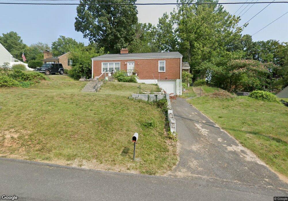
708 Reid St Staunton, VA 24401
Estimated Value: $268,558 - $335,000
3
Beds
2
Baths
1,440
Sq Ft
$209/Sq Ft
Est. Value
About This Home
This home is located at 708 Reid St, Staunton, VA 24401 and is currently estimated at $300,390, approximately $208 per square foot. 708 Reid St is a home located in Staunton City with nearby schools including Ware Elementary School, Shelburne Middle School, and Staunton High School.
Ownership History
Date
Name
Owned For
Owner Type
Purchase Details
Closed on
Jan 30, 2007
Sold by
Powell Stephen J and Powell Katherine P
Bought by
Powell Stephen J
Current Estimated Value
Purchase Details
Closed on
May 9, 2005
Sold by
Lacey Michael J and Lacey Kathy A
Bought by
Powell Stephen J and Powell Katherine P
Home Financials for this Owner
Home Financials are based on the most recent Mortgage that was taken out on this home.
Original Mortgage
$132,905
Interest Rate
7.1%
Mortgage Type
Adjustable Rate Mortgage/ARM
Create a Home Valuation Report for This Property
The Home Valuation Report is an in-depth analysis detailing your home's value as well as a comparison with similar homes in the area
Home Values in the Area
Average Home Value in this Area
Purchase History
| Date | Buyer | Sale Price | Title Company |
|---|---|---|---|
| Powell Stephen J | -- | None Available | |
| Powell Stephen J | -- | None Available |
Source: Public Records
Mortgage History
| Date | Status | Borrower | Loan Amount |
|---|---|---|---|
| Previous Owner | Powell Stephen J | $132,905 |
Source: Public Records
Tax History Compared to Growth
Tax History
| Year | Tax Paid | Tax Assessment Tax Assessment Total Assessment is a certain percentage of the fair market value that is determined by local assessors to be the total taxable value of land and additions on the property. | Land | Improvement |
|---|---|---|---|---|
| 2025 | $2,015 | $221,380 | $67,080 | $154,300 |
| 2024 | $1,755 | $197,180 | $58,480 | $138,700 |
| 2023 | $1,755 | $197,180 | $58,480 | $138,700 |
| 2022 | $1,434 | $155,820 | $43,220 | $112,600 |
| 2021 | $1,434 | $155,820 | $43,220 | $112,600 |
| 2020 | $1,329 | $139,920 | $43,220 | $96,700 |
| 2019 | $1,329 | $139,920 | $43,220 | $96,700 |
| 2018 | $1,249 | $128,720 | $43,220 | $85,500 |
| 2017 | $1,249 | $128,720 | $43,220 | $85,500 |
| 2016 | $1,258 | $132,420 | $43,220 | $89,200 |
| 2015 | $1,258 | $132,420 | $43,220 | $89,200 |
| 2014 | $1,275 | $134,220 | $43,220 | $91,000 |
Source: Public Records
Map
Nearby Homes
- Lot 2B 4.8 acre Hillcrest Dr
- 1 ACRE Hillcrest Dr
- 812 Hillcrest Dr
- 418 Cardinal St
- 1775 Shutterlee Mill Rd
- 1185 Pinehurst Rd
- 2508 S Sharlaine Dr
- 1315 Churchville Ave
- 2408 Cedar St
- 204 Burnley Dr
- 207 Burnley Dr
- 208 Burnley Dr
- 628 & 630 D St
- 1233 Pinehurst Rd
- 304 Burnley Dr
- 118 Boddington Rd
- 404 F St
- 72 Hudson Ave
- 608 B St
- 418 G St